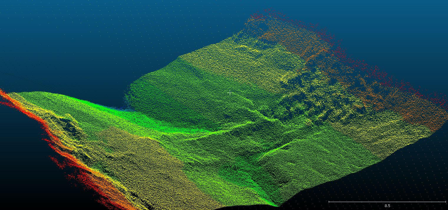
Underwater Point Clouds
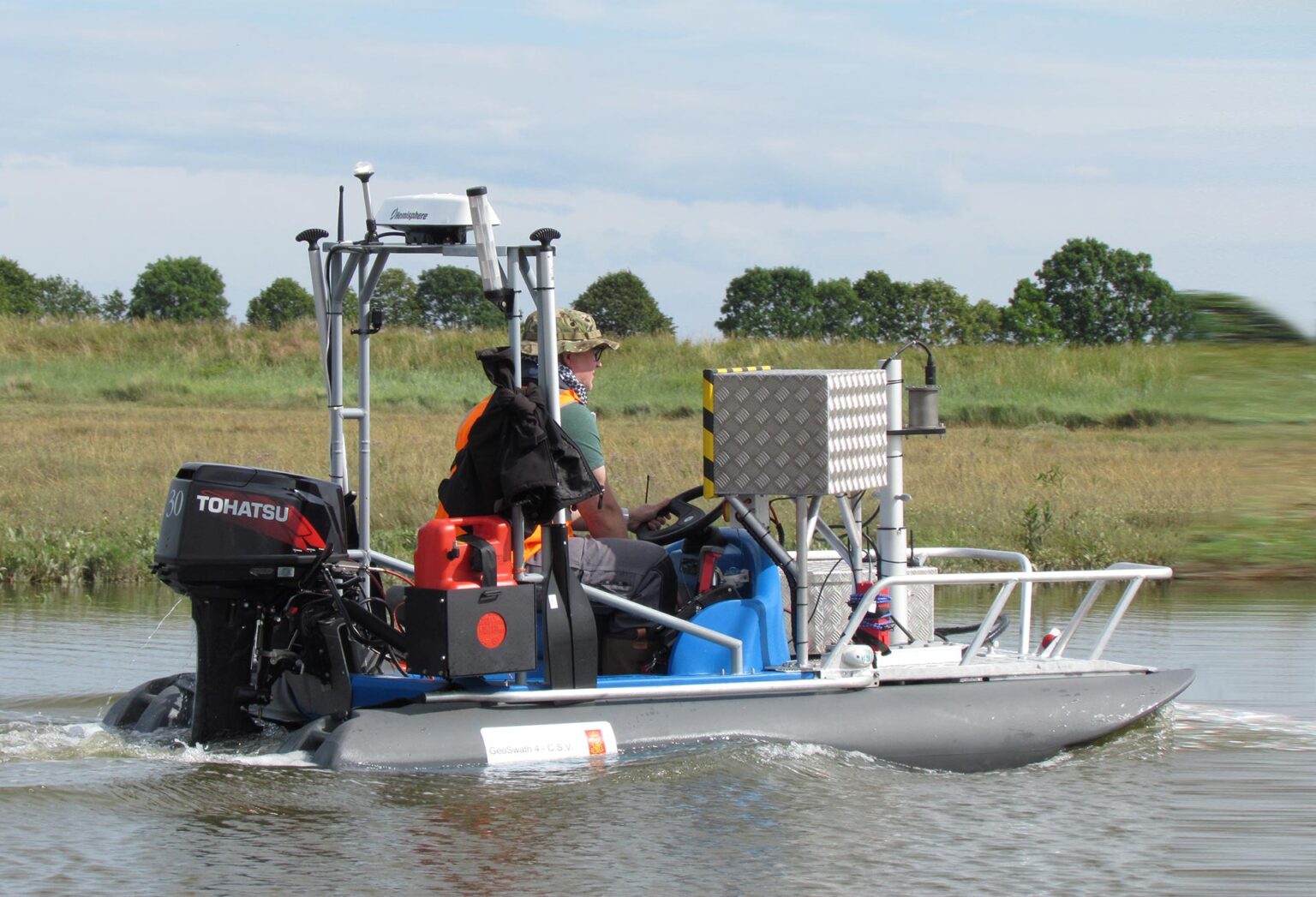
Storm Geoswath Survey Vessel
Storm Geoswath is a compact survey vessel which is ready to launch with its fixed interferometric sonar equipment pre-calibrated. It is often launched down vegetated banks using Storm’s in-house designed ramp and winch system, making more rivers accessible and reducing mobilisation fees to zero as there is no need for expensive crane launches. The draft of the vessel is only 0.32m with an air draft of 1.60m thus allowing bathymetric surveys in smaller, shallower watercourses with low bridges.
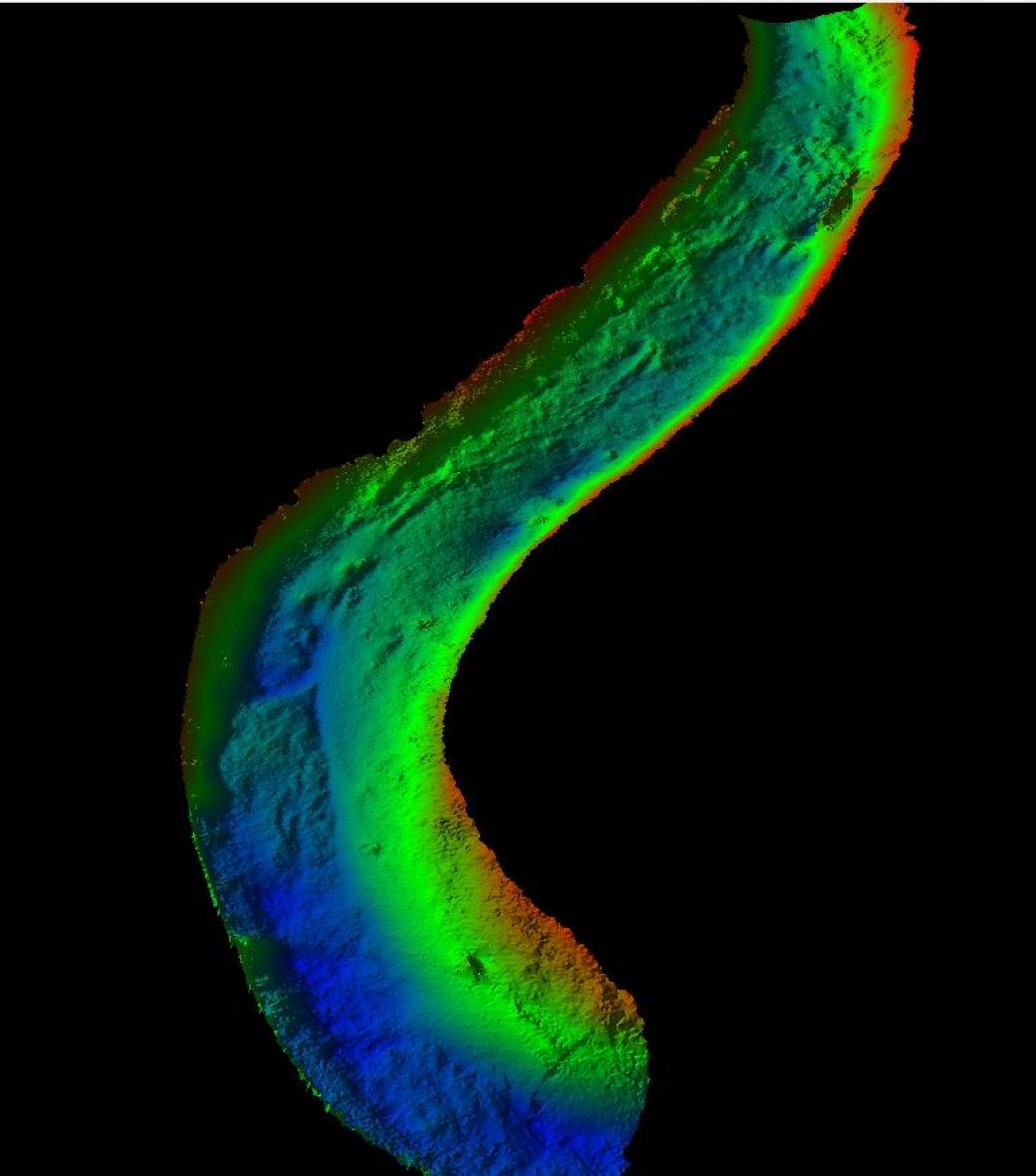
High density georeferenced point data
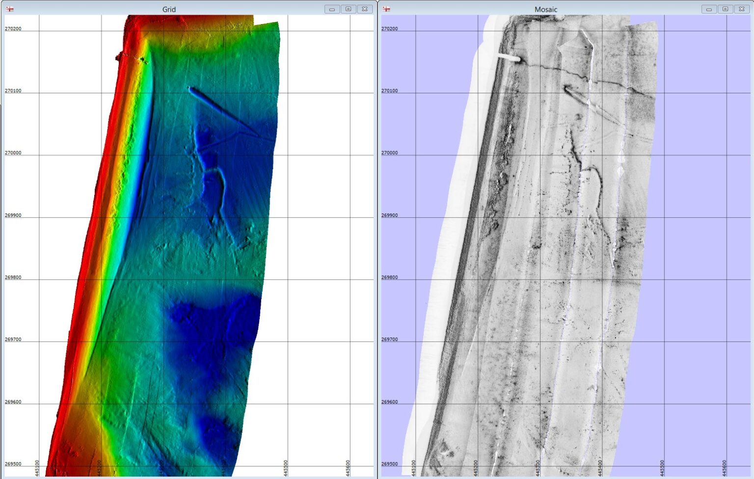
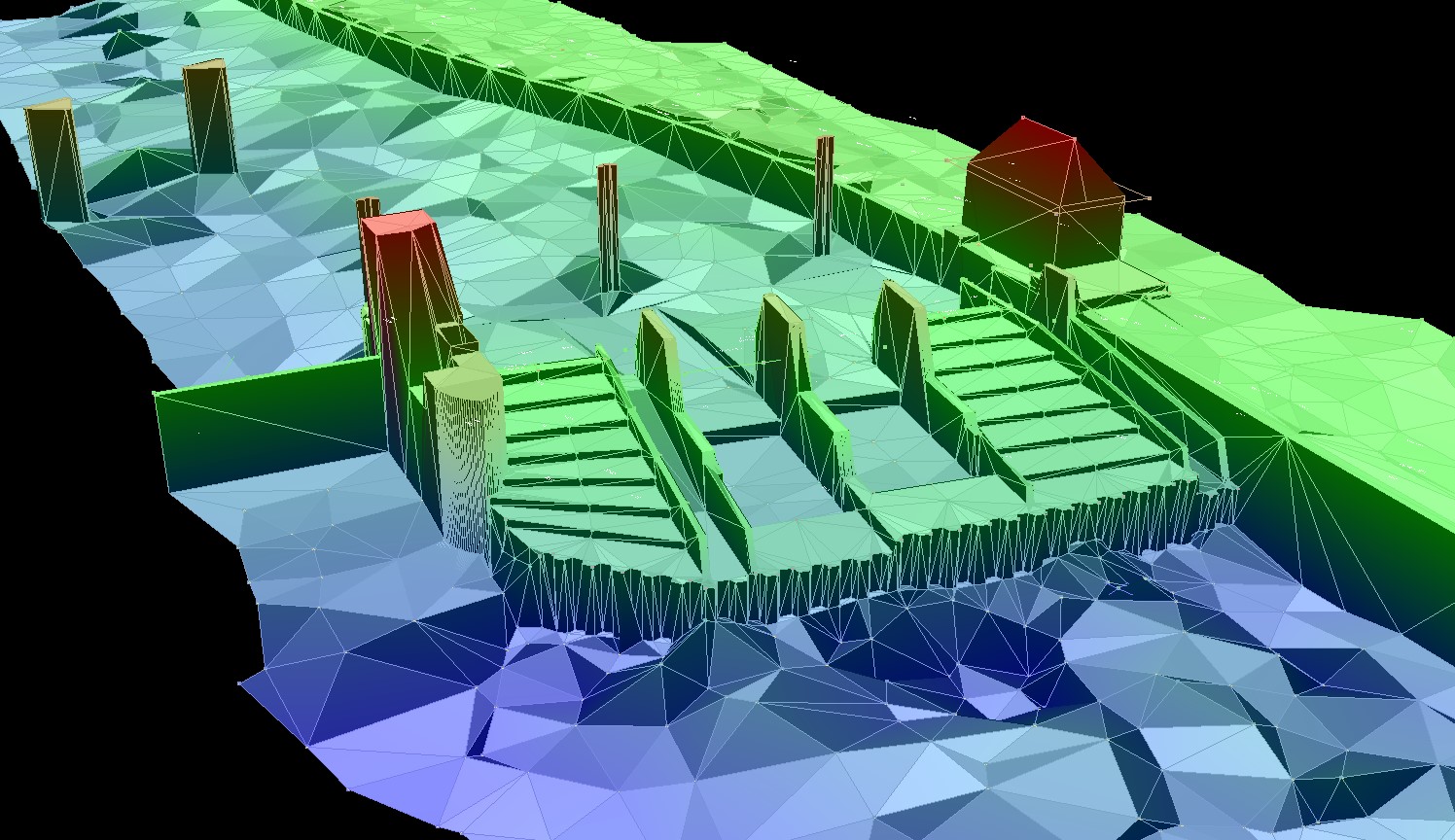
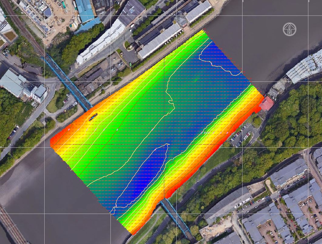
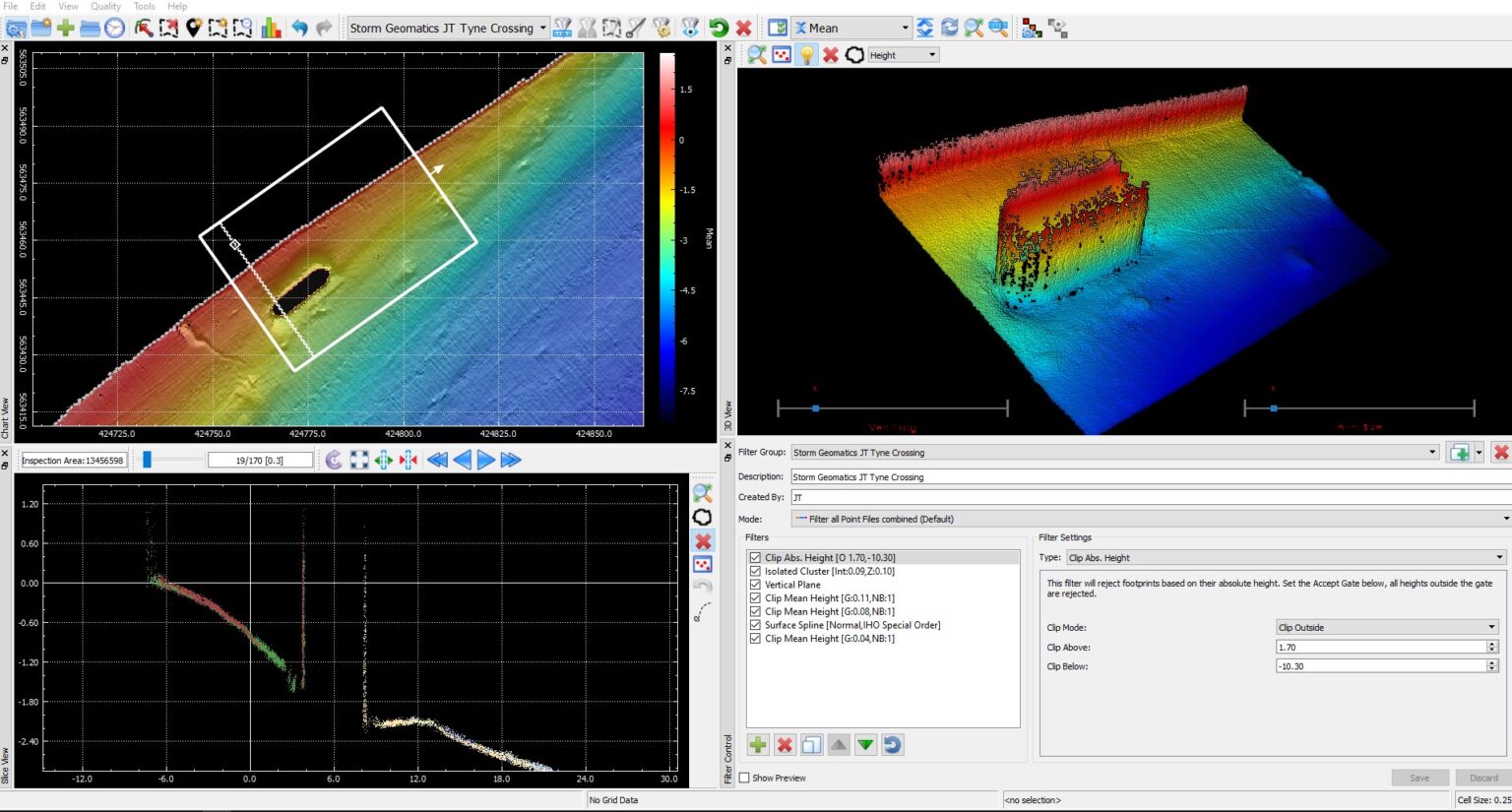
Data from Storm Geoswath is captured in point clouds above and below the waterline allowing visibility of the entire watercourse using a high density of georeferenced point data. Underwater structures are surveyed using the 240 degree beam width of the sensor and presented in 3D point cloud format allowing the user to inspect assets for damage and wear. Habitat surveys are also undertaken with this interferometric system as it reaches into the margins of rivers and lakes and measures up to the waterline. By combining the underwater point clouds with high resolution lidar data, the full geometry for a river corridor is captured for use in digital twins.

Mike Hopkins
Managing DirectorFind Out More
Do you have a Underwater Point Clouds project we can help with?
Call 01608 664910 or


Recent News

Do All Rivers Lead to Liverpool?

Geospatial Survey Delivery Across UK River Infrastructure