Bathymetric Surveys
See Beneath the Surface – Expert Bathymetric Surveys for Accurate, Reliable Underwater Mapping.
Using state-of-the-art sonar systems, precision GPS, and advanced data analytics, we deliver highly accurate maps of underwater terrain. Whatever your requirements, our surveys provide the reliable insights you need to make confident, informed decisions. We bring expertise, technology, and precision together to ensure your project’s success.
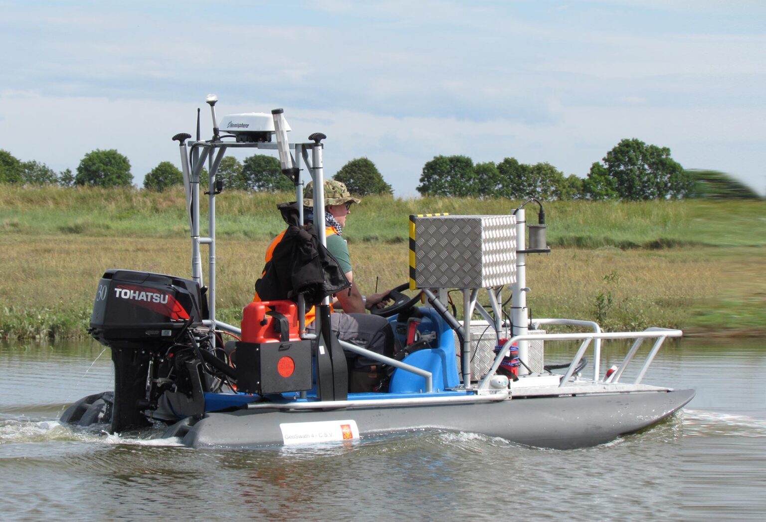
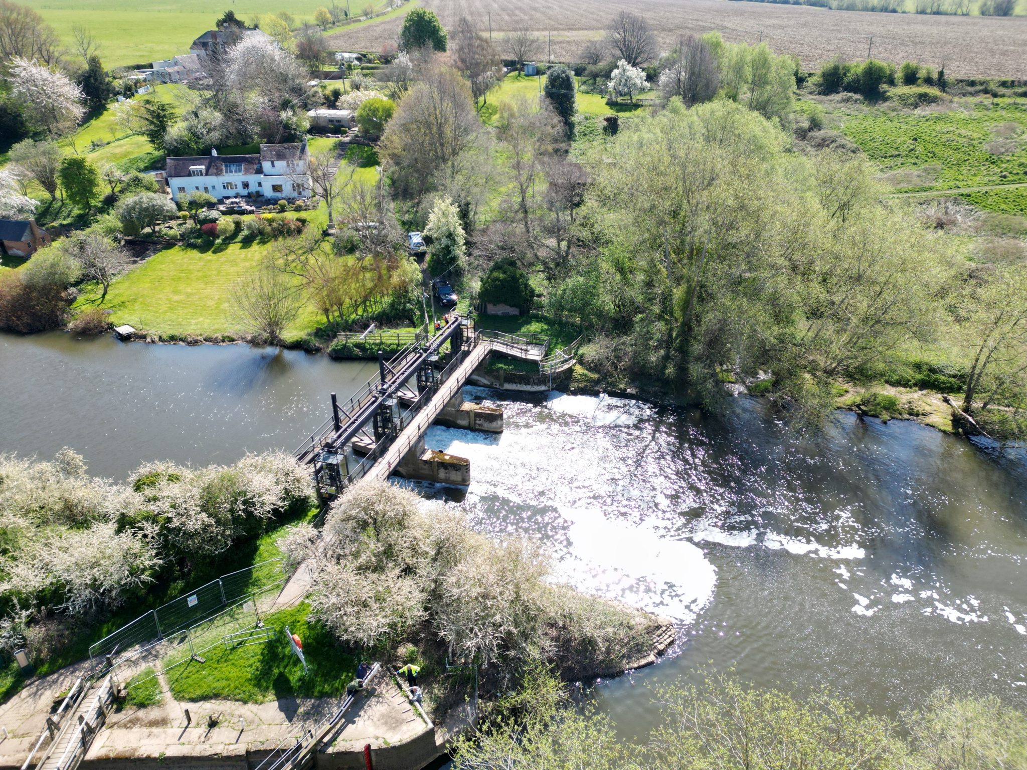
Storm Geoswath Survey Vessel
Storm Geoswath is a compact survey vessel which is ready to launch with its fixed interferometric sonar equipment pre-calibrated. It is often launched down vegetated banks using Storm’s in-house designed ramp and winch system, making more rivers accessible and reducing mobilisation fees to zero as there is no need for expensive crane launches. The draft of the vessel is only 0.32m with an air draft of 1.60m thus allowing bathymetric surveys in smaller, shallower watercourses with low bridges.
Frequently Asked Questions about Bathymetric Surveys:
What is a Bathymetric Survey?
A Bathymetric Survey is a form of hydrographic survey which is used to map out the details of underwater terrain, showing us the bed topography that is beneath the body of water, from rivers, lakes, ponds to estuaries. It can be used for a variety of purposes such as flood risk assessments, volume calculations, hydraulic modelling, water quality studies, habitat mapping and more.
How is a Bathymetric Survey performed?
A Bathymetric Survey is performed typically by use of a survey vessel equipped with an echo sounder which generates signals as the vessel moves across the water. These signals bounce off the underwater features and returned to the echo sounder where the distance is calculated and transformed to a coordinate system using GNSS.
What problems can bathymetric surveys help solve?
Bathymetric surveys map underwater terrain, helping engineers and asset managers monitor siltation, assess scour around structures, design river restoration, manage flood risk, and inspect submerged infrastructure like pipelines and outfalls.
Why is the Storm GeoSwath vessel better value than traditional river channel surveys?
The Storm GeoSwath vessel uses advanced sonar in shallow waters and can be launched without a crane, making it safer and more accessible. This method is often better value than traditional river channel surveys.
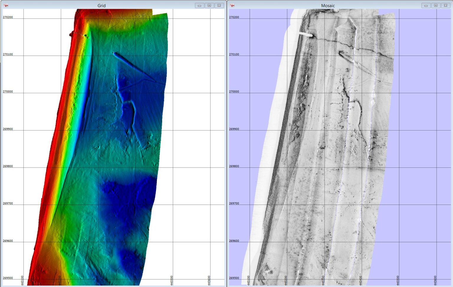
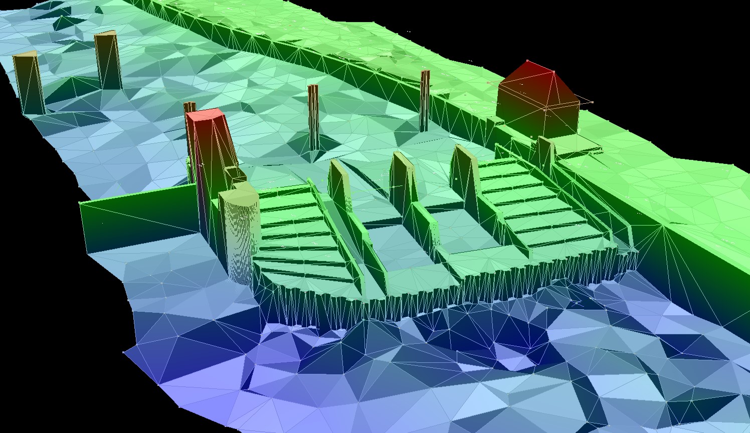
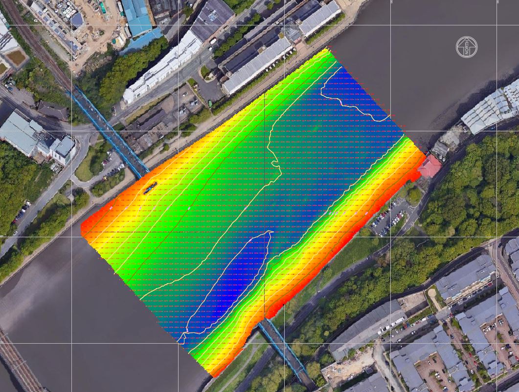
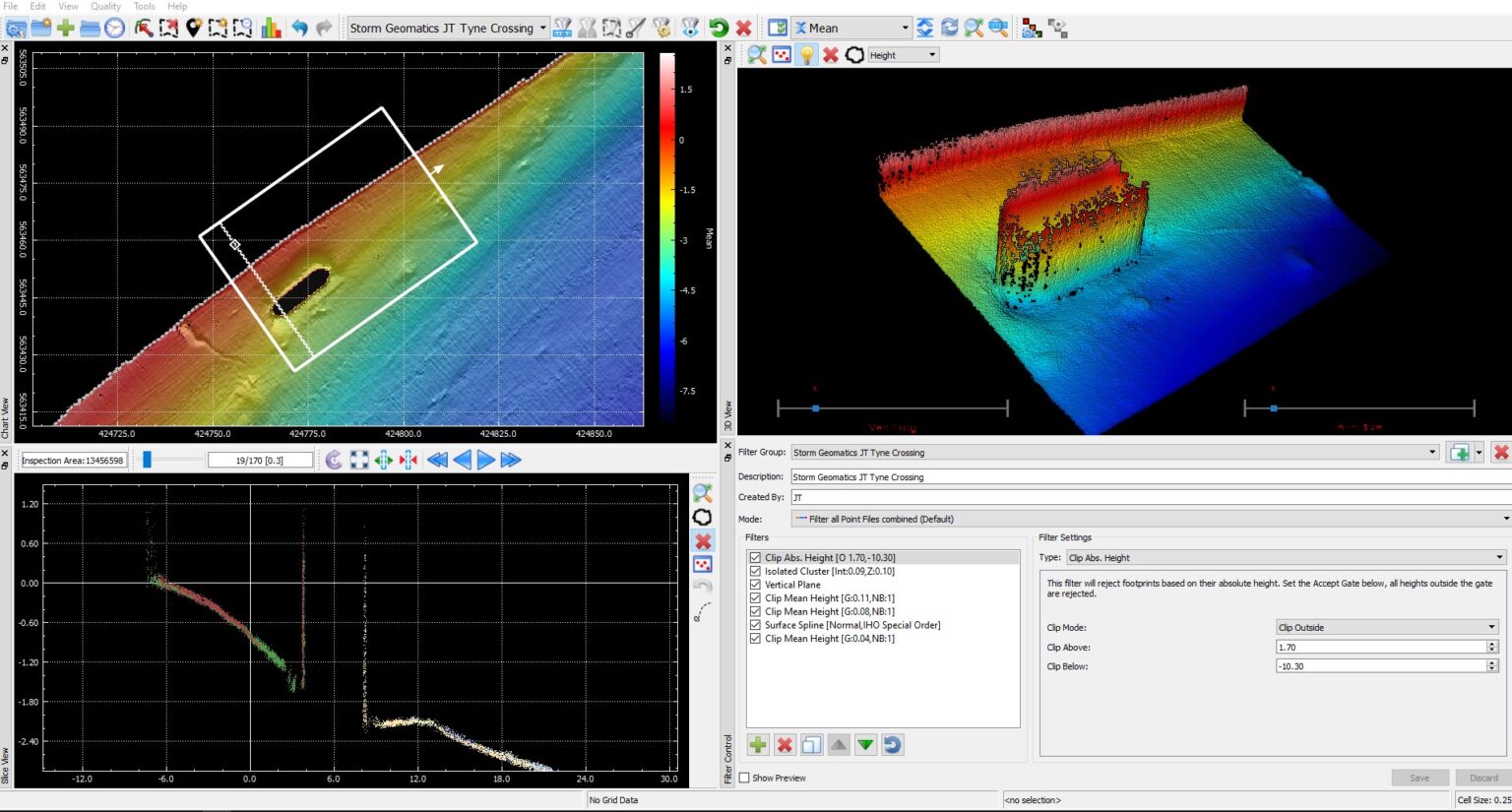
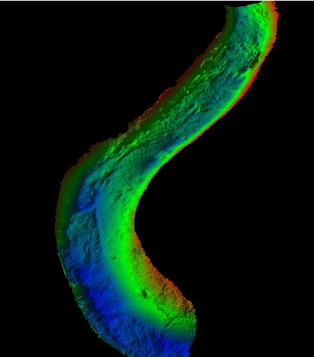
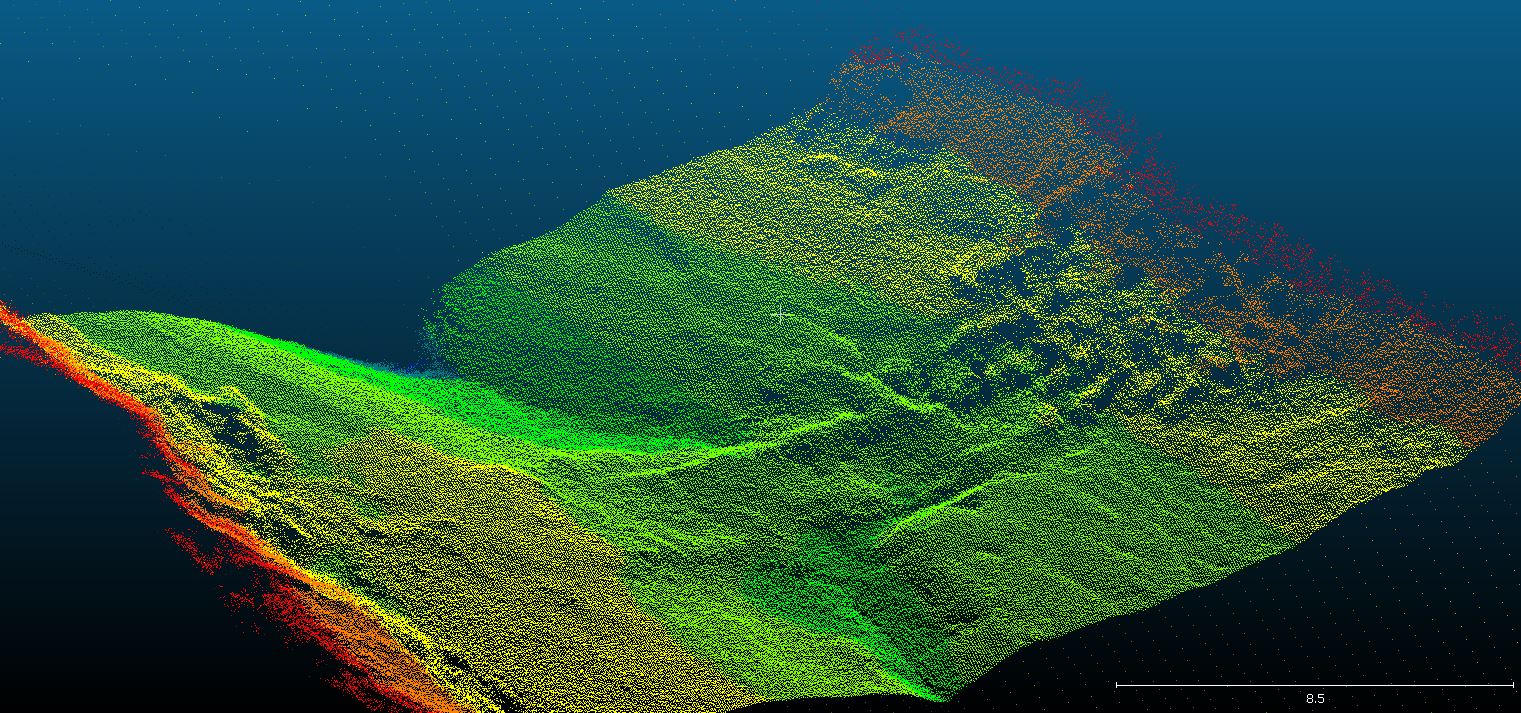
High density georeferenced point data
Data from Storm Geoswath is captured in point clouds above and below the waterline allowing visibility of the entire watercourse using a high density of georeferenced point data. Underwater structures are surveyed using the 240 degree beam width of the sensor and presented in 3D point cloud format allowing the user to inspect assets for damage and wear. Habitat surveys are also undertaken with this interferometric system as it reaches into the margins of rivers and lakes and measures up to the waterline. By combining the underwater point clouds with high resolution lidar data, the full geometry for a river corridor is captured for use in digital twins.

Mike Hopkins
Managing DirectorFind Out More
Do you have a Bathymetric Surveys project we can help with?
Call 01608 664910 or

Recent News

Do All Rivers Lead to Liverpool?

Geospatial Survey Delivery Across UK River Infrastructure