2024: Storm Set for a New Era of Exceptional Survey Services

A new calendar year set the stage for continued innovation and excellence with Storm adding a new surveying service to their resources. To meet the needs of existing and new clients Storm Geomatics are currently expanding the capabilities of their surveying team to provide inhouse utility and GPR (PAS128) surveys. One client recently remarked that “A company that can provide both river surveys & utility surveys is high on my wishlist”. Reacting to this Storm are now recruiting to bring in an experienced utility surveyor on a clear pathway to leadership. If you are that person, please look on the recruitment page. Experienced Utility Surveyor
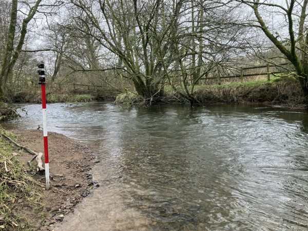
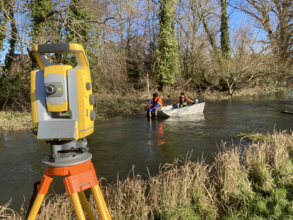
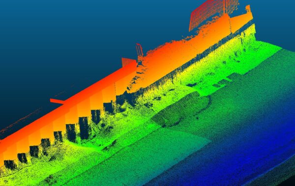
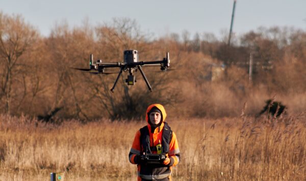
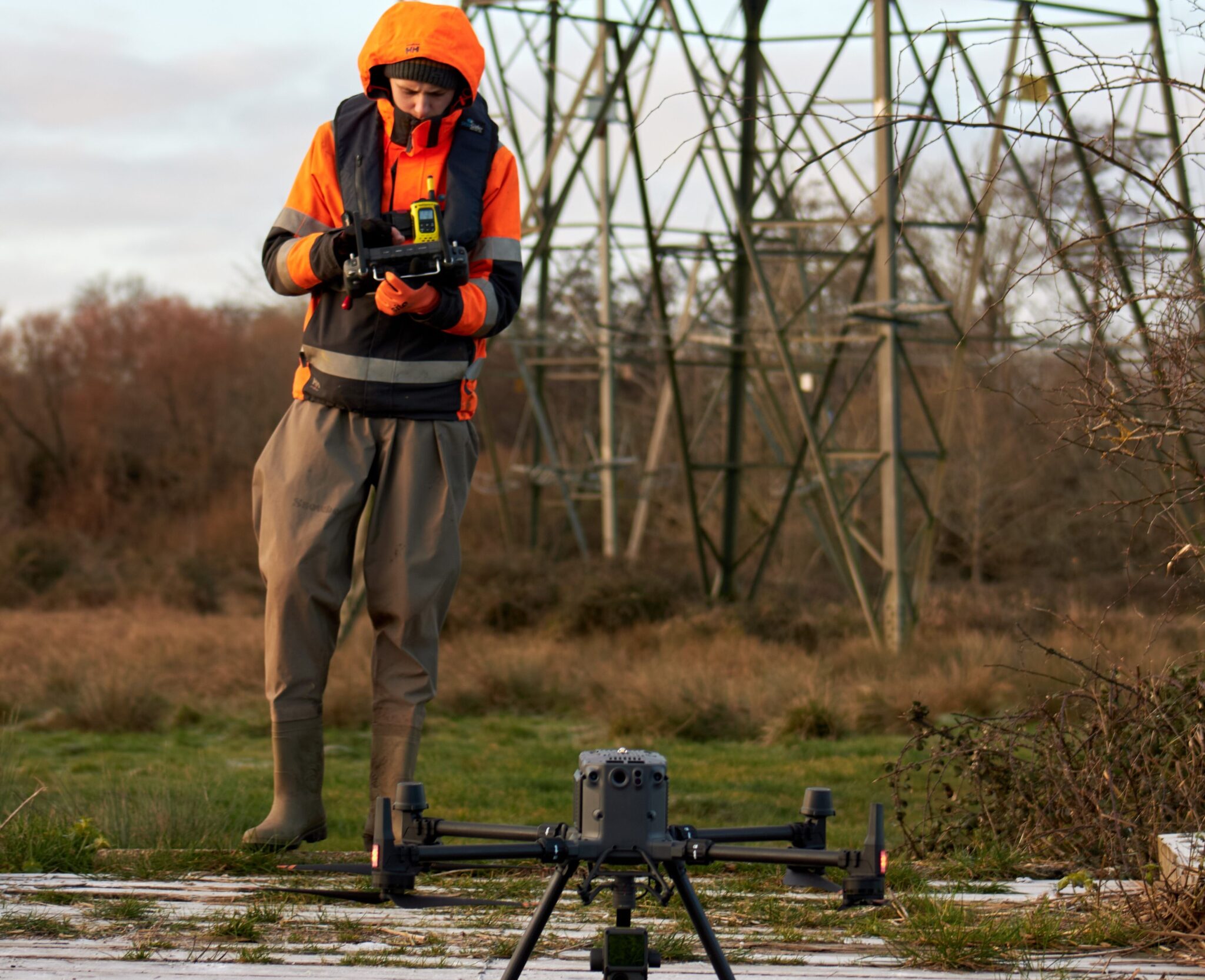
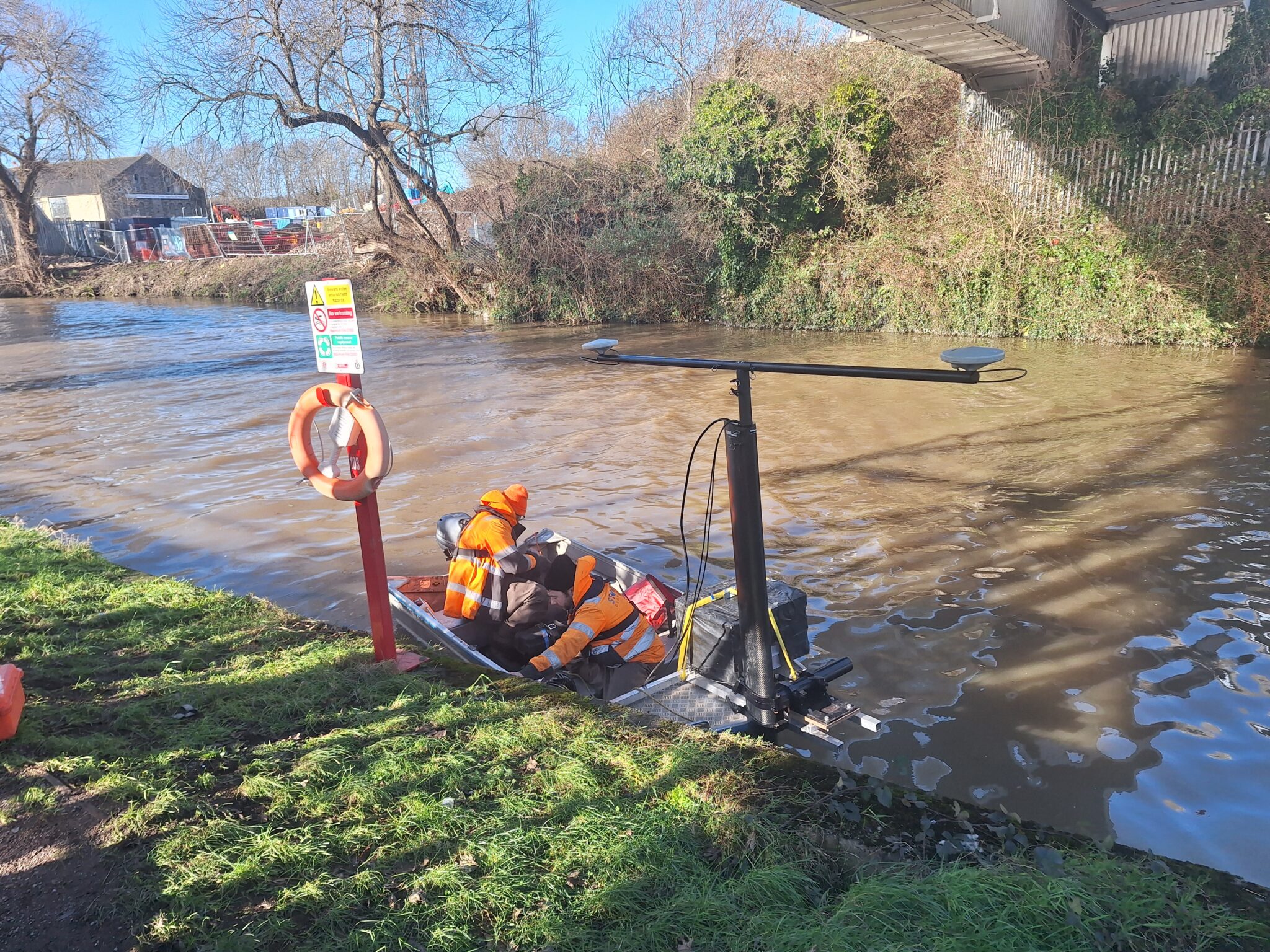
During a cold snap of weather that descended in early January two survey teams returned to the River Test in Hampshire to capture vital data, now accessible due to the reduced foliage during the winter months. The purpose being to create a River Digital Twin of the project area. Expert RPAS and Bathymetric survey methods were carried out to create the intelligent data for the River Digital Twin. Read case studies for RPAS and Bathymetric to view the results and outcomes for the survey.
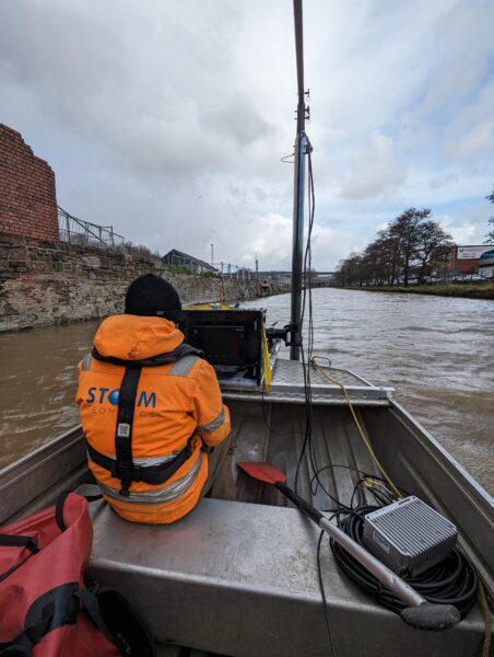
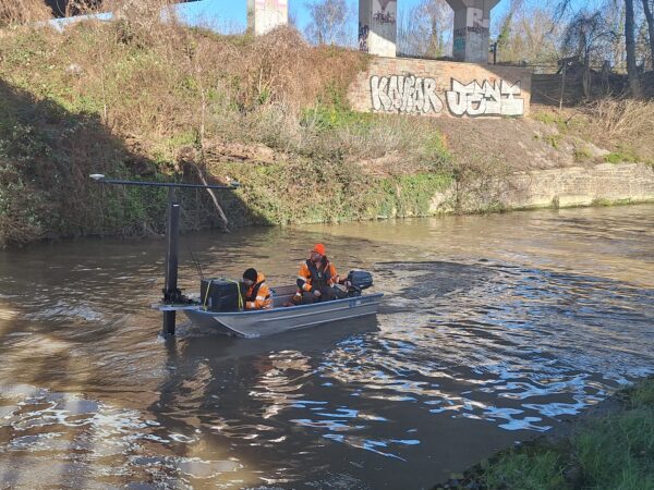
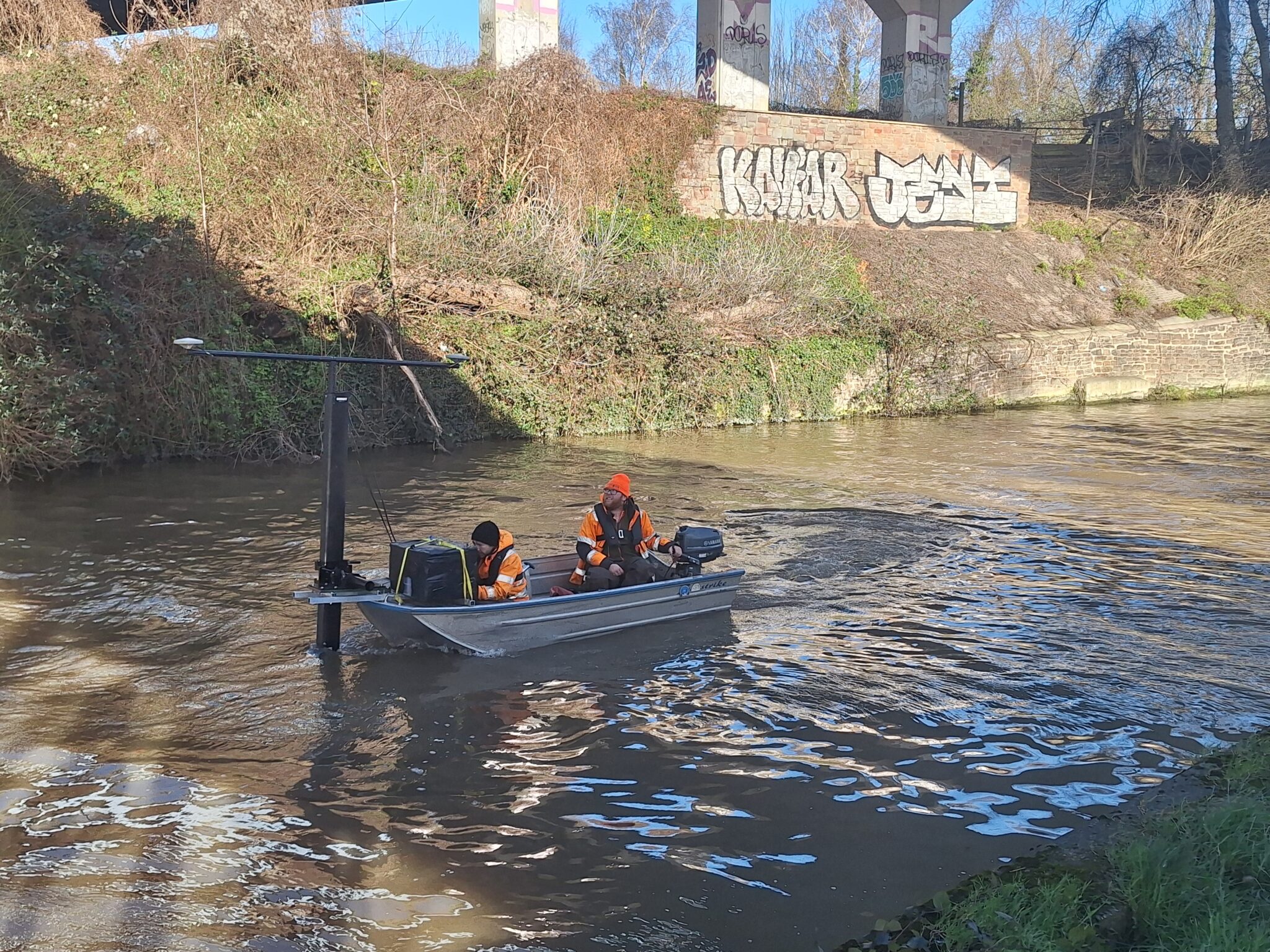
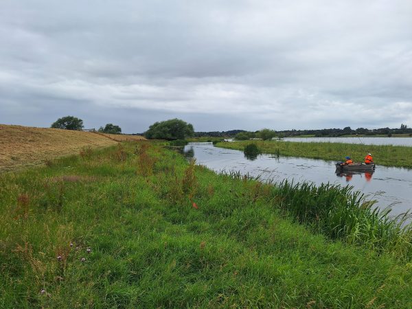
Also, in January a team led by Senior Surveyor Laurence Washbrook carried out a bathymetric survey of the Bristol canal as the area is due to be regenerated in the near future. Before work commenced a survey to assess the stability of the canal walls was required. An attempt by a dive team to collect the data had been unsuccessful due to the turbidity of the canal. Hence the requirement for Storm to conduct this survey. Follow the surveyor’s progress from the project case study.
Collaboration has long been a priority of Storm Geomatics, this month, Storm presented a collaborative webinar alongside client and Flood Risk Consultants Aegaea. Over one hundred people from around the globe signed up and watched Daniel Cook, Director at Aegaea and Storm’s Managing Director Mike Hopkins expand on the webinar title “Data to Action”, focussing on the importance of survey data to enhance a flood risk assessment. The trends of frequent flooding and higher intensity of storms is increasing flooding. To mitigate this increase there is a requirement right now for good data capture and good hydraulic models. Good data makes it easier to identify areas that are flooding and design infrastructure to avoid clashes and maximise site space. The webinar explained how through collaboration of survey data and fine tuning has improved the quality of flood risk assessments. This is achieved through 5 key phases. A full recording of the webinar will offer you our solutions to promote these best practices.
A senior team of Storm Surveyors looks forward to another trip to Scotland in February to continue their RiverEye surveys to locate beavers & their habitats. How will the team fair in finding the elusive rodents? … check back next month find out…
Our social media channels are buzzing with new case studies and survey innovations, are you following us? Linkedin X Instagram


Other News

Helping Clients Reduce Risk with Better Geospatial Data
River Surveys and Team Bonding: Storm’s Action-Packed August