

River Avon Asset Condition Surveys
The Background
- Date
- Ongoing
- Client
- Jackson Engineering
Storm Geomatics are commissioned to undertake comprehensive asset condition surveys across ten sites along the River Avon, spanning three counties. The primary objective of the project was to provide all stakeholders; the asset owner Environment Agency, designer Ove Arup, civils contractor Jackson Engineering with further information to accompany previously carried out dive surveys to understand scour, undermining and general condition.
This geospatial data will allow stakeholders to assess the condition and operational effectiveness of critical river infrastructure, including weirs and sluices, which play a vital role in flood prevention and maintaining navigation on the river. These geospatial surveys will assist in identifying signs of deterioration, damage and structural movement before they could impact asset performance.
Project Background
Located along the River Avon, the surveyed assets form an important part of the region’s water management infrastructure. Regular inspection and monitoring are essential to ensure they continue to function safely and effectively.
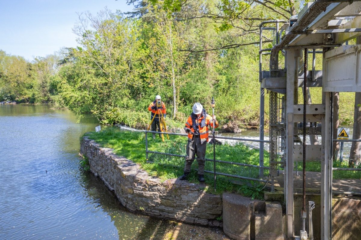
Storm surveyors carried out detailed geospatial surveys to capture both above and below water environments, enabling stakeholders to accurately assess structural condition, measure deterioration and plan future maintenance activities. The project required the collection of high-resolution geospatial data across multiple locations, each presenting its own unique environmental and operational challenges.
Storm Geomatics was commissioned to deliver this data at scale. A project that embodies the ethos of Storm Geomatics, you could say, “a project they were born to complete” combining specialist river surveying expertise with resilient project planning across complex access and asset conditions, summer vegetation also caused surveyors to scratch their heads at times!
Community Impact
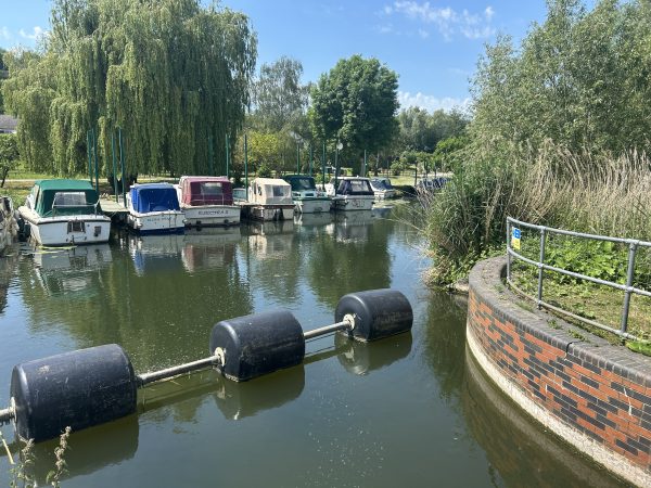
Assets keep the rivers navigable for local communities.
The surveyed weirs and sluices are critical assets that help manage water levels, reduce flood risk and maintain navigable waterways for local communities and river users. By providing accurate condition data, Storm Geomatics enabled informed asset management decisions that support the long-term resilience of these structures and the communities that depend on them.
Early identification of issues such as scour, undercutting and structural movement helps reduce the risk of future failures and costly emergency repairs.
Storm Geomatics Capability
Storm Geomatics were tasked to deliver a fully integrated surveying solution, combining multiple survey disciplines to create a complete digital representation of each site. Using a combination of topographic survey, terrestrial laser scanning, photogrammetry, multibeam bathymetric survey and manual bathymetric techniques, the team captured detailed and accurate datasets both above and below the waterline.
This multidisciplinary approach ensured that every asset was surveyed comprehensively, providing clients with a rich dataset capable of supporting condition assessments, maintenance planning and future engineering works. With senior discipline leads heading up this complex project, their expertise successfully managed complex sites across a large geographical area delivering right first time survey data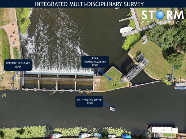
To achieve the level of required data detail Storm deployed a number of specialist survey technologies including:
- GeoSwath Multibeam Survey System for detailed underwater mapping.
- Trimble X9 Terrestrial Laser Scanner for rapid, high-density capture of above-water structure
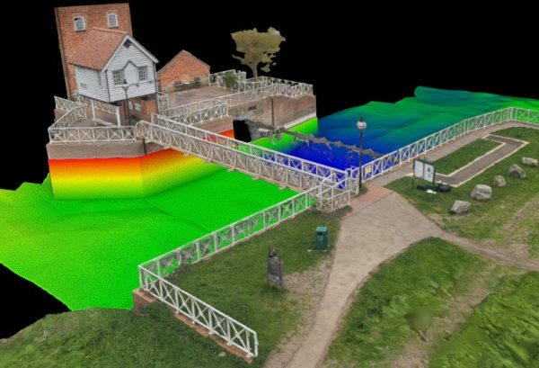
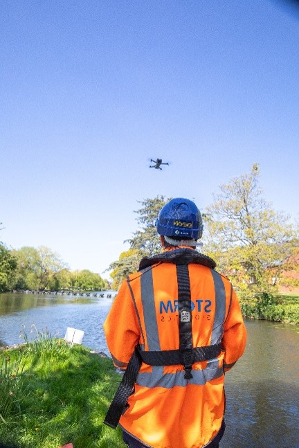
- DJI mini 5 RPAS for high-resolution aerial imagery and photogrammetric modelling.
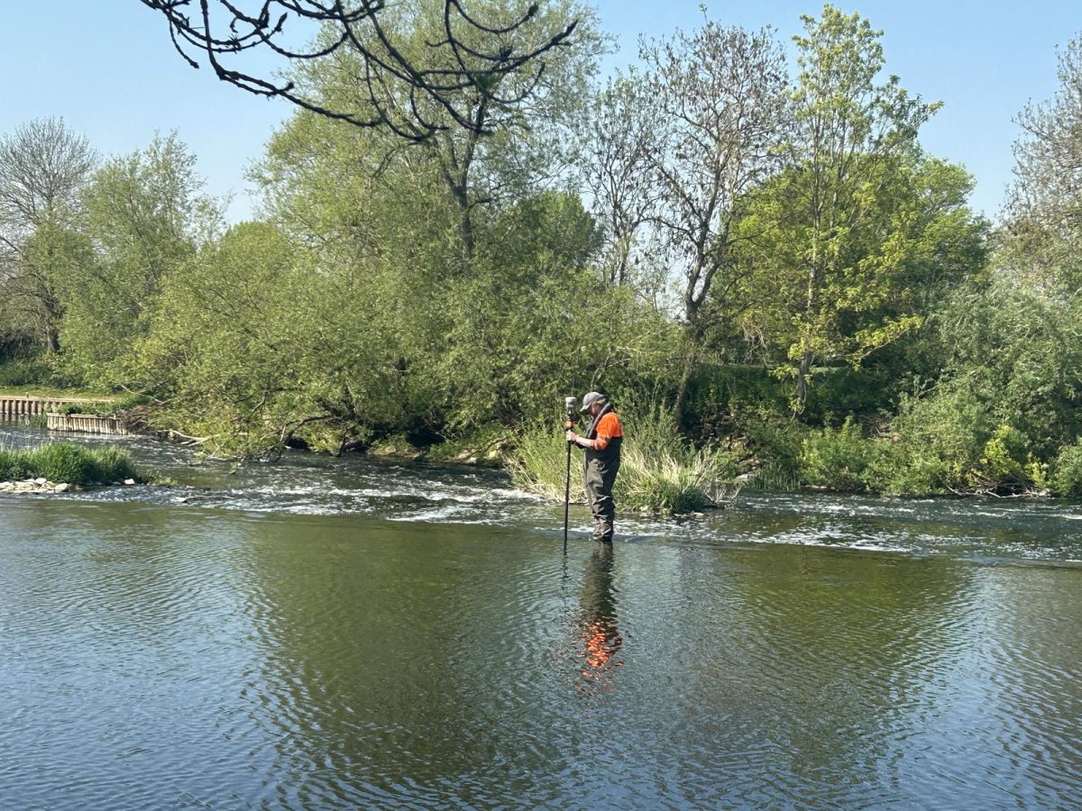
- Manual bathymetric survey techniques undertaken from Storm’s Sea Strike survey vessels and by wading where conditions required. Later converted to point-cloud to match the deliverables from the multibeam survey and terrestrial scanners
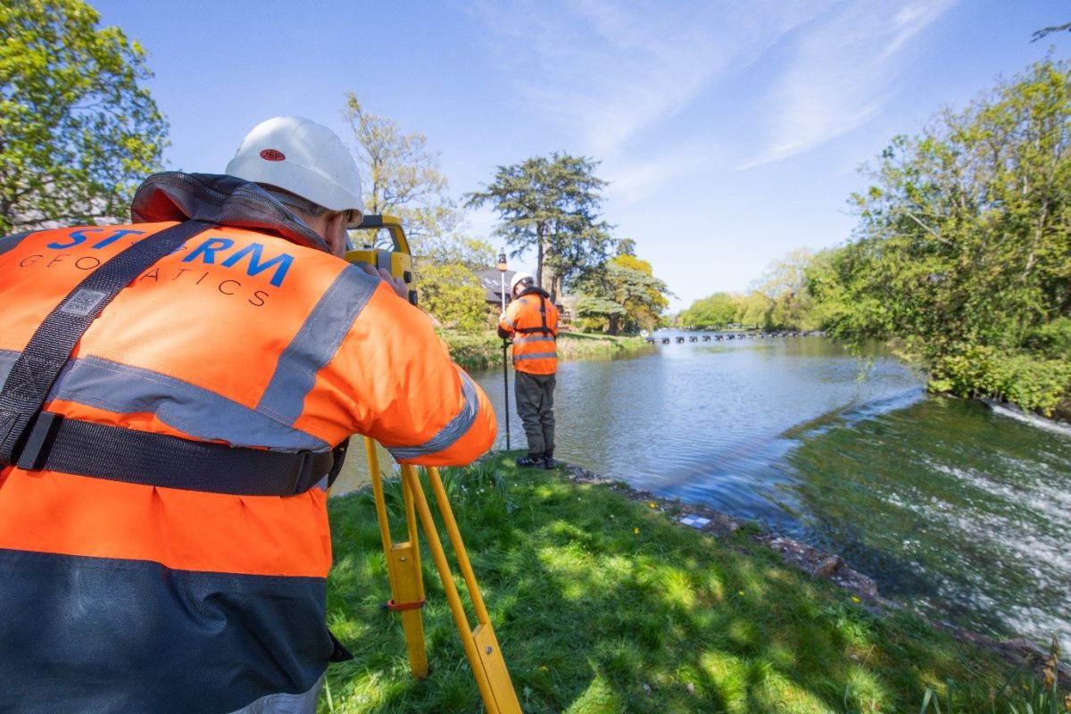
- Conventional topographic survey equipment to support the creation of an integrated site dataset.

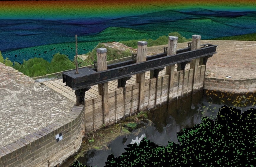
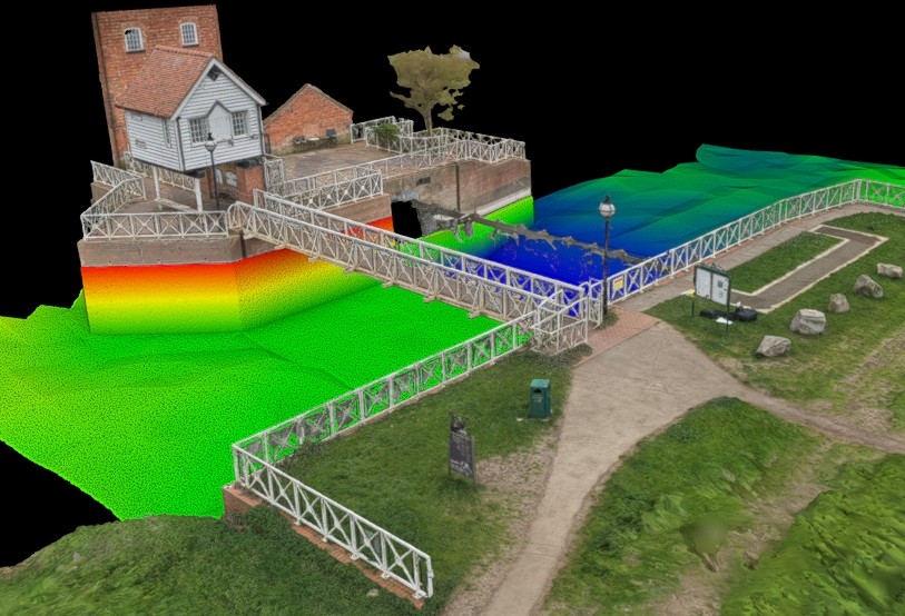
Photogrammetry example
The Challenge
Surveying at this scale always provides challenges, often overcome through Storm’s survey teams experience of working in water everyday. Principal Surveyor, Laurence Washbrook commented.
The time of year these surveys were conducted was critical with water levels being low enough to allow us to safely get to the assets to survey them
Challenge |
Storm Geomatics Solution |
| Surveying ten sites across three counties required careful planning and coordination. | Storm deployed a coordinated multi-disciplinary survey approach, allowing topographic, bathymetric and photogrammetric surveys to be completed efficiently across all locations. |
| Water levels needed to be low enough for safe access while maintaining suitable survey conditions. | Surveys were scheduled during the optimum seasonal window to maximise access and data quality. |
| Submerged vegetation and shallow water affected the effectiveness of multibeam bathymetric surveys. | Where vegetation prevented multibeam operation, manual bathymetric surveys were undertaken to maintain complete coverage. |
| Access to weirs and sluices was often restricted and operationally challenging. | The Trimble X9 scanner and DJI Mini drone enabled rapid data capture in confined and publicly accessible environments. |
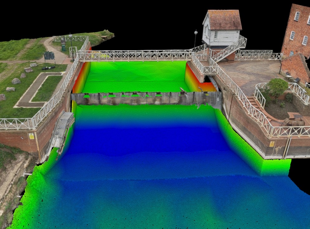
| Data from multiple survey methods needed to be delivered as a single, consistent dataset. | Bathymetric, laser scanning, topographic and photogrammetric datasets were integrated into a seamless point cloud deliverable. |
| Detailed condition assessment was required both above and below the waterline. | Storm’s integrated survey approach identified scour holes, undercutting, sheet pile deformation and other signs of deterioration. |
The Results
By combining multibeam and manual bathymetric surveys, topographic survey, terrestrial laser scanning and photogrammetry the stake holder chain can now identify and measure scour holes, undercutting, structural damage and bowing of sheet metal piling. Completion of this significant project is on target for late summer 2026 demonstrating Storm Geomatic’s ability to deliver innovative, multi-disciplinary survey solutions and most importantly ensuring these vital assets have a prolonged operative lifespan.
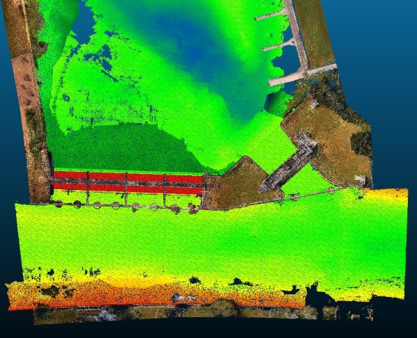
Final combined deliverable of bathymetric data, terrestrial scan data & topographic data.
The client received accurate, actionable information to support ongoing asset management, maintenance planning and future investment decisions. Storm Geomatics thrive from projects such as this
Recent News
What Happens When Rivers Go Digital?
How To Keep Survey Projects Moving During a Record-Breaking Summer