Geospatial Survey Delivery Across UK River Infrastructure

May has been a busy and productive month, with strong progress across key projects and continued delivery of “right first time geospatial data to support clients’ decision-making.
Here’s a look at what we’ve been working on and, importantly, the value it’s delivering.
River Avon Weirs & Sluices Programme Progress
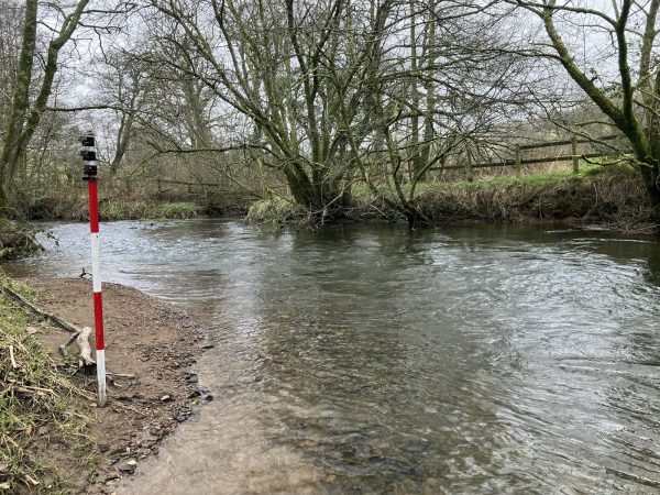
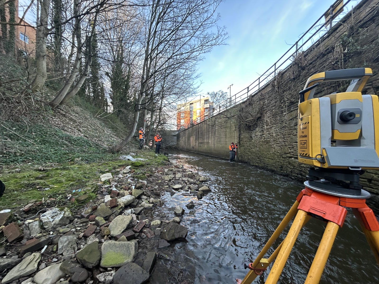
Survey work has continued throughout May on the River Avon Weirs and Sluices programme delivered in collaboration with Jackson Civil Engineering on behalf of the Environment Agency.
This multi-site project is focused on capturing detailed above- and below-water geospatial data to assess the condition of ageing river assets. The resulting datasets will support refurbishment planning and long-term asset management strategies, ensuring these structures continue to operate safely and effectively.
To achieve this, Storm surveyor’s deployed a multi-disciplinary survey approach, including:
- RPAS photogrammetry for realistic visualisation and defect identification
- Laser LiDAR scanning for highly accurate structural geometry
- Interferometric multibeam and single beam echo sounding for bathymetric modelling
- Integration of topographic survey data
All datasets are combined into a comprehensive, high-accuracy model, giving engineers and asset owners complete understanding of each structure above and below the waterline.
Progress is on track, with final surveys scheduled at Stanchard Pit Weir and Sluice (Tewkesbury) in early July. Deliverables have now commenced, including Barford Weir and Abbey Mill, with initial photogrammetry models successfully provided.
This level of precision enables confident decision making and reduces uncertainty in long-term asset management.
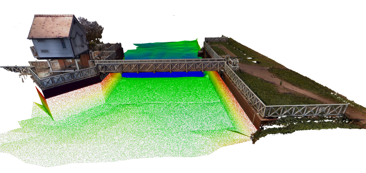
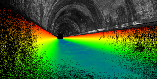
Terrestrial Scan LiDAR
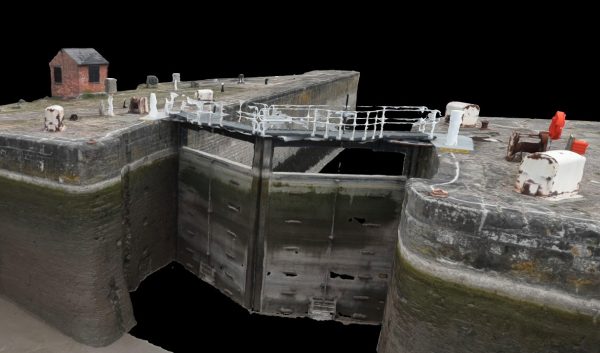
Figure 1 and 2 demonstrate the comparison
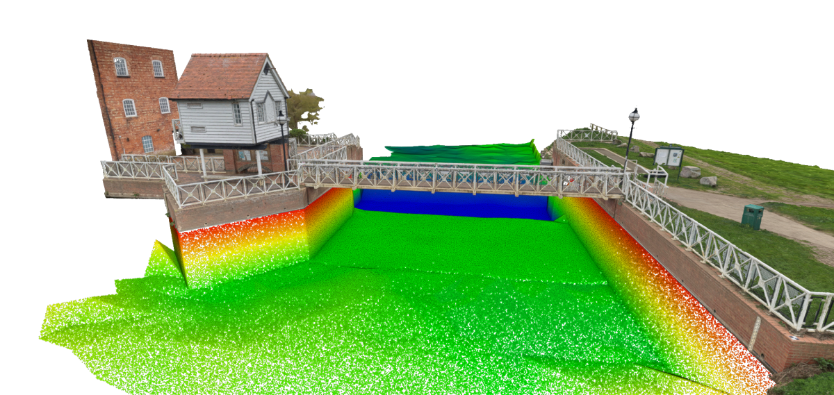
3D Photogrammetry
Adapting Survey Techniques for Seasonal Conditions
As expected, the progression into summer has introduced denser vegetation within river environments, impacting survey methods across Storm’s active survey sites..
- Increased plant growth has limited the use of GeoSwath CSV systems
- Denser foliage is affecting terrestrial laser scanning coverage
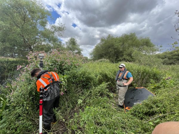
In response, our team has adapted quickly by increasing the use of manual survey techniques to maintain data quality and coverage regardless of environmental constraints. Our flexible approach ensures that data accuracy is not compromised, even in challenging seasonal conditions. A critical factor in maintaining “right first time” geospatial Data for hydraulic modelling and engineering design.
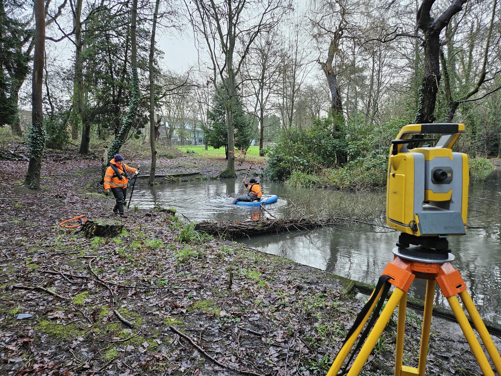
Sheffield Flood Alleviation Scheme Completed
May marked the successful completion of a large-scale river survey project on Porter Brook and the River Sheaf in South Yorkshire.
Delivered in collaboration with long-standing client Arup, on behalf of Sheffield City Council, the project provides essential geospatial data to support a flood alleviation scheme designed to reduce risk across Sheffield.
Urban river surveys of this scale present significant logistical challenges, particularly around:
- Land access and stakeholder coordination
- Working within constrained, developed environments
- Maintaining programme efficiency across large survey extents
The project was led by Senior Surveyor Tom Atkinson, who applied extensive experience from previous large-scale river surveys to ensure smooth delivery. Early-stage planning included comprehensive landowner engagement, securing access across the full survey route before mobilisation.
Storm’s structured approach to project planning and delivery ensured that the survey remained on programme, providing robust baseline data for flood modelling and infrastructure design.
Accurate geospatial data of this nature forms the foundation of effective flood risk mitigation and resilient urban planning.
Yorkshire Monitoring Project Completed.
Following installation in February, the water level monitoring system at a sewage outfall site for Yorkshire Water has now completed its programme.
Mike Hopkins returned to site to safely decommission and remove the equipment, ensuring everything was completed efficiently and responsibly.
Monitoring programmes such as this provide essential insight into water level behaviour and asset performance, helping water companies make more informed operational decisions and manage environmental impact more effectively.
Supporting Better Decisions with Geospatial Data
As we move into June and the peak survey season Storm continue to provide right first time data supporting:
- Asset refurbishment®
- Flood alleviation schemes
- Habitat regeneration
By continuing to progress survey projects throughout the UK with focus on specialist surveying expertise within inland water environments. Real-life examples can be found via the Case Study Page.
Keep a look out for Stage 4 in the series on Storm’s unique River Digital Twin® service. To recap on all the series articles please do have a read:
1. High-Resolution Point Cloud River Digital Twin®- Redefining River Intelligence
2. DTM River Digital Twin® – Elevating River Intelligence
3. Live Environment Sensor River Digital Twin®– Mobilising River Intelligence
Next month Storm will be reporting on their visit to Flood & Coast 2026 conference in Liverpool.


Other News
London’s Underground Tunnels bring out the Rockstar’s of Geospatial Survey
A Record Month Surveying Rivers