Step Change
“Step Change to make Geospatial Data of UK River channels more accessible and interoperable”
The Flood [&] Coast Event of 2020 is now transformed into a series of four digital sessions running from October 2020 through to July 2021. Storm Geomatics are a contributor to the digital series and have produced a video with ASN Media and JBA Consulting around river channel data.
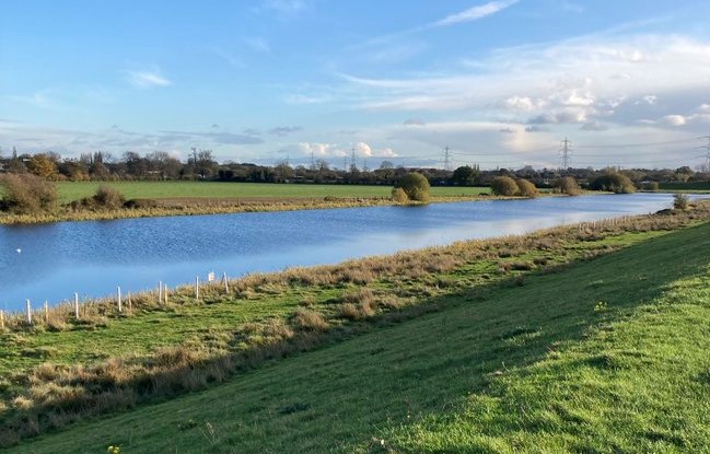
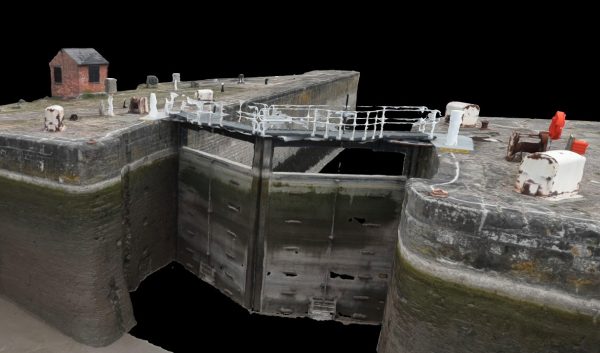
Geospatial Data is the “Gold” needed to create hydraulic models to solve global flood problems. This base data, is used to create accurate flood risks models and is the mainstay of information in hydraulic studies.
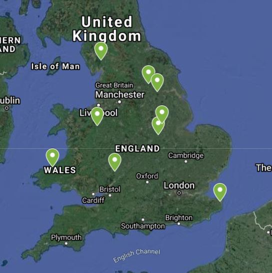
Storm Geomatics Managing Director, Mike Hopkins has accumulated over 25 years’ experience of gathering geospatial data for consulting engineer clients to use in flood risk mapping and modelling projects throughout the UK and beyond. He is currently spearheading the formation of an expert taskforce to gain funding for a UK portal for geospatial data of the UK’s rivers. The purpose of this portal is to ensure that data is more accessible and interoperable across many users. It will benefit a large spectrum of users such as river trusts, planners, developers, ecologists, water companies, research, education and leisure users to name but a few. By creating an accessible portal the data can be given a life span and gain more usage from a wider audience, extracting extra value out of the original investment and giving the opportunity for users to make better decisions in their field of interest.
Experts in river channel data acquisition and presentation will play a vital role in the management of the data within the UK portal by providing maintenance, acquisition and analysis ensuring the live information is fit for purpose.
To launch this initiative and attract funding from the Geospatial Commission (established in 2018) Mike is seeking fellow experts who create and use this data, who might also understand licencing and funding avenues or who are influencers in the world of water. By joining together and presenting a strong case for investment to the Geospatial Commission or other funders will help launch the portal and ensure the project becomes a reality. So please take time to watch the video currently displaying via the Flood and Coast 2020 website, or you can watch the slightly extended version here.
If you think a step change is needed please do get in touch with Mike Hopkins via his email address; mike.hopkins@storm-geomatics.com


Other News

Geospatial Survey Delivery Across UK River Infrastructure
A Record Month Surveying Rivers
