Phosphate Testing – Adding Superior Value
Summer 2021 rolls on with vegetation thickening and a heat wave all testing the wills of the Storm Geomatics surveying teams. However, a full schedule keeps the Storm machine rolling!
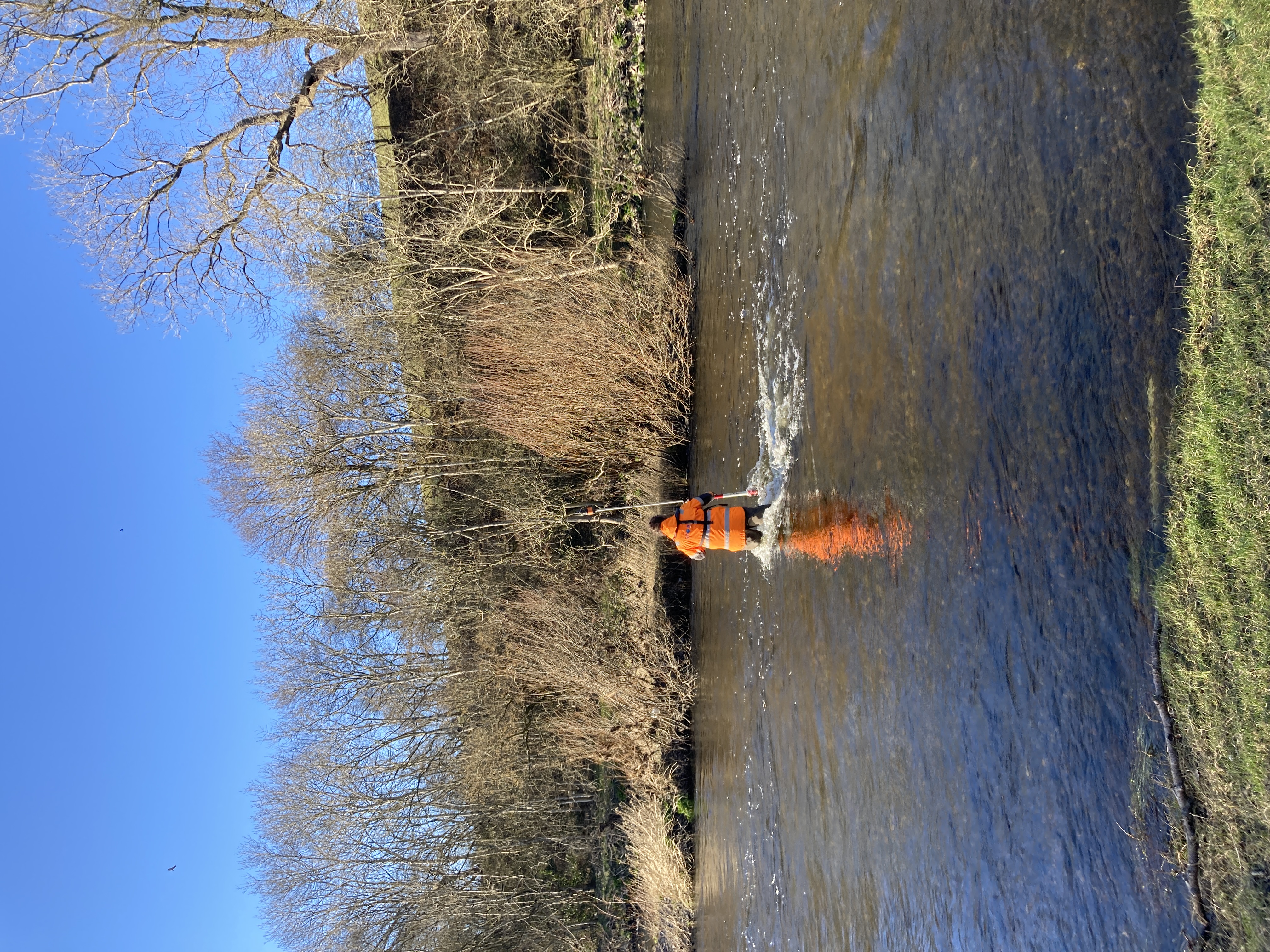
In mid-July the mighty compact survey vessel Storm Geoswath I was deployed to the River Ouse, Yorkshire. Storm Geomatics were contacted by the Environment Agency to carry out a full multibeam survey of the River Ouse near Riccall following an urgent request from the Yorkshire Asset team. The flood embankment is showing signs of deterioration and to successfully plan appropriate interventions going forward, a full picture of the riverbed is required to determine how the fluvial processes at this location interact with the landform thereby better understanding possible reasons for the degradation of the riverbank.
The River Ouse at this location is a particularly dynamic riverine environment owing to the tidal surges from the Humber Estuary and it was determined that Storm GeoSwath I, with its wide swath bathymetry system and compact size, was the perfect tool for the survey and no time was wasted in preparing the risk assessment and method statements (RAMS) to meet the clients’ requirements and tight deadlines.
Storm’s Southwest office welcomed Sam Baimbridge for work experience. Sam is a Geography undergraduate at Swansea University. Always keen to connect the tech savvy next generation to the land survey profession Storm were very happy to host Sam. Here is what Sam had to say about his time at Storm, “I have really enjoyed my time at Storm Geomatics, the experience has ensured me that I want to pursue a future in the geospatial profession and I found that everyone at Storm-Geomatics was very helpful and accommodating to me. I particularly enjoyed learning a new software in CAD and GeoRiver® as well as bolstering my skills using QGIS, a software I was more familiar with and applying it to a surveying task a client has requested. Dealing with real customers rather than fake scenarios in lectures at university made my work even more rewarding. Not only does the surveying work appeal to me with it being a technologically advanced sector; the working lifestyle is healthy and dynamic. The variation between task preparing, data presentation in the office and surveying out in the field makes surveying an interesting job that has piqued my interest.” Do keep in touch Sam and good luck in your final year.
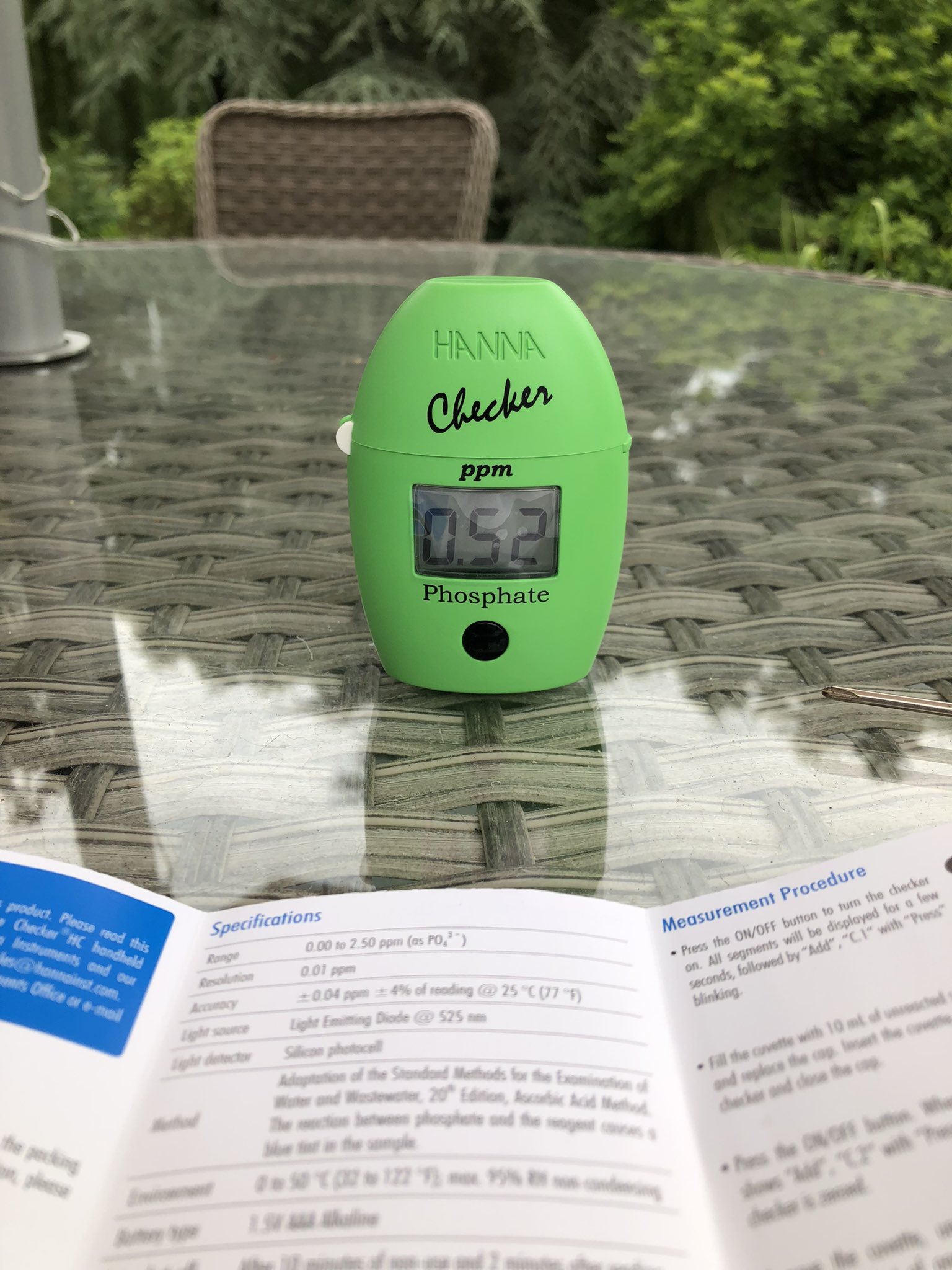
The fourth cornerstone on which Storm Geomatics is built is to provide Superior Value to all projects. A new and additional service will now be rolled out with all survey deliverables. Mike Hopkins, Managing Director explains; “Unnaturally high levels of phosphates in our rivers is like a fertiliser in the water, promoting excessive growth of micro-organisms such as algae. Algae extracts large amounts of oxygen out of the water and creates a blanket over the surface blocking light that important submerged aquatic plants need to thrive. Low levels of oxygen in the water put stress on fish which can lead to fish die-offs. Excessive phosphate in rivers is classed as pollution and it comes from diffuse pollution (leaching in or running off land) or point source pollution (known pollution source such as a sewage outfall) and by identifying watercourses and tributaries with high levels of phosphate and plotting this on a map could lead to action being taken to reduce the pollution levels. Therefore Storm Geomatics have decided that by taking phosphate readings they will play their part in cleaning up the rivers of the UK.”

Other News

Geospatial Data Powers Asset Management

Geospatial Survey Delivery Across UK River Infrastructure