Inclement Weather Tests Storm’s Technology
In contrast to the record hot temperatures of July 2022, this year July recorded an average rainfall across the UK of 82mm. Coupled with intermittent sun and mild temperatures the increase in foliage proved challenging for Storm’s surveying teams. Storm’s investment into advanced technology greatly assisted surveyors to meet deadlines and keep deliverables on track. Ensuring all client’s projects were delivered to schedule.
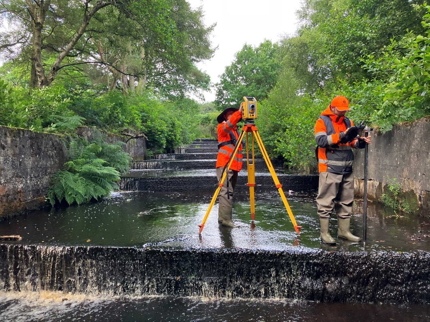
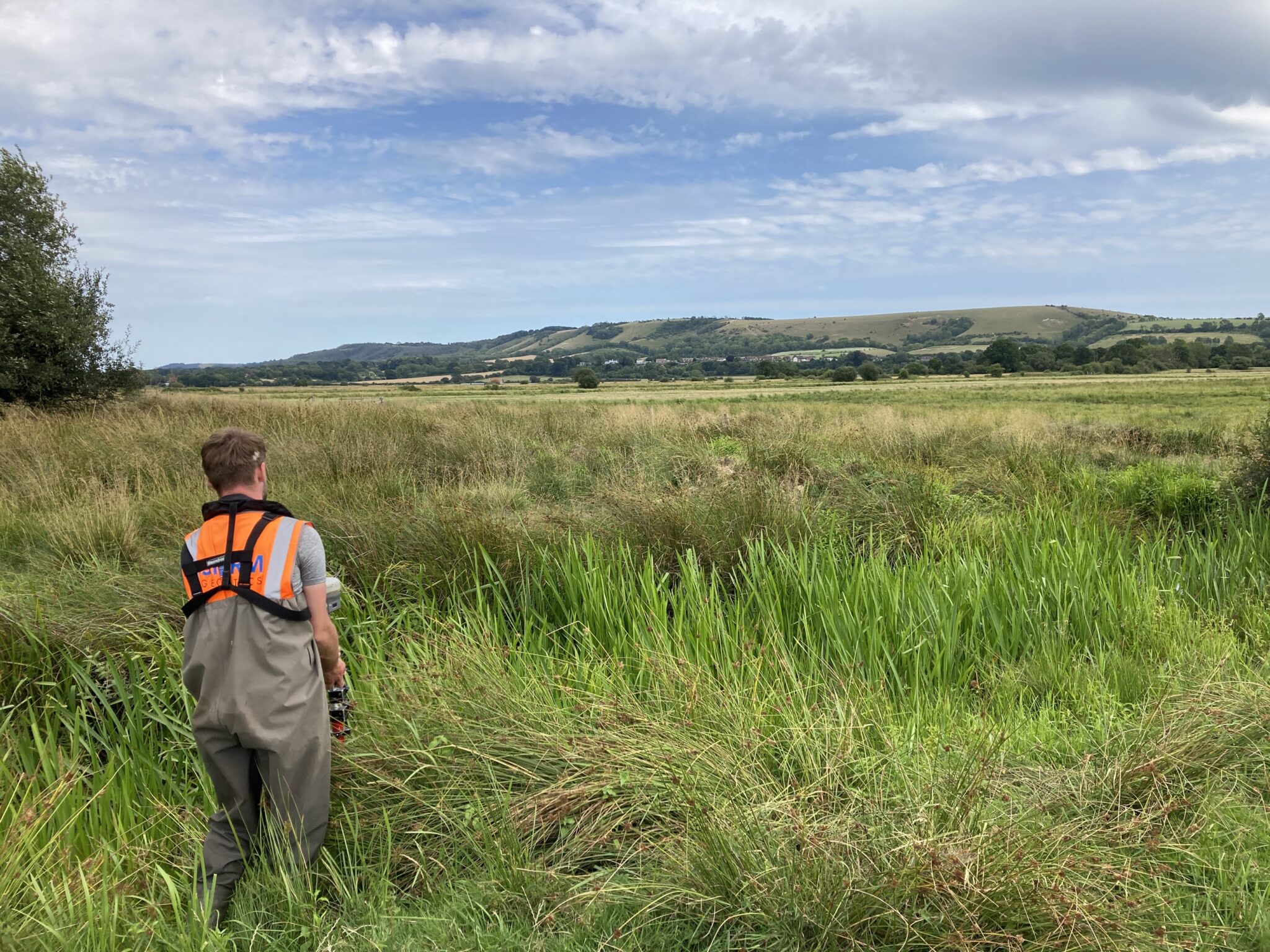
Surveyor Tom Isaac lead a team that carried out a topographic survey of 50 separate ditches at RSPB Pulborough Brooks Nature Reserve in West Sussex. The data taken will be used to create a ditch hierarchy to better understand how the area will perform under flood. Making use of the Trimble R12i with tilt compensator ensured the project deadline was honoured.
Surveying took place around an abundance of wildlife, hundreds of deer, working cattle and all manner of different bird species. Storm surveyors ensured they were careful to disturb as little of the land as possible. No hacking down of reeds and shrubs on the banks in case there were nesting birds. The surveying equipment and PPE were disinfected at the start and end of each day to ensure biosecurity was maximised.
Surveyors were also mindful to ensure all gates were closed behind them to prevent escaping cattle!
Tom Isaac commented “It’s always a great pleasure working in a site such as RSPB Pulborough. You’ve really got to take advantage of the views and wildlife available to you whilst doing your job. “
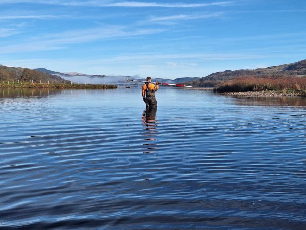
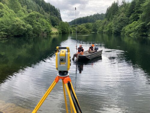
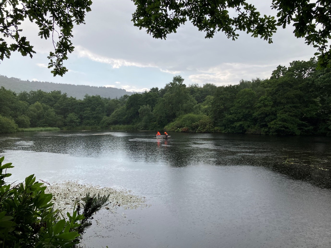
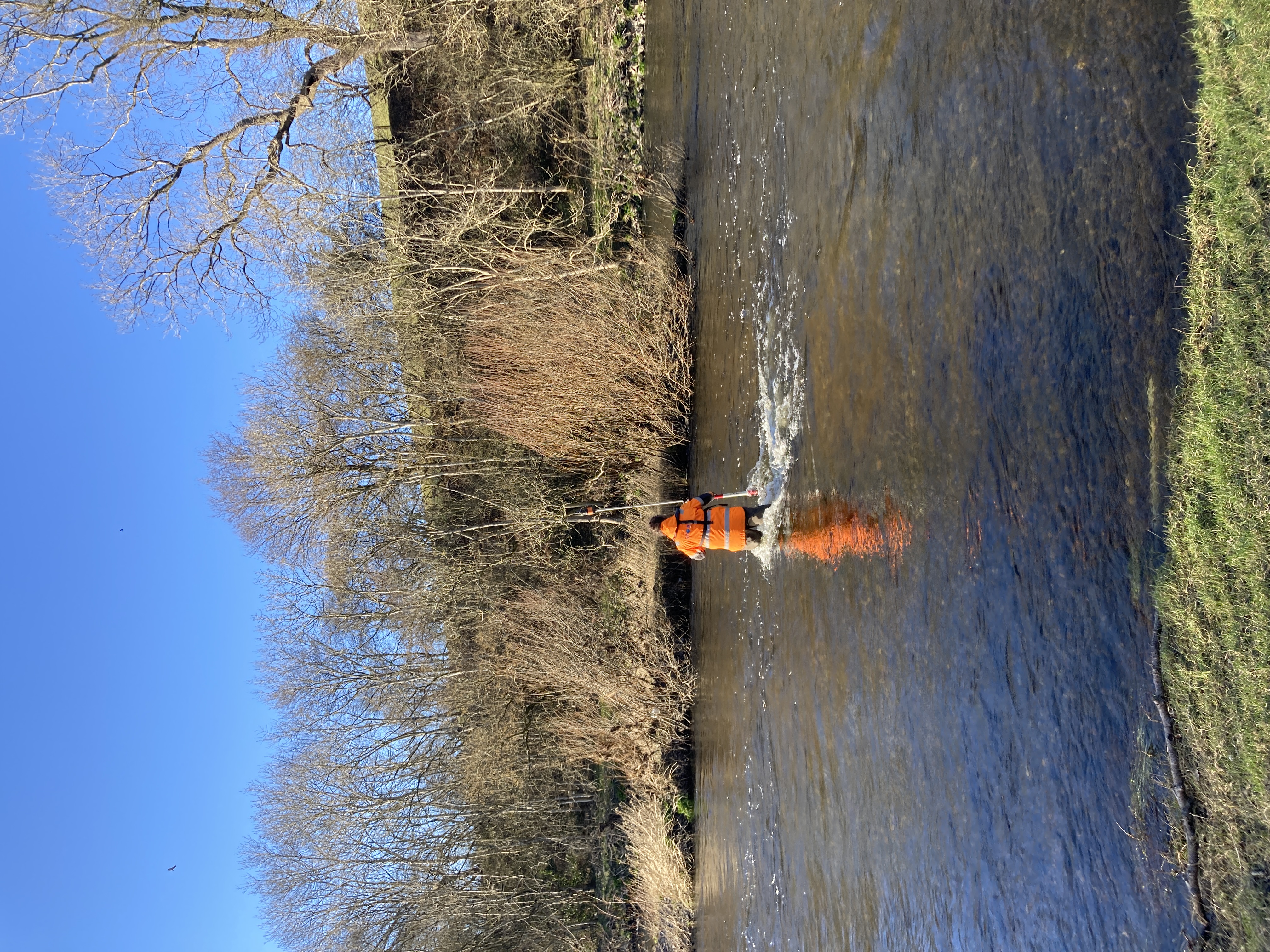
A team led by Surveyor Ben Frimley undertook a bathymetric survey in Yorkshire for Storm’s client JBA Consulting on behalf of Forestry England. The survey took place within the North Yorkshire Moors National Park and Dalby Forest. Seven lakes required a 5m level grid of the bed and silt levels. In addition, banks, outflows, structures and 10m resolution level information of the surrounding area. The three-person survey team undertook this using a Trimble S5 total station, R12i GNSS receiver and TSC7 controller. The excess foliage proved a challenge for the surveyors as access and GNSS availability was limited. The inclement weather again tested surveyors resilience during this project. However collaboration with Forestry England enabled minimal vegetation clearance to undertake the survey. The team set up temporary control points around the cleared areas where GNSS was available. These issues highlighted the importance of a pre-project site walk to assess all hazards, areas where GNSS would likely not be available and the current ground conditions of the site. Despite the challenges presented by the project the site works were completed within the timeframe allocated and office processing could begin on schedule.
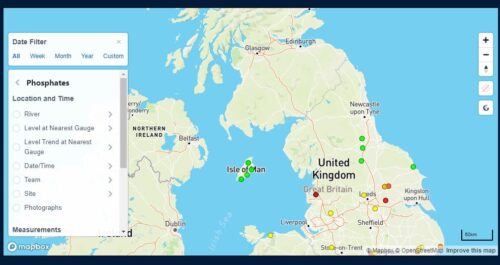
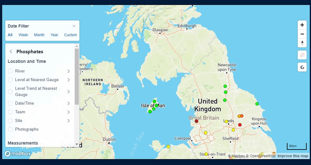
As Storm strive to provide a deep 360 package of data for their survey projects one additional service offered is a populated map of phosphate levels on the UK’s River. This free resource can be accessed here Phosphate Map. Storm believes this is a way of contributing to the clean-up of nutrient pollution, water samples are taken at each of the surveyor’s visits. Please use this data freely if it can help to reduce pollution from phosphates. Do contact us if you would like this data in tabular form.
Storm welcomed two new trainee surveyors to the team in July, Jamie Phillips will be based at Shipston and Taylor Wilson is now part of Storm’s southwest team. Their progress through training can be followed via their twitter accounts. @jamiep_sg and @TWilson_sg
Our wet ‘n wild adventures can be followed via our various social channels @stormLinkedin Twitter Instagram


Other News
From Dee to Data: Storm Delivers Dynamic River Data
Surveying Through the Seasons