
River Test’s Digital Twin – What’s The Story?
The Background
- Date
- January 2024
Storm Geomatics once again had the pleasure of working on the river Test a chalk stream located in Hampshire. 438 hectares of the Test is designated as a Site of Special Scientific Interest, it forms part of the Solent and Southampton Ramsar site and is a Special Protected Area. The client required channel and bathymetry data for the purpose of constructing an in-depth hydraulic model covering the lower reaches of the River Test and River Itchen. Permission was granted by Natural England and the Hampshire & Isle of Wight Wildlife trust to perform the survey works.
The Challenge
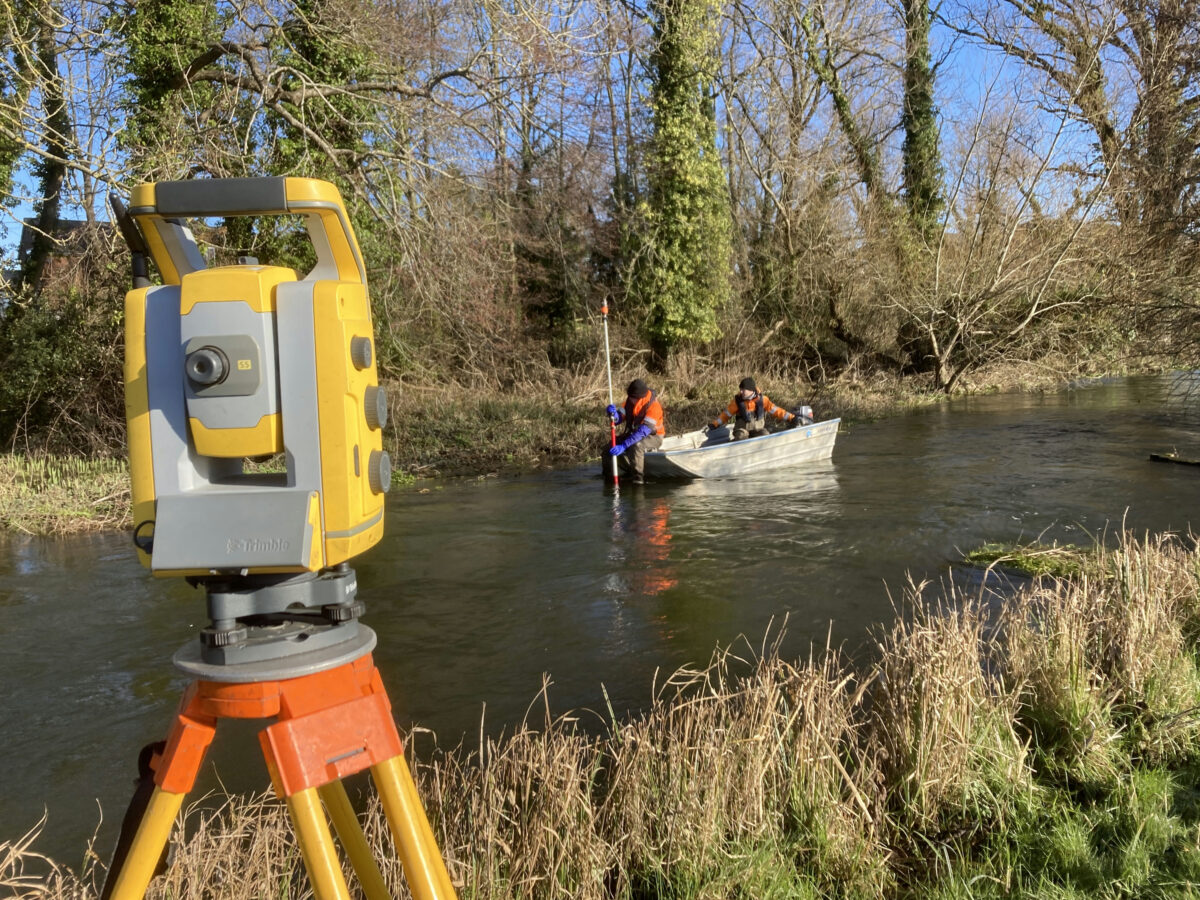
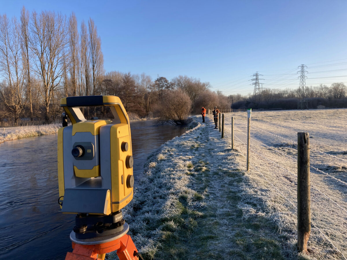
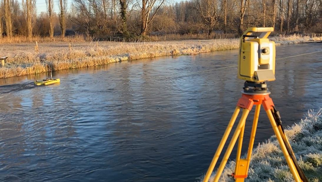
Due to the river Test’s protected status and the sensitivity of chalk streams, careful consideration was required when designing a methodology. Our RPAS was utilised to reduce the impact on the local environment and collect a large dataset providing a dense colourised point cloud of ground levels. This could then be combined with the bathymetry data collected using the Norbit iWBMS Multibeam Sonar System attached to a small aluminium survey vessel, further limiting disturbance to the Test.
The Norbit and survey vessel was unable to access some parts of the reach, therefore a Tri-drone, an unmanned surface vehicle, fitted with a single beam echo sounder was deployed to collect the missing data. Wading was used as a last resort due to this being the most disruptive form of surveying in this sensitive area.
The Test is very popular with fisherman and the survey site was situated on the grounds of a private fishing club. Keeping an open line of communication with stakeholders, Storm was able to gain permission and access onto the fishing grounds. Starting the surveying works as early as possible and approaching any fisherman on site to explain our works ensured all parties were kept happy. All fishermen were engaging, understanding, and were interested in the works we were performing.
The Results
Site work was completed within the limited window provided. Utilising multiple surveying techniques and equipment a fully detailed river digital twin of the lower Test was produced.
- James Mayers
SurveyorRecent News

Do All Rivers Lead to Liverpool?

Geospatial Survey Delivery Across UK River Infrastructure
