How to Get Ready for the UK Water Restoration Fund
Planning a River Restoration Project? Start with a survey.
The UK Environment Agency’s Water Restoration Fund is an excellent opportunity to improve river health, reconnect habitats, and increase public access to nature through sustainable approach. But turning funding into action requires one essential ingredient: dependable, model-ready geospatial data.
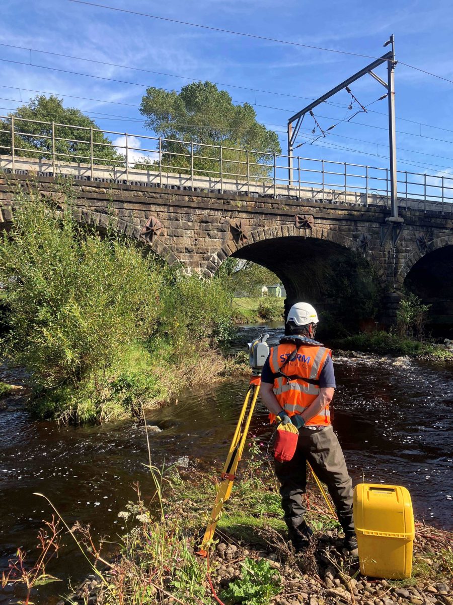
At Storm Geomatics, we now have 18.5 years’ experience of river restoration projects across the UK — from chalk stream reconnections to natural flood management interventions. If you are among the organisations awarded funding, the time to think about survey is now. Take advantage of our Yearly Survey Calendar.
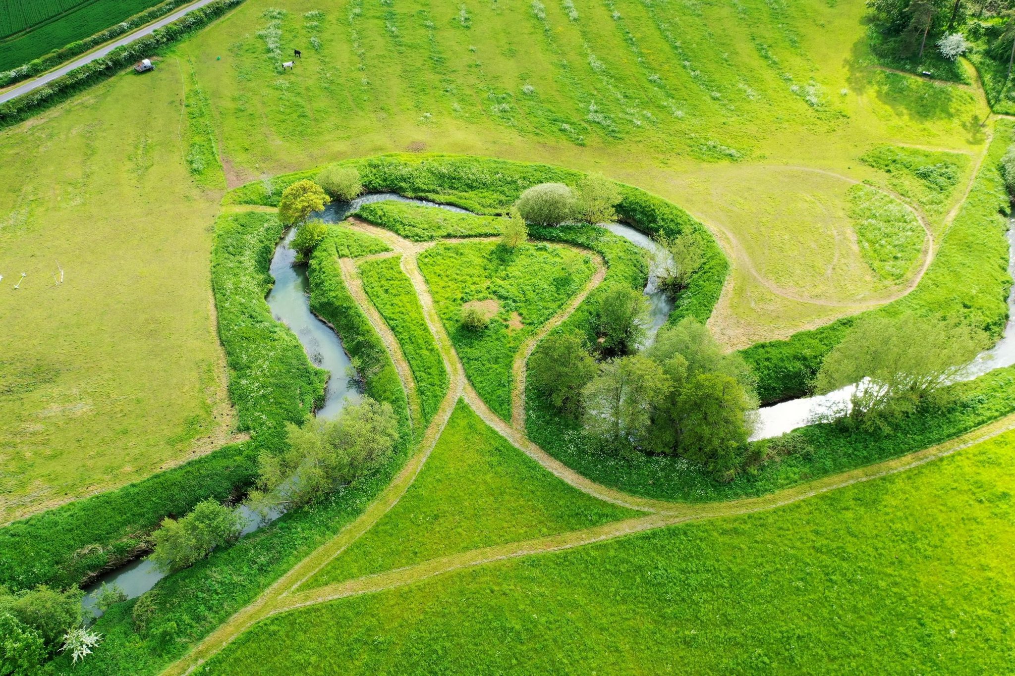
Fig 1: 18.5 years surveying UK’s Rivers
Why “Fund Survey Ready” Matters
Too often, survey is treated as a checkbox product: send surveyors out, collect a few levels, deliver a file. But this approach underestimates the impact that good — or bad — data can have on a project’s timeline, cost, and effectiveness to create real change.
Being fund survey ready means you are not just gathering data — you are delivering informed solutions. Is the survey collecting the right features, in the right format, at the right time, and with full consideration of how that data will inform modelling, design, and ecological reporting?
Common Pitfalls in Funded River Projects
We’ve identified five recurring survey issues that can derail progress:
- Poor access planning causing costly delays.
- Data misaligned with hydraulic modelling needs.
- Contextual features missed (like minor weirs or debris dams).
- Survey timing during unsuitable flow or tide conditions.
- Incorrect file formats or coordinate systems requiring rework.
Avoiding these is not about experience — it is about understanding how your project goals translate to solutions.
Our Approach: Elevating Data to Hyper Intelligent Status
At Storm Geomatics, our river surveyors do not just survey within the project specification — they think like engineers, ecologists, and fund managers. Our teams:
- Engage early to understand your project objectives.
- Work closely with your hydraulic modellers and designers.
- Anticipate what “value-adding data” looks like for your specific intervention.
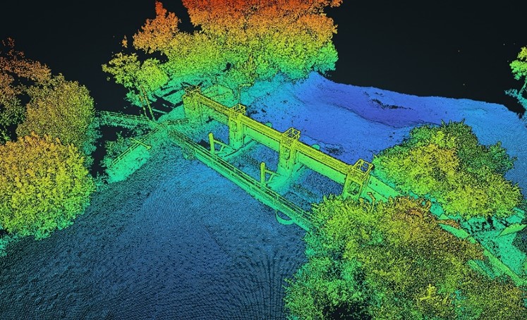
- Deliver in formats that drop straight into modelling software or GIS by creating data deliverables through GeoRiver® software.
The result? Fewer delays. Greater clarity. Higher stakeholder confidence.
Real Impact, Real Results
In one recent project, we prevented over £5,000 in redesign costs simply by identifying a hidden river structure during the survey phase — a feature that would have been missed by a non-specialist land surveyor. At a recent industry conference, we took the opportunity to chat with regular clients, who gave us confidence we are providing peace of mind.
You’re on speed dial as our chosen surveyors, the value of your data aligns with our requirements & maximises outcomes
Group Director, Tony Gee
Get Ready for the Water Restoration Fund
If you are planning works under the Water Restoration Fund, now is the time to engage your survey partner. The best projects are built on crucial information — and that starts with river surveyors collecting and processing data into your desired output model.
Want to talk survey strategy?
Let us explore how we can help you get fund survey ready, avoid common pitfalls, and make every metre of restoration count. Contact Toby Moyse or Anthony Pritchard who will be happy to advise and help you.