A Commitment to the Riverine Environment

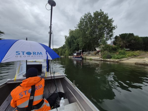
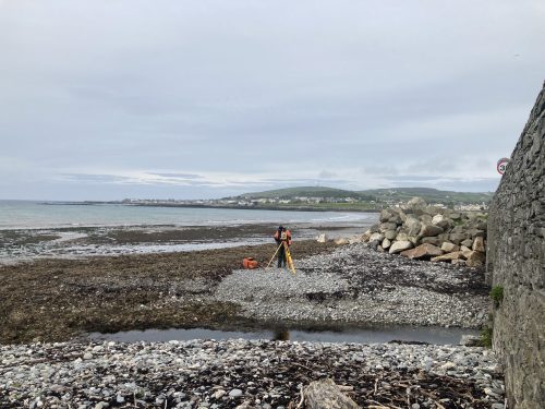
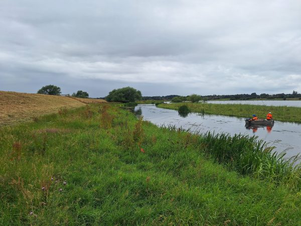
During May survey teams from Storm Geomatics began an extensive project for the Isle of Man Government to assist in standardising fluvial models and provide updated flood risk mapping of rivers and coastal towns. Teams were deployed across the island to undertake cross sections surveys, topographic surveys of seawalls and beach profile surveys. With a project of this size, detailed logistical planning is paramount to ensure deadlines are met [&] safety policies strictly adhered to. All operational staff are trained in DEFRA level 1[&]2 Water Safety and RYA powerboat training, the client required a company with this level of experience hence Storm’s involvement in the project.
As May closed the teams returned to the offices to begin processing the data via GeoRiver® software and will redeploy back to site in late June after the world famous TT Race series is completed for 2022. You are able to follow the surveyor’s progress via their Twitter accounts where they provide detailed and up to date progress on the project.
This is Storm’s company mission “Measurement experts who use innovation to understand river functions and provide knowledge to inform projects that reduce flooding and improve natural habitats”. In a bid to support this statement Storm provide a free phosphate measuring service on the rivers they visit. Results can now be tracked via https://www.storm-geomatics.com/phosphate-map.html. This map shares data in an effort to reduce pollution of the UK’s rivers. Do get in touch with us should you require this data in tabular form.
Earlier in the spring Storm welcomed their first student intern Finley Teague. During his internship Finley will research and consult “Ecological restoration for flood landscape migration as an integrated landscape approach.” It is intended Finley’s research will assist in the development of survey method’s adopted at Storm. Meet Finley and find out why this collaboration is so exciting for Storm Geomatics. https://www.linkedin.com/pulse/storm-welcome-first-intern-student-storm-geomatics-limited/?trackingId=HZV3wR%2Fln6iS306bNISJiQ%3D%3D
When considering a software package to process river channel surveys to deliver hydraulic model source data making the move to a new process can be daunting. That is the reason the GeoRiver® team at Storm have created easy to follow, short instruction videos. The videos can be found on the[nbsp]GeoRiver® You Tube Channel . This is an easy and fast method of support. Do subscribe to discover more about why GeoRiver® is the only software on the market fit for purpose.
Don’t forget – All the wet and wild adventures from Storm can be viewed via our LinkedIn page @Storm Geomatics Limited and our other social media channels. Twitter @stormgeomatics Instagram @stormgeomatics1
Other News

Helping Clients Reduce Risk with Better Geospatial Data
River Surveys and Team Bonding: Storm’s Action-Packed August