Springtime and Surveying is Easy…
The advancement of spring and the sunnier, longer days is always a welcome period of the year for the surveying teams at Storm. 2022 being no exception as their quest to contribute to flood alleviation and improve the environment continues.
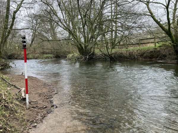
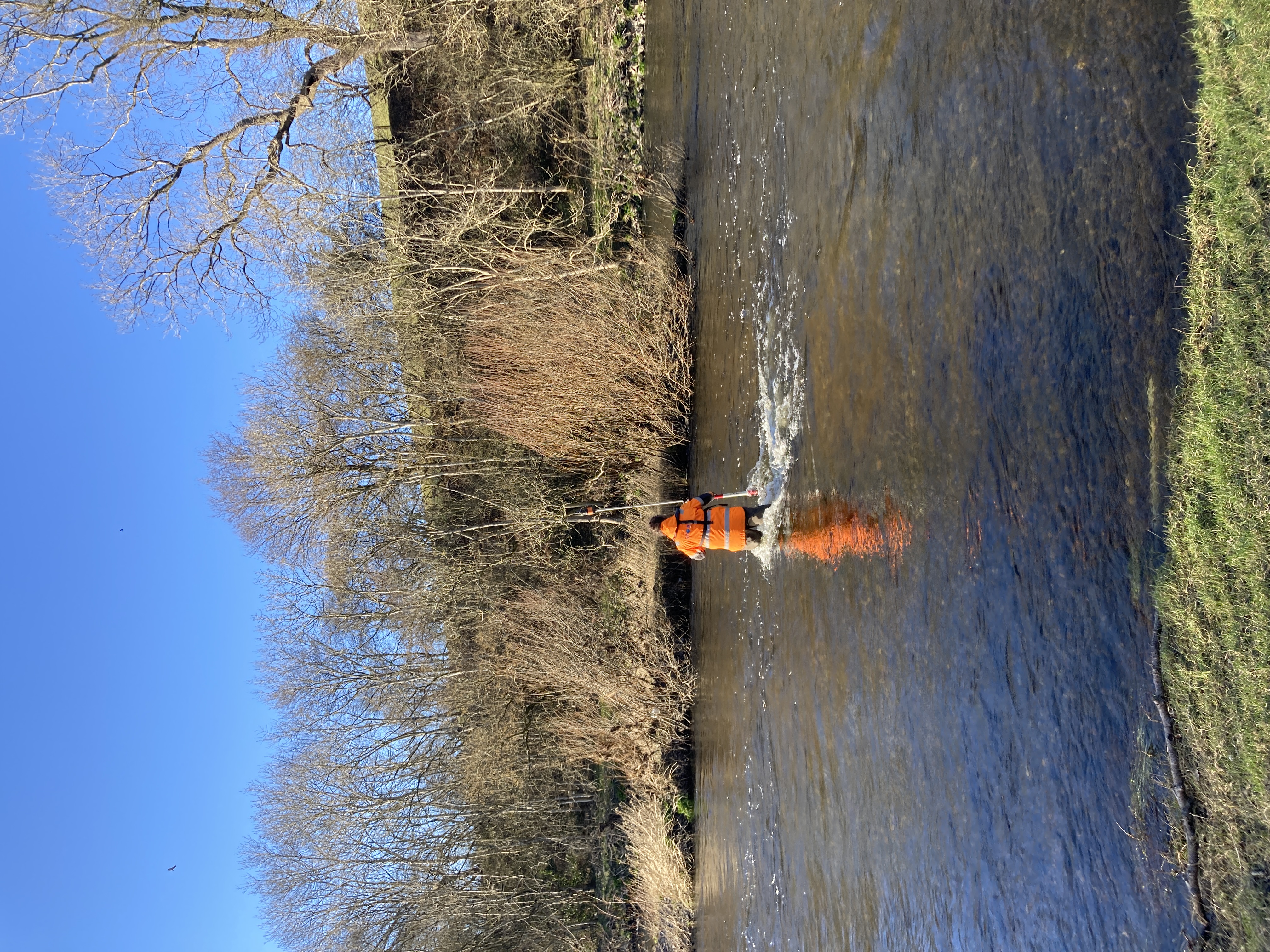
From bright sunshine to snow blizzards led to an incredibly varied fortnight for the team of two Sam’s who conducted a rigorous channel survey for the Environment Agency out on the Cambridgeshire, Essex and Sussex border.
The team completed 168 cross sections in two weeks, with the majority of sections comprising of concrete weirs to control the flow of water, down the Upper Stour and the Kirtling Brook tributary to which is directly fed by the Kirtling Green Outfall, part of the Ely – Ouse Water Transfer Scheme.
Fortunately for the surveyors the flow was minimal down the channel which allowed for the river to be safely waded, enabling the team to complete the 25m interval bed levels to client requirements. [nbsp]The purpose being to gather an accurate gauge of the volume of water that could potentially flow down the channel. These deliverables will enable the Environment Agency (EA) to assess the flood risk to the area.
The surveyors once again used the Trimble R12 GNSS receiver to great effect being able to resection the Trimble S5 total station even under slight tree cover, therefore allowing the team to work efficiently.
The scheduling of this survey was perfect, allowing the surveyors to be able to conduct a full channel survey with minimal vegetation obstructions, allowing them to collect all the necessary data in a cost effect manner despite experiencing four seasons of weather in two weeks and waking up not knowing whether to wear thermals or sunglasses! It was enjoyable to complete a survey that has a variety of structures and challenges and this was all possible from the knowledge and skills developed by Storm Geomatics and their in-house training and development schemes.
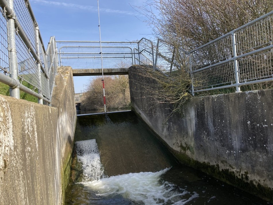
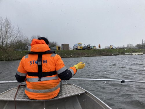
Meanwhile in Nottingham another survey team, led by Anthony Jarrett undertook a bathymetric survey of four areas around the Colwick sluice gate with a view to construct a fish pass around the gates. The landward topographical data was collected by a survey partner, however a company with specialist skills in the water environment was needed to survey the bed of the river Trent in the areas of interest. Hence the collaboration with Storm Geomatics.
Storm used a combination of survey skills and equipment, from manually poling the riverbed with a pole and prism to collecting data using a single beam echo sounder. The pole was used in areas where there was hard and soft bed detail in order to work out silt depths and the echo sounder was used where silt wasn’t present as it is unable to penetrate the silt layer. Storm undertook the work from a lightweight survey vessel along with a robotic Trimble S5 total station, prism and GNSS rover equipment. This project is set to run for a full two years monitoring the riverbed and supplying repeatable data for analysis of the river topography over time.
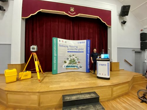
Toby Moyse and Alex Lyall represented Storm Geomatics at a careers fair in North Oxfordshire open to all secondary age school pupils and their parents. It gave Storm an opportunity to meet keen future geospatial experts and offer them an insight into the diverse profession. Taking an interactive approach by demonstrating some surveying methods sparked a large amount of interest from the school pupils. Storm are always willing to spend time showcasing their part in the Geospatial Profession to the next generation so please contact Polly Hopkins polly.hopkins@storm-geomatics.com if you think we can assist at any other similar events.
At the end of March Storm took delivery of a further EHV Hybrid and two full electric vehicles, the addition to the fleet will allow the release of existing diesel vehicles. Storm Geomatics plan on converting to a full hybrid and electric fleet in the near future. This change of fleet will directly mitigate Storm’s biggest emission source, travel and assist in the target of becoming a Net Zero Company.
Look out next month for news on the upcoming release of a Version 1.5.5 GeoRiver® software and the benefits all subscribers are able to take advantage of. It’s going to be a game changer!
Don’t forget – All the wet and wild adventures from Storm can be viewed via our LinkedIn page @Storm Geomatics Limited and our other social media channels. Twitter @stormgeomatics Instagram @stormgeomatics1
Other News

Biodiversity Gains Delivered with Data
From Dee to Data: Storm Delivers Dynamic River Data