Short Days…..Long Term Investment

The shortening of days and a loaded work schedule has tested the team at Storm to plan and execute projects within deadlines and budgets to exacting customer requirements. During November, surveys took place throughout the UK. The Storm Geoswath I survey vessel proved to be in even higher demand because of its capability of measuring a swath sector greater than 180 degrees which enables the sonar to survey right up to the waterline and beneath any overhanging foliage. To this end Storm, are expanding the specialist Geoswath I team to ensure the vessel is reaching its capacity and keeping demand from clients up to schedule. Additionally, to further improve the Geoswath vessel Storm are also investing in a new navigation system and software. During December, the Geoswath I specialist squad will be undertaking training to further enhance the survey deliverables offered to our clients. A win – win situation for both Storm and their clients.
Away from site, colleagues are currently evaluating the focus of the business. Storm has a fundamentally client focused ethos. The four cornerstones are the foundations of this ethos and are the result of customer lead focus groups.
- Reduce all Risk
- Accurate Data Capture
- Deliver on Time
- Superior Value
Never a company to rest on their laurels Storm will be revisiting these corner stones in early 2021 again being led by our customer’s requirements and problems.
Being inspired by learnings as a Beta tester for the exciting new venture Geospatial Marketing Academy has helped to strip back Storm’s customer focus to enhance the service offered by Storm Geomatics.
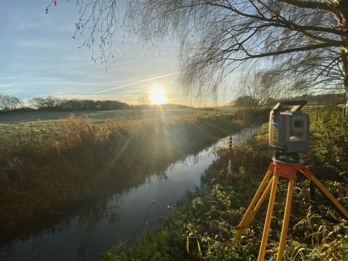
During November, the Geoswath squad were deployed to carry out a 33km bathymetric survey of the Lower Don to capture a highly detailed point cloud of the bed.[nbsp] In just 5 site days, using our cutting edge interferometric wide beam sonar, the GeoSwath was able to capture highly accurate point cloud data, that represents the topography of the riverbed.[nbsp] This data will be compared to data collected in 2011 and will improve The EA’s understanding of silt accumulation throughout the channel.
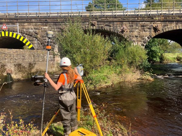
Alongside the Geoswath squad a team from our South West office provide some traditional method survey data to qualify the Bathymetric survey data. The survey involved using the boat and pole to precisely measure bed level data beneath each of the structures running across the Lower Don Reach. The tidal nature of the reach made it particularly tricky due to depths, strength of flow and debris floating on the ebbing tide. The team engineered a mount to capture georeferenced wide-angle photography for the full length of the 33km survey. This project was a perfect example of traditional survey methods working in tandem with the innovation offered by the Storm Geoswath Survey Vessel.
As mid-winter and the shortest day approaches Storm wish to say a huge thank you to their team of surveyors, assistants, managers and office-based staff. This year has been unprecedented and uncertain, and the way Storm are battling through this is testament to the whole company’s commitment. So onwards with one last big push into the Christmas break. Do keep tuning into Storm’s social media channels that are buzzing with the adventures in the wet and wild days of a River Surveyor.
[nbsp]
Other News

Geospatial Data Powers Asset Management
River Surveys and Team Bonding: Storm’s Action-Packed August