Open Spey Casting Championships at the CLA Game Fair
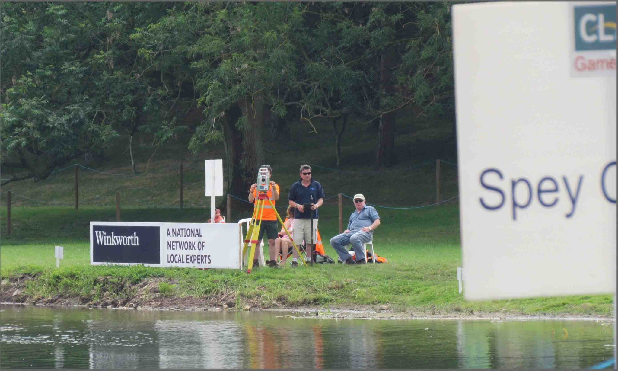
For the fourth year running Storm Geomatics were asked to measure the distances at the Open Spey Casting Championships at the CLA Game Fair – this year at the beautiful Blenheim Palace. Spey casters from around the globe converge at the Game Fair every year and spend two days looking for that one cast that shoots further than anyone else which will get them a place in the final. Storm have perfected a technique to pinpoint the fly location with an accuracy of 10mm which is important to the competitors who are mostly competing for the honour of holding the title – the cash is a bonus. Conditions on the River Glyme weren’t ideal for the final on the third day and it was a tight finish with the top three all within 0.98m of each other, James Chalmers topping it with 56.52m. MD Mike Hopkins pitched his tent next to James on the first night of the show and borrowed some additional tent pegs from him when news came that a storm was coming in. After some pizza and a glass of cider and an announcement that the Game Fair site was expecting torrential rain and flooding Mike decided to strike his tent and drive the 30mins home to save a drenching! On returning in the morning James notified me that I had made the right decision as it had come down very heavy for a solid 2 hours!
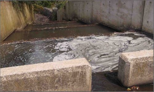
July saw the award of a landmark project for Storm Geomatics as they engage with Gatwick Airport Limited to prepare hydraulic model data across the entire catchment surrounding the airport. Following a flood which stopped the airport running on Christmas Eve last year, a report was made and documented by David McMillan (Chair of the Board of Governors of the Flight Safety Foundation) as to what happened and how this type of event can be prevented in future. The report goes in depth into all the different contributing factors to the flood and outlines an alleviation plan; part of which reads “Update and revise flood models in conjunction with the Environment Agency”. Storm Geomatics were firstly invited to supply a proposal to carry this out and were then selected as the preferred suppliers for this service. The task involves integrating existing survey data into new survey to create a complete catchment model. This has many complications which are reduced significantly with the implementation of the company’s software “Storm GeoRiver” which has tools specifically designed to cope with exactly this type of project.

Other News
Powered by Electricity.

Will August 2025 Be the Driest on Record?