
Your Flood and Coast questions answered
Your Flood and Coast questions answered
Building directly on conversations had at Flood & Coast 2026, here is how River Digital Twin® could apply in the context of your project.
Often geospatial data is underused because there is not a platform to display it so all stakeholders can understand it. The RDT® is that platform.
Flood risk decisions are often made with limited visibility of how the river behaves under real-life pressure. Meaning stake holders make slow decisions based on past behaviours in isolation not as the whole scenario.
A River Digital Twin® creates a dynamic representation of real-world flood systems, enabling simulation, testing and clearer understanding of outcomes.
- Simulate river behaviour
- Test interventions before committing
- Understand weather event impacts
- Explore ‘what happens if’ scenarios
What this means is improved clarity between stakeholders because they understand clearly.
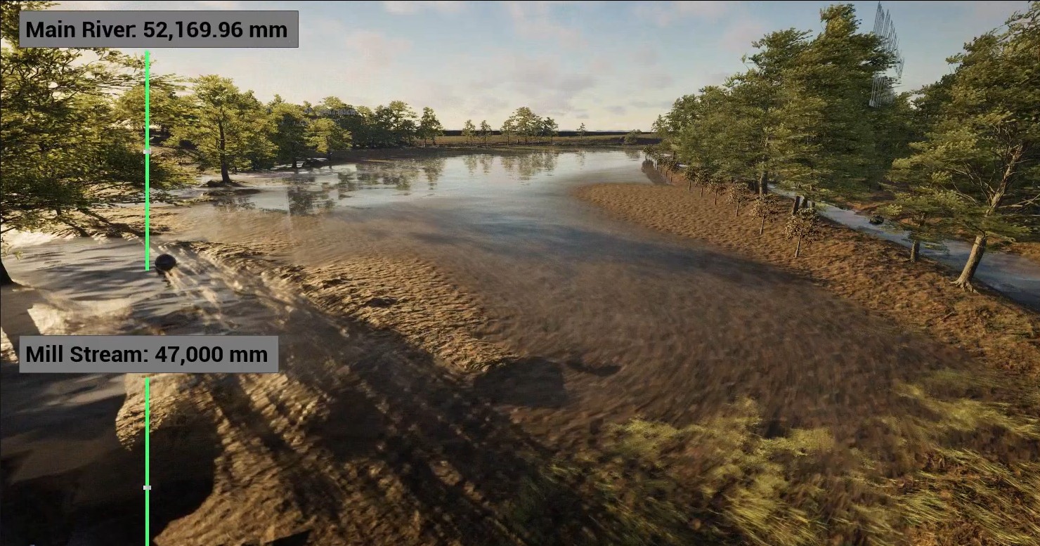
A real life example of that is Halford Flood Meadow, a flood plain on the River Stour. Storm Geomatics undertook a pioneering project to create a River Digital Twin® for this site, combining traditional survey deliverables with advanced visualisation technology. The goal was to improve flood resilience planning, support habitat restoration, and provide stakeholders with an interactive view of future scenarios.
Combined datasets formed the foundation for a full River Digital Twin®, developed further using Unreal Engine assets. This interactive model simulates near-real conditions, allowing stakeholders and professionals to explore flow dynamics, flood scenarios, and ecological changes.
Where a River Digital Twin® is useful
- Catchment and strategic planning
- River Flood Modelling
- Scheme development through option testing.
- Long-term resilience planning
Would it be useful to explore how a digital twin approach could work for your area or project?
We would be happy to build directly on the Flood & Coast conversation with you. Why not book a meeting with us?