Mobilising River Intelligence – Live Environmental Sensor River Digital Twin®
In Stage 1, we explored how River Intelligence must be redefined by moving beyond static reports and fragmented observations towards a deeper, system‑wide understanding of how rivers behave, capturing river corridor data in colourised point cloud format.
In Stage 2, we elevated that intelligence through the DTM River Digital Twin® (RDT®), demonstrating how a digital terrain model of the river and floodplain create the surface that water will flow down the river and across the floodplain, useable in 1D, 2D and 3D modelling.
Stage 3 is where Live River Intelligence becomes embedded in the River Digital Twin®.
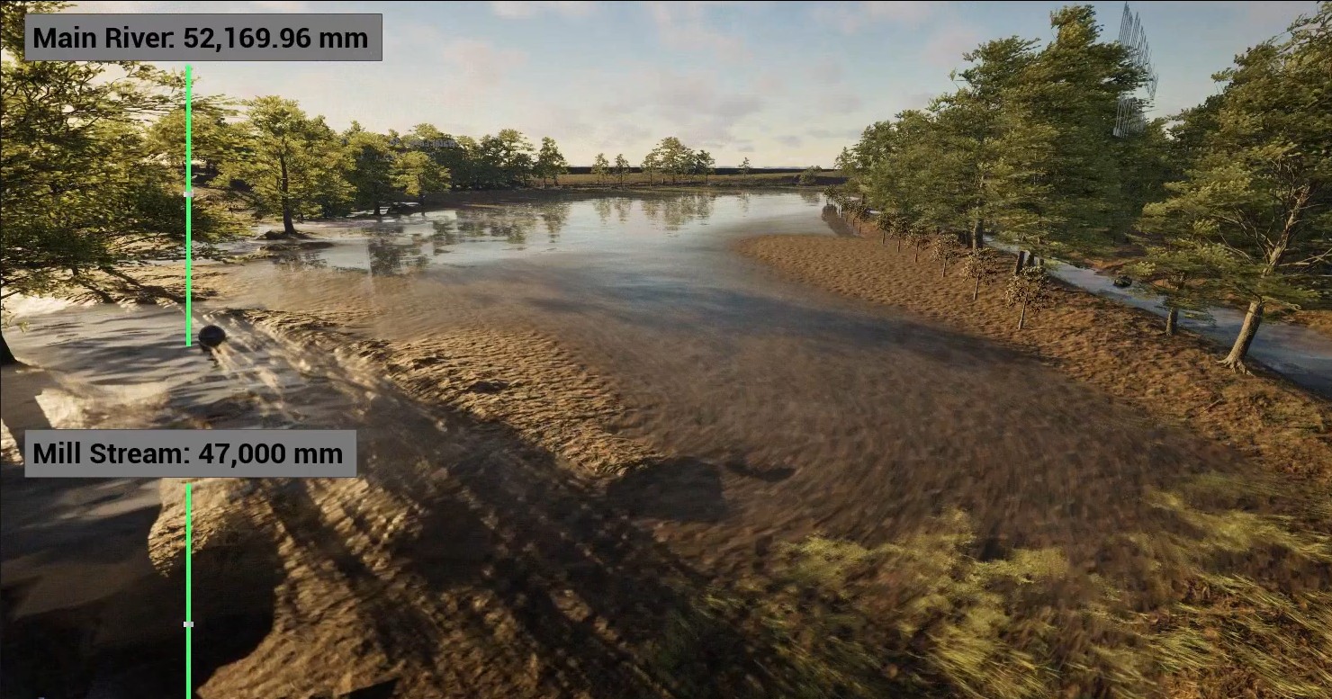
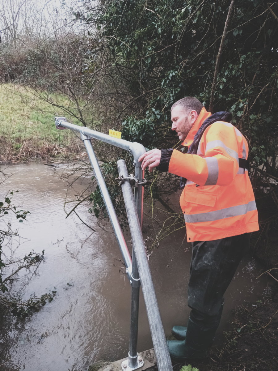
Stage 3 is defined by the introduction of live environmental sensors embedded within the river channel and floodplain, transmitting near‑real‑time data directly into the River Digital Twin®. These sensors monitor key variables such as water level, rainfall, temperature, UV, turbidity, and soil moisture. Creating a continuous, transparent stream of evidence about how the river is behaving right now.
Until this stage, River Intelligence is primarily descriptive and predictive, built from high‑resolution terrain models and desktop analysis. With Stage 3, data becomes observable in real time changing how stakeholders and designers engage with the project.
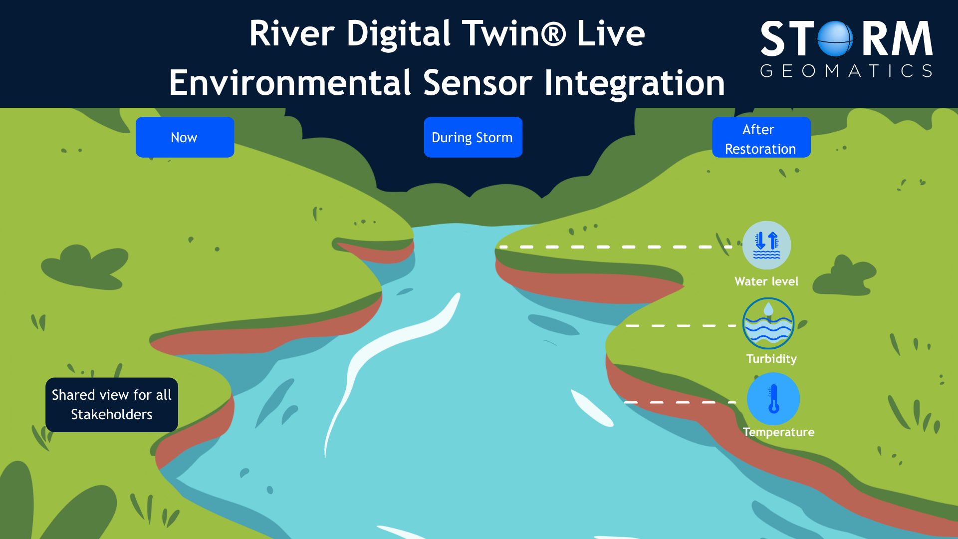
Making River Behaviour Visible and Trustworthy
One of the core strengths of the Live Environmental Sensor River Digital Twin® is that it moves discussions towards shared observation.
Instead of relying on periodic site visits or historic datasets further up or downstream, stakeholders and designers can see how water levels respond to rainfall, how turbidity changes during storm events, or how temperature and dissolved oxygen proxies fluctuate during sensitive ecological periods. This visibility is particularly powerful when engaging non‑technical stakeholders, because it grounds conversations in what is actually happening, not what might happen.
Concerns around flood risk, soil saturation, access, or unintended impacts are often rooted in uncertainty. Live sensor data, presented through the River Digital Twin®, replaces that uncertainty with evidence so enabling clearer, more informed decisions.
Supporting Proactive Engagement Rather Than Reactive Objection
Stage 3 also marks a shift from explanation to engagement.
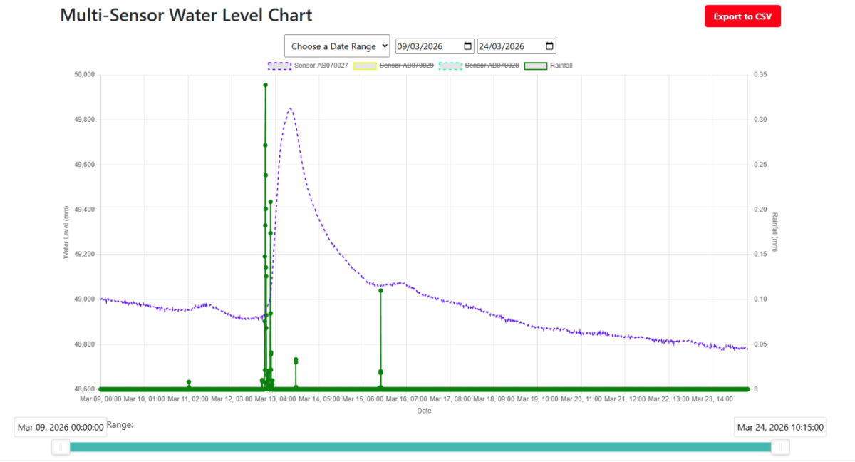
Live monitoring provides early warning of rising water levels, blockages, or sediment movement, enabling safer and faster decision‑making by project engineer teams, landowners and their neighbours. Live environmental sensors feeding into a River Digital Twin® creates transparency:
- Data is continuous, not one‑off
- Changes can be tracked over time
- Discuss the project in real-time
Creating a Common Language Across Stakeholders
When stakeholders clearly understand the objectives, success becomes far easier to achieve.
For example, river restoration projects typically involve a wide range of participants: environmental regulators, local authorities, engineers, ecologists, landowners, and community groups. Each brings different expertise, priorities, and perspectives.
Live environmental sensors ensure that the River Digital Twin® is not static. Conditions can be monitored continuously, allowing stakeholders to observe seasonal variation, extreme events, and the impact of interventions over time. They are able to engage with what they are seeing as the River Digital Twin® immediately explains what is happening.
In the next article, Stage 4 will explore how this intelligence is taken into the ultimate delivery stage. Fusing live data and modelling into a Near-Real-Time Operational River Digital Twin® that supports decision‑making during events, enables scenario testing, and underpins long‑term river stewardship.
If you’re interested in how this capability is applied in practice, look out for Stage 4 coming soon. But if you want to know sooner, just drop a message to Mike Hopkins MCInstCES he just loves to chat all things RDT®