Adapting Bathymetric Surveys with Geospatial Gatherings
Storm have continued with a full order book throughout November with new survey methods being tested at their training site along the River Stour, close to Storm headquarters in South Warwickshire.
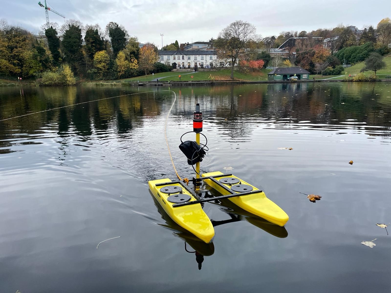
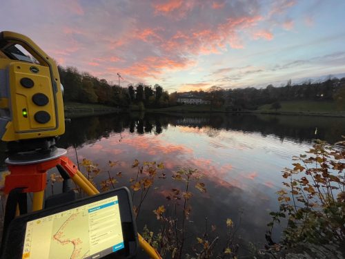
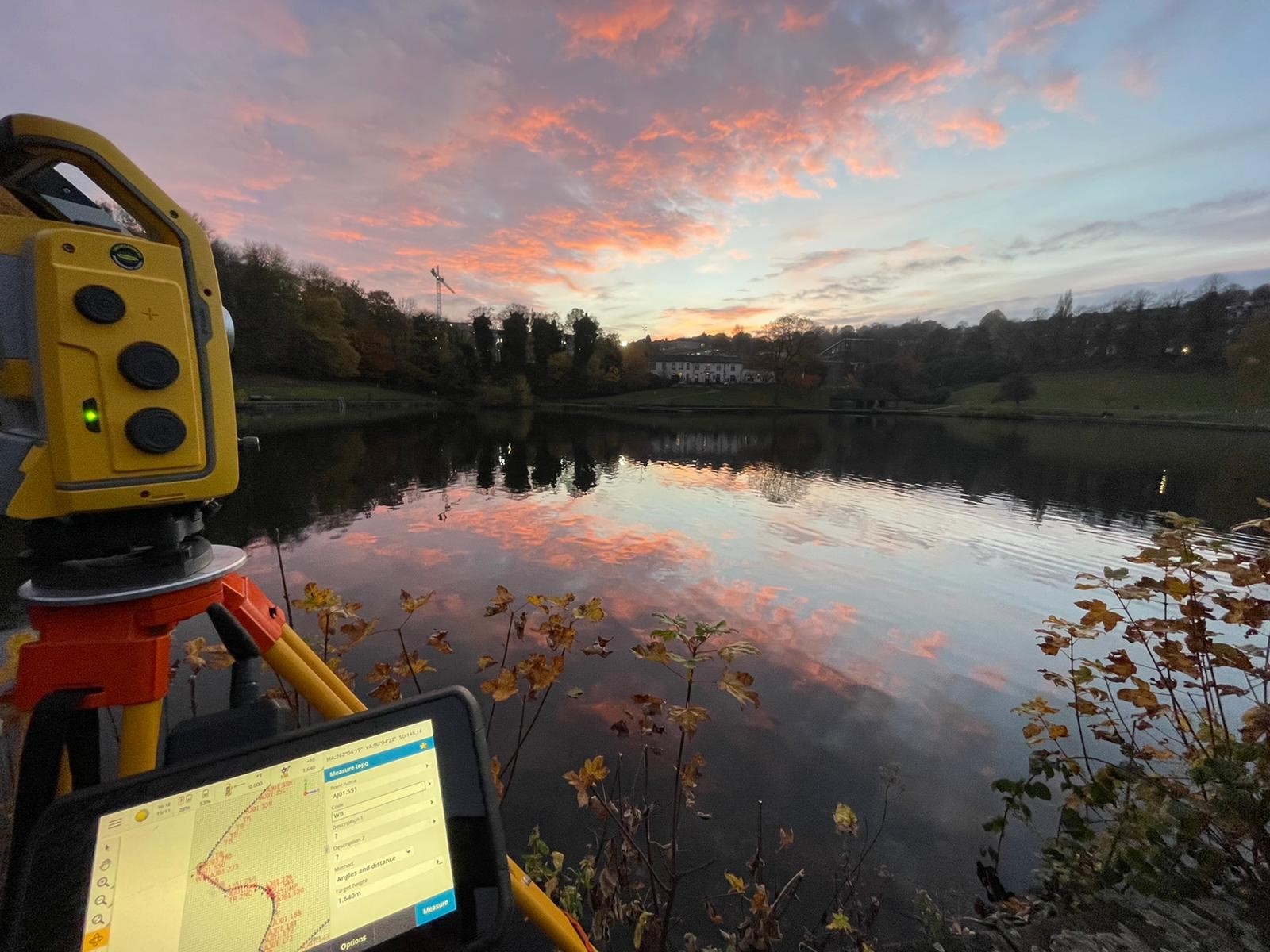
A team of surveyors undertook a bathymetric survey of the Crookesmoor Pond located in Crookes Valley Park which is one of three parks in the Crookesmoor area of Sheffield. It was previously known as Old Great Dam, a water supply reservoir. Due to its previous purpose many people visiting the park had varied theories of the depth of the pond and were very interested in the team’s work. Storm measured water depths of 9 metres, the interested public questioned on figures of 20 metres or greater. Even though the water temperatures were in the single figures there were plenty of wild swimmers or ‘plungers’ as they referred to themselves who swam in the pond all during Storm’s visit in mid-November.
Our client for this project was environmental-engineering company Sanctus Limited. Working alongside an environmental engineer, Gemma who was on site collecting sediment samples that were to be sent off to a lab for further investigation. The purpose of the survey was to determine the depth of the pond for exploration into the use of the pond for water-based sports and activities. This was on behalf of Sheffield University but there were conflicting local opinions on this – especially since there was a fatality of a student in July 2021.
To complete this project, a Hydrone- RCV remote controlled un-manned vessel equipped was used with a single beam echo-sounder. Due to the open nature and relatively clear water this was an efficient way to gather the depths at a two-metre grid interval of the pond that was approximately 16,800m^2. This method of surveying was adopted in preference to the traditional poling off a boat or a float tube to save time, and to produce a higher calibre of equally spread data. Storm collected most of data required from a small number of total-station set ups due to the openness of the pond which was useful as it ensured the surveyors could focus on driving the boat in straight lines to assure a neat grid was collected. With many thanks to Anthony Jarrett and his team for executing this project so efficiently.
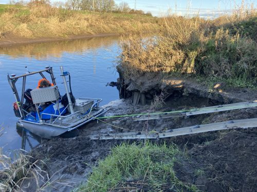
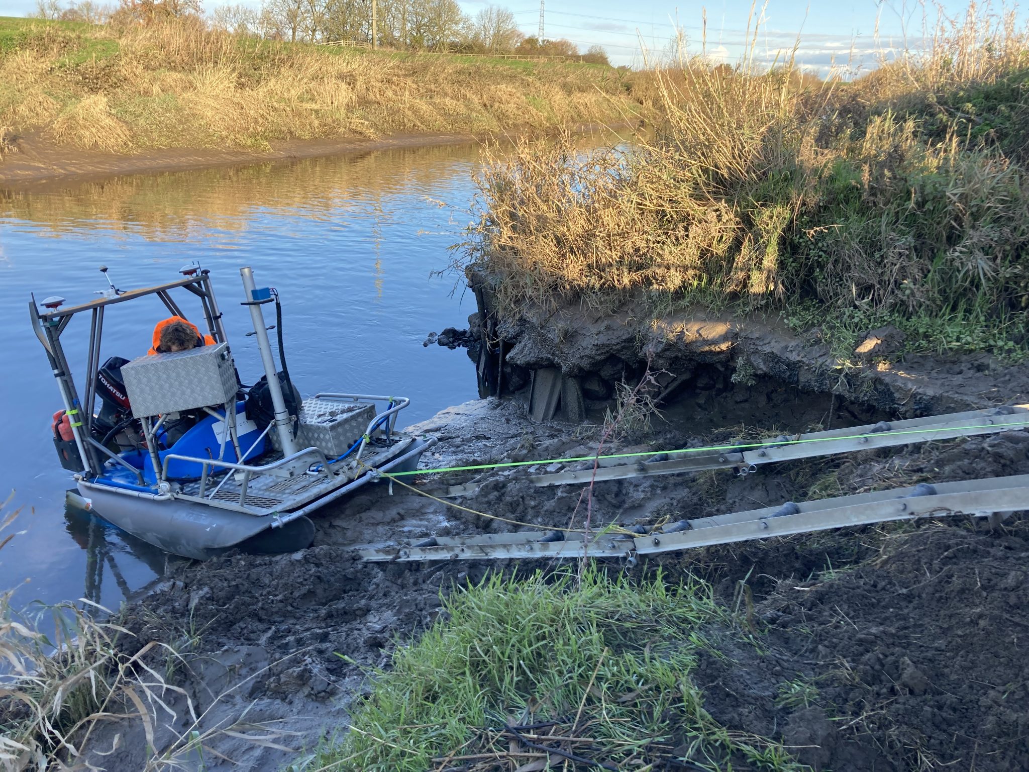
Meanwhile Storm Geoswath I compact survey vessel was deployed to the River Don near Doncaster to carry out a multibeam bathymetric survey along two stretches of the river for post dredging purposes. The Environment Agency requested the surveyors capture measurements of 150m either side of Kirk Bramwith Bridge and 150m either side of Stainforth Bridge 2 kilometres downstream. Ease of launching the GeoSwath I vessel from the shallow banks of this tidal river was helped along with Storm’s custom-built ramps. The Geoswath I is a compact vessel that can be launched and recovered in remote locations and avoids the problem of finding a suitable site thus saving site time. The photograph demonstrates the ease of launch and recovery.
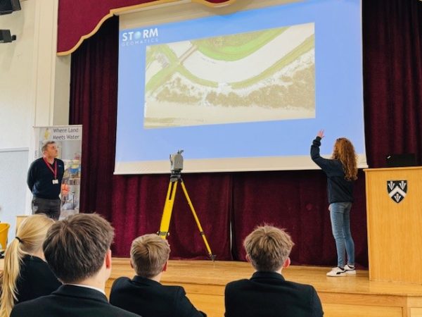
The geospatial profession gathered at the Excel arena for the eagerly anticipated GeoBusiness 2021 exhibition and conference on 24 and 25 November. Members of Storm’s management team attended on both days and concluded what a worthwhile trip it was. Managing Director Mike Hopkins made this comment “Having attended every GeoBusiness since its inception as an exhibitor, this was the first time I had attended as a visitor. I have to say it was a very pleasurable experience. I organised my day around seminars on data presentation and live data streaming from the field whilst allowing time to visit exhibitors stands. I placed an order with Seafloor Systems for a tri-hulled radio-controlled single beam survey vessel which is compact and tough, it will work well in some of the more difficult rivers, ponds and lakes we survey. The vessel is made in California, and it was great to see overseas suppliers in the UK, they provide a different variety of sensors and methods, opening up choice for our surveyors. Above all, it was just fun to meet up with friends from the geospatial world and talk about the market, projects and the ups and downs of our crazy profession. “
Director Anthony Pritchard also attended and commented “ Great to see Geobusiness back with a bang at the London Excel recently. A great show with plenty of thought provoking presentations. Inclusion and Diversity played a large part in this years’ show, and I listened to both RICS and CICES current position and future plans to move this forward – did you know your company is likely to be 25% more profitable when females are part of the executive board and up to 36% more profitable with ethnic diversity? I believe this needs to start in school where children and young adults are educated on the opportunities to be found within the geospatial sector – they can’t be interested in something they don’t know exists! RICS are planning on updating their guidelines for use of GNSS in Land Surveying and Mapping and looking for information via the questionnaire at the following link: https://communities.rics.org/RICSGNSS/answerQuestionnaire?qid=7628035
Meanwhile three more of the surveying team successfully completed the RYA Power Boat Level 2 qualification conducted by trusted supplier Bristol Maritime Limited. A vital qualification needed within the river surveying discipline.
The shortening of daylight and testing weather conditions require a dedicated team effort from all at Storm, thank you to the whole team for ensuring November was another month where projects kept to schedule and budget and all our clients were very pleased with the quality of deliverables they received.
Don’t forget – All the wet and wild adventures from Storm can be viewed via our LinkedIn page @Storm Geomatics Limited and our other social media channels. Twitter @stormgeomatics Instagram @stormgeomatics1
Other News

That’s A Wrap: 2025 River Surveys & Festive Resilience
Dry Spring, Fresh Momentum – April Survey Highlights