Training, Trimble and Testing – Bumper Month!
September has proved to be the busiest month of 2021 to date for Storm Geomatics Limited. A full order book has taken team’s across England and Wales embarking on a diverse range of surveys for clients.
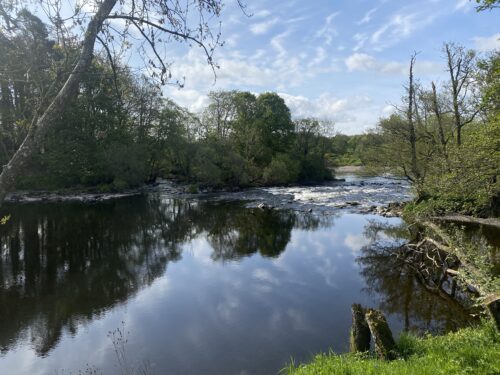
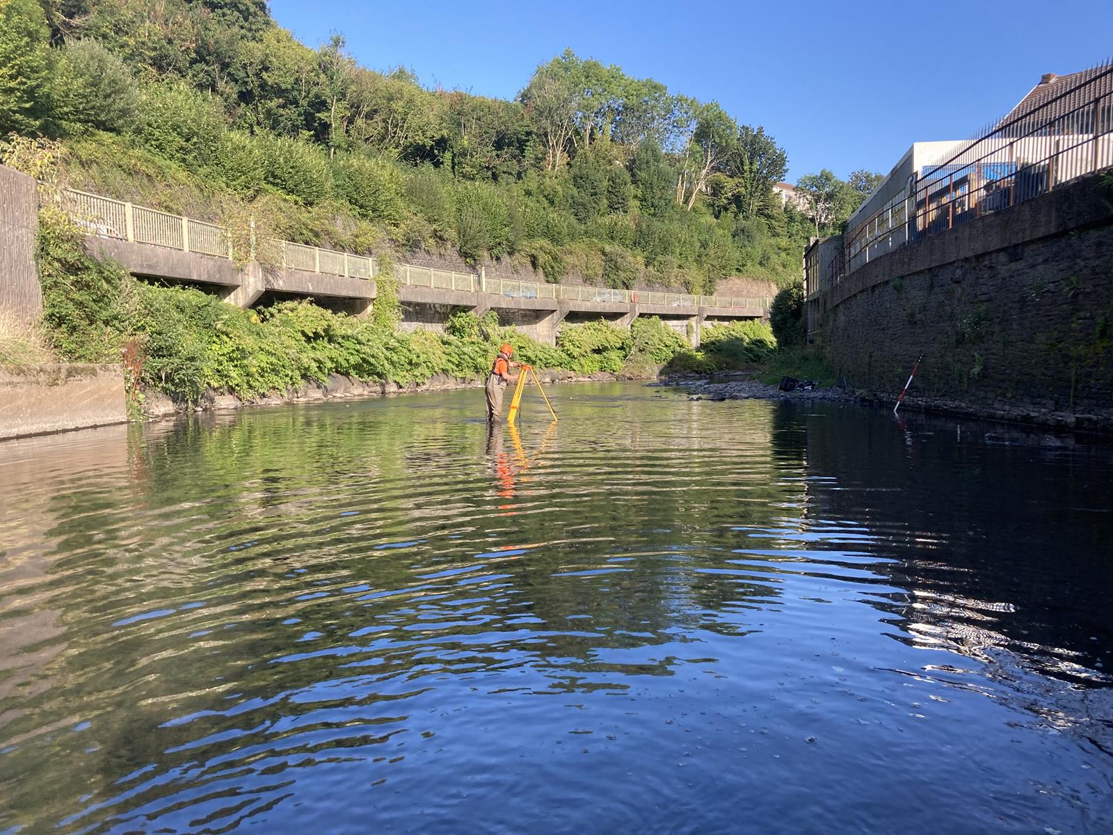
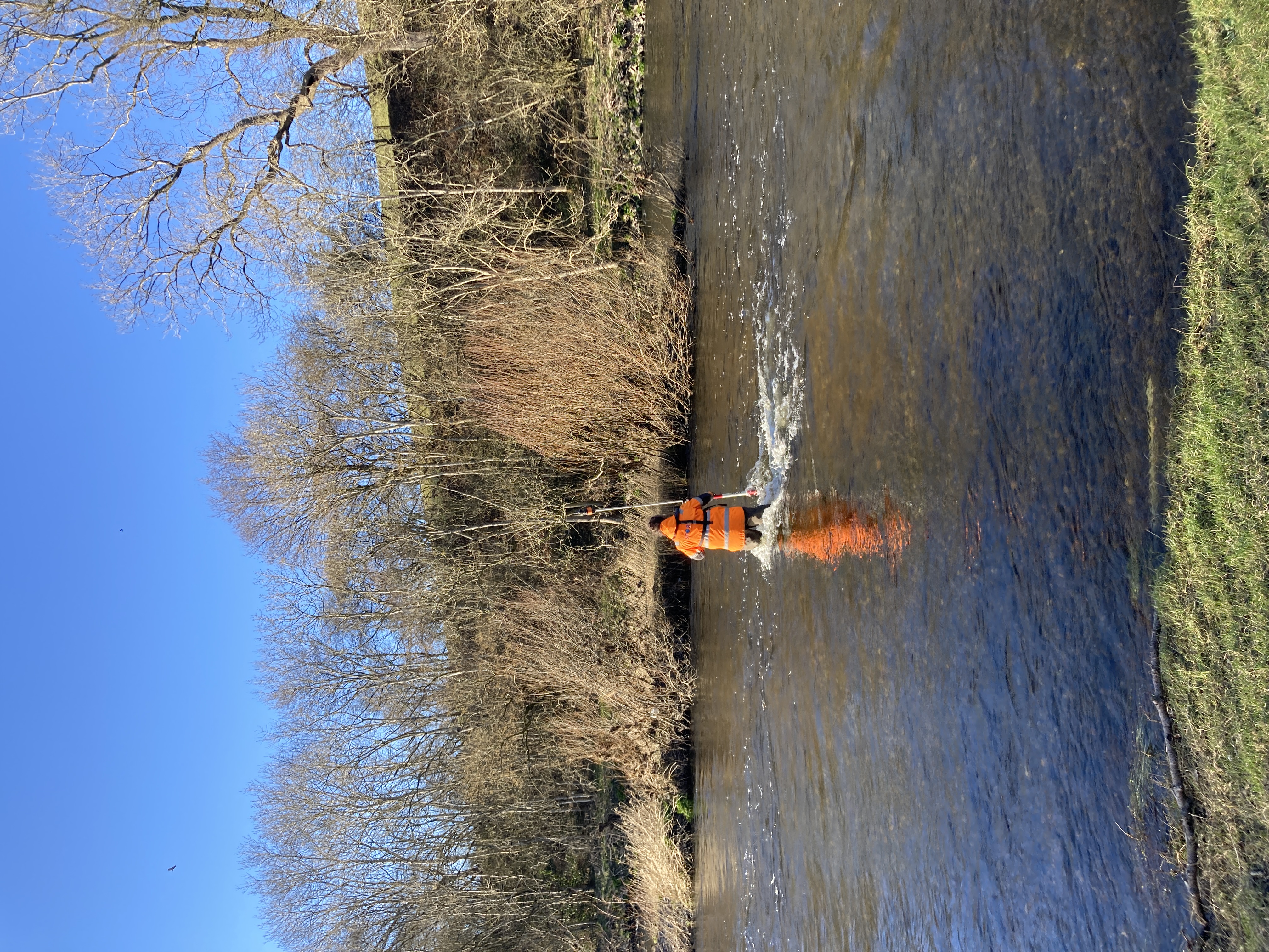
The Southwest team continue to concentrate their resources on 32km of rivers within the Rhondda Valley, Wales. Survey Manager Steve Drew, explains….” Our client, Ove Arup were commissioned by Natural Resources Wales to update the assessment of flood risk to the Rhondda Valley which has seen some significant flood events over recent years. The survey information will be used to produce a 1D-2D hydraulic model for the area to better understand and reduce flood risk. The survey involves measuring key points along the valleys’ watercourses (totalling approximately 32km in length) and measuring over 400 cross sections with several kilometres flood asset surveys. We utilised Trimble survey equipment, notably the S5 total stations measuring to Trimble MT1000 Active Prisms which gave us brilliant tracking performance in tough conditions. R12 GNSS receivers proved invaluable amongst very challenging GNSS conditions and the TSC7 controllers gave us the processing power to capture and view large data sets with background mapping in the field.” [nbsp]For more information on this project do keep checking our website Case Studies – Storm Geomatics[nbsp]for a more detailed case-study.
Three members of the Southwest team undertook their DEFRA Level 2 Water Safety Awareness training expertly conducted by Bristol Maritime. Storm welcomed the recent Environment Agency instruction that this training is now mandatory when embarking on a water survey commissioned by them. The first cornerstone on which Storm Geomatics operate is to “Reduce all Risks” ensuring relevant training of all operational staff is strictly adhered to.
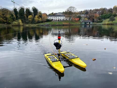
Another survey team were commissioned to undertake a lagoon survey in Cambridgeshire during September. The topography of the site provided a challenge but by using a combination of methods (Geoswath, Hydrone [&] handheld GPS Poling) surveyors were able to successfully measure the two manmade lakes which were previously clay and gravel pits. These three methods were utilised to account for the variations in depth, bed softness and sub-aquatic vegetation. The mighty Storm Geoswath was able to cover large areas of deeper water[nbsp]to accurately map the bed, whilst the hydrone was extremely useful for covering intermediate depths with softer beds that were unable to be waded safely but were too shallow for Geoswath to cover effectively. These two datasets were then tied into the poled data from the more vegetated lake edges to create the full bathymetric model of the lake beds for the client to calculate the lake volumes.
The health of the UK’s Rivers is fast becoming a national environmental issue, to assist clients and “Add superior value” to survey deliverables, Storm now offer a complimentary phosphate level testing service, building up a database across the UK. Recent testing on the Little Avon River, Berkely, Gloucestershire produced a reading of 1.31ppm in late September. Taken after a period of heavy rain the high levels could relate to run off from adjoining cultivated fields – a safe reading is advised at 0.10ppm.
As Storm want to actively contribute to the improvement of the UK river network two members of the team have embarked on the MoRPh River Condition Assessment course: Surveyor Jack Crompton and Managing Director Mike Hopkins hope that through this qualification Storm will be able to provide clients with more information regarding the impact of their development on the local environment within which it is situated. This information will help inform development decisions prior to work being carried out ensuring river biodiversity is either improved on site or a biodiversity offset credit is taken elsewhere. Developers will soon need to improve the biodiversity of their sites by 10% above its baseline value ensuring that development has a positive impact on biodiversity for the future. Jack commented ”I wanted to undertake this training as it is an interesting cross over between surveying and environmental data collection that we can use as a business to bring something different to clients looking to develop more sustainably near river environments.” [nbsp]To follow Jack and Mike’s progress do follow them on Twitter – @JackC_SG @StormGeomatics[nbsp]
A reminder: Have you registered for the GeoRiver® webinar yet? Join Anthony Pritchard on Thursday 14 October at 10.00 BST. To register please click here: https://lnkd.in/gq-2zEss This webinar will save you days on processing your river channel data. Take 30 minutes to find out how. Or follow Anthony @Anthony Pritchard
Do keep up with all adventures from Storm via our Linkedin page @Storm Geomatics Limited and our other social media channels.

Other News
Future River Surveyors, How to Inspire Them…
From Dee to Data: Storm Delivers Dynamic River Data