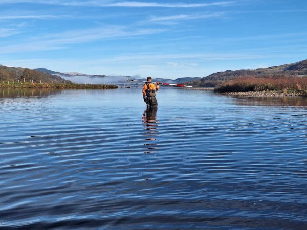
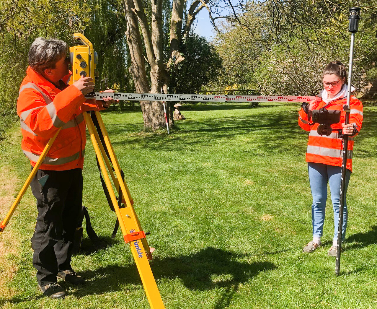
Surveyors do it 2m apart!
So, a month on from Storm’s last news, has anything changed, is there any news to write about? [nbsp]
Covid -19 and the ensuing effects of the pandemic continue to dictate our daily lives both personally and professionally. Storm Geomatics continue to follow the advice of the UK government on how they can operate during this time.
At Storm, April 2020 has been a month of planning and strengthening their expert knowledge for data capture of flood scheme projects. To be in a strong and reactive position the management team have compiled a real time map of both current and prospective projects throughout the UK. From here the operations team can ensure desk top studies and risk assessments are carried out in specific geographical regions. Ensuring survey teams will be able to carry out their tasks within government guidelines and observing social distancing, keeping them safe, the public safe and landowners safe too. The first cornerstone at Storm is to Reduce All Risk – our surveyors are trained, qualified and experienced at water based projects.
Storm Geomatics now, believe more than ever, collaboration and communication are key to be able to mobilise surveyors to carry out vital data capture. So,[nbsp][nbsp][nbsp][nbsp][nbsp][nbsp] the team are working with their clients and landowners to make all this happen. Partnership and expertise is at the forefront of all Storm’s project work.
In the March news the focus was on innovating the company’s survey methods. Time has been put to good use doing just this, Managing Director Mike Hopkins is developing quite a following on twitter with his demonstration videos. Check out Mike’s account @stormgeomatics
Georiver® the data preparation software is still available for a free trial and the company are asking people get in touch if they would like to take up this opportunity as it will certainly help make up time on their return to operations. Anthony Pritchard is very excited to share this amazing software with more industry partners and can be contacted on email using this address anthony.pritchard@storm-geomatics.com
On a personal level many of the Storm surveying staff have spent time in April completing their Approved Development Scheme to achieve ICES accreditation. Some are finding this challenging but reports coming in to the management team are that they are keen to put their new found knowledge into practice out on site. All the Storm Geomatics family keep in regular contact and ensure everyone is doing well and is staying healthy.
At HQ a new garden has been landscaped so when staff do return there is a pleasant outside area to enjoy and space to maintain social distancing in the open air.
In conclusion April 2020 has been a month like no other within the history of Storm Geomatics. As a team they continue to be determined to reduce flooding across the globe through measurement, understanding and innovation.
The message is stay safe, keep determined, keep focused. #carryonsurveying…

Other News
Midsummer Species Count Brings Diversity to the Meadow
January’s Surveying Surge: Holding Back the Flood