News & Resources
Critical Data On Hundreds Of Environment Agency Assets
01.06.2014
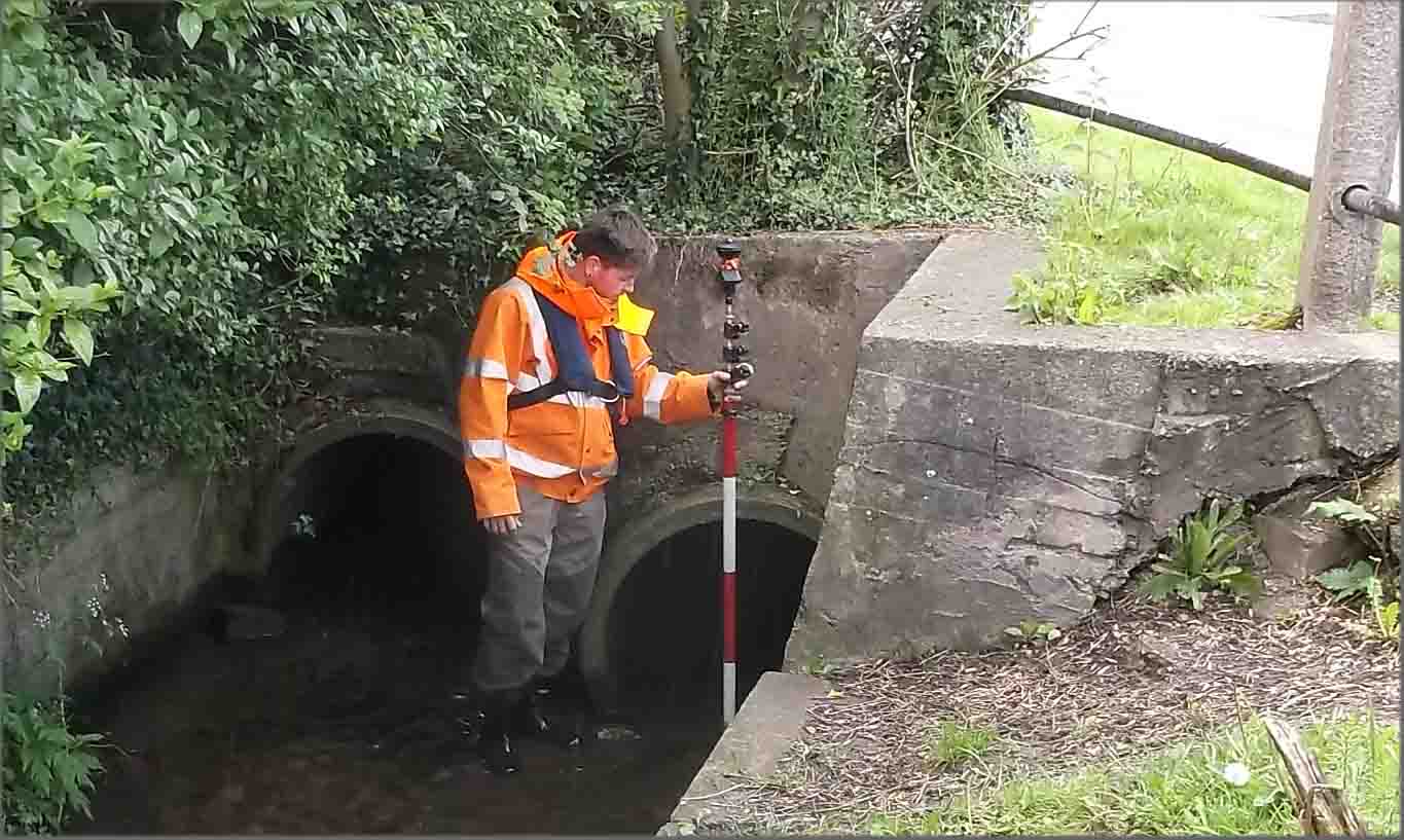
Surveyors at Storm Geomatics spent the majority of June on a challenge to capture critical data on hundreds of Environment Agency assets within the Midlands, Thames and Yorkshire regions. The company’s recent boost in capacity has opened doors to bigger projects with tighter deadlines – and this was no exception. Assets were supplied as GIS files by each region which the survey teams uploaded onto their Leica controllers. Assets were then located and critical data was populated into the GIS table. Storm Geomatics were the perfect survey team to execute this project with vast knowledge and experience in locating, recognising and capturing EA assets in all the different guises they can take.

Other News

Geospatial Data Powers Asset Management
Essential Bridge Scour Surveys Across England Storm Geomatics has been commissioned to deliver routine scour assessments across 34 bridge...
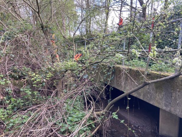
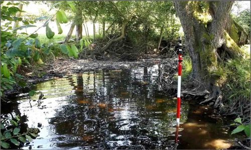
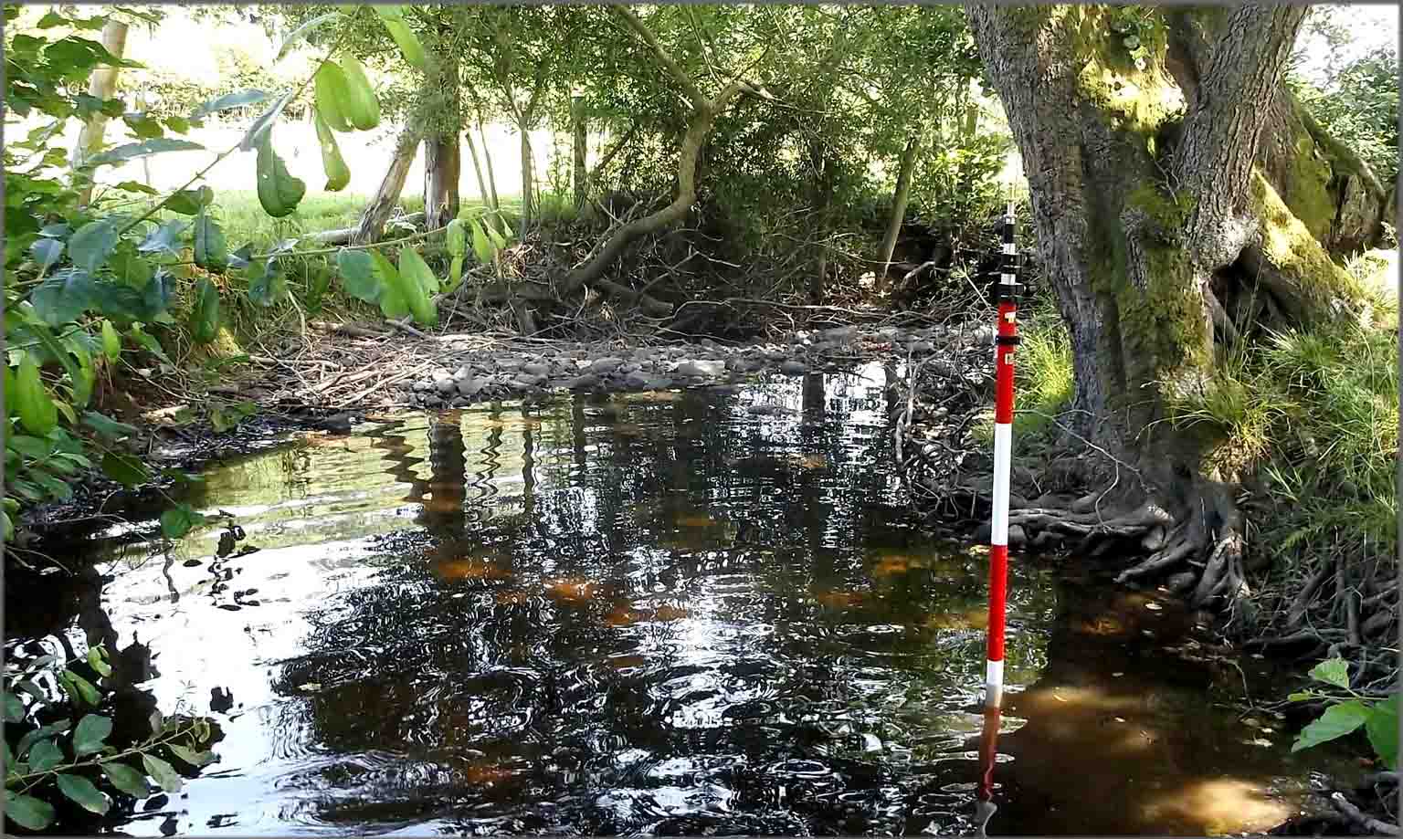
Storm Surveyors Conquer Springtime Vegetation
Storm surveyors used their safety training and experience whilst undertaking a complex project of a river cross section survey
Positioning a Syphon Pipe in Winter? Tough Guy Surveyors get it done.
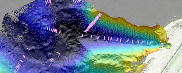
Point Cloud of Gouthwaite Reservoir