
Near Real-Time Operation River Digital Twin® – Stage 4 of our River Digital Twin®
In Stage 1, we explored how River Intelligence must be redefined by moving beyond static reports and fragmented observations towards a deeper, system‑wide understanding of how rivers behave, capturing river corridor data in colourised point cloud format.
In Stage 2, we elevated that intelligence through the DTM River Digital Twin®, demonstrating how a digital terrain model of the river and floodplain creates the surface that water will flow down across, usable in 1D, 2D and 3D modelling.
In Stage 3, Live River Intelligence became embedded in the River Digital Twin®, with environmental sensors providing a continuous, transparent stream of evidence about how the river is behaving in near‑real‑time.
Stage 4 is where the River Digital Twin® becomes operational.
From Live Data to Near‑Real‑Time Operation
Stage 4 is defined by the creation of a Near‑Real‑Time Operational River Digital Twin®.
At this stage, we bring together:
- High‑resolution topography and terrain models
- Live environmental sensor data
- External drivers such as weather, rainfall, and hydrological inputs
- Physical river processes, including flow, storage and interaction with the floodplain
These components are fused into a single, continuously updating system capable of simulating river behaviour as conditions evolve.
The River Digital Twin® is no longer just showing what is happening, it is actively modelling what is happening and what is likely to happen next.
Simulating River Behaviour as It Happens
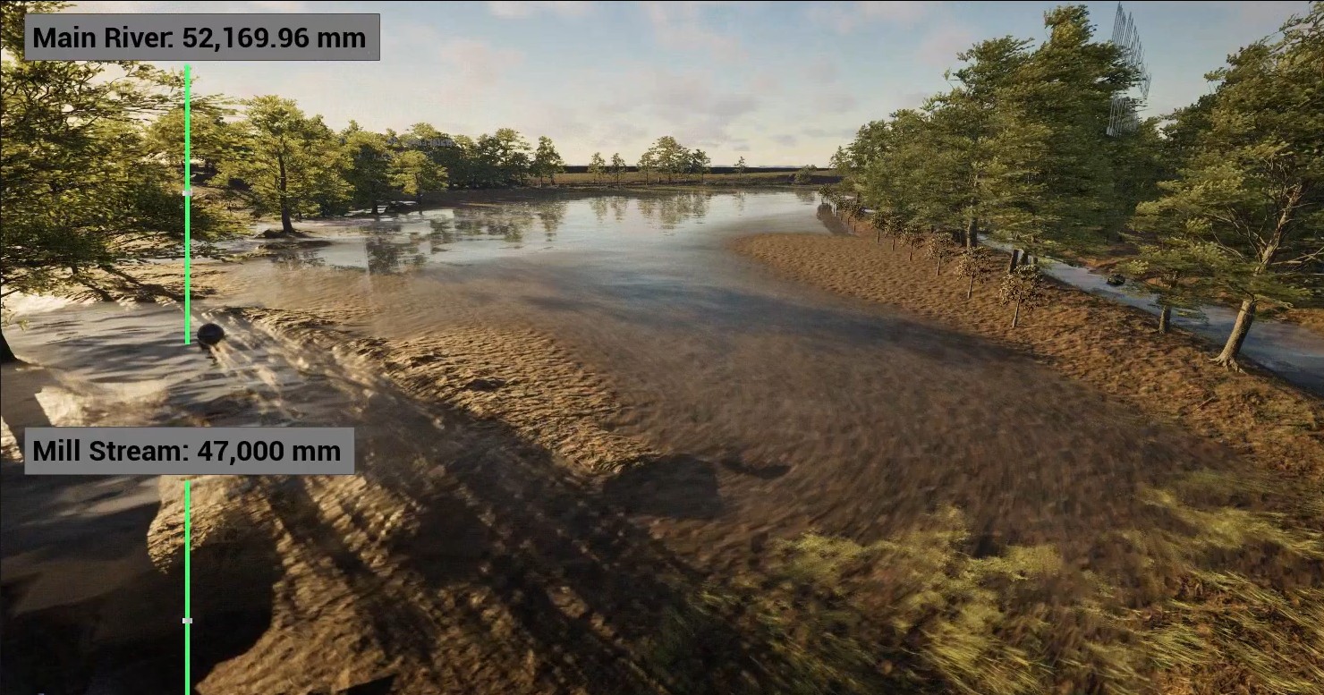
One of the defining characteristics of Stage 4 is the ability to simulate how the river responds to real‑world conditions.
Rainfall events, rising water levels, saturated ground conditions and changing channel dynamics can all be represented within the River Digital Twin® as they unfold.
This allows stakeholders and project teams to:
- Track the interaction between rainfall, water level and storage in near‑real‑time
- Understand how water moves through the channel and floodplain during events
- Identify potential pressure points and constraints
- Observe how quickly systems respond to changing conditions
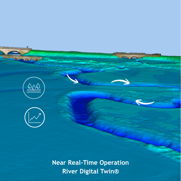
The river becomes a dynamic, observable system, rather than something interpreted retrospectively.
Enabling Scenario Testing for River Restoration
Beyond real‑time understanding, Stage 4 unlocks the ability to test “what if” scenarios in a live, evidence‑led environment.
This is particularly powerful for river restoration and nature‑based solutions.
For example, stakeholders can explore:
- How wetland creation may increase attenuation and reduce downstream flood peaks
- The effect of reconnecting the floodplain under different flow conditions
- How channel re‑profiling alters flow pathways and velocities
- The long‑term behaviour of proposed interventions under varying weather patterns
Instead of relying solely on static models or assumptions, decisions can be informed by simulations grounded in real data and observed system behaviour.
Supporting Confident, Collaborative Decision‑Making
Stage 4 represents a step change in how decisions are made.
The combination of live data and simulation creates a shared, evidence‑driven platform where:
- Engineers can test and refine designs
- Environmental specialists can assess ecological outcomes
- Regulators can better understand system response and risk
- Landowners and communities can visualise potential impacts
This reduces uncertainty and moves discussions beyond opinion and assumption towards transparent, data‑led collaboration.
Strengthening Stakeholder Engagement
WhAs with previous stages, communication remains central, Stage 4 significantly enhances engagement.
The Near‑Real‑Time Operational River Digital Twin® provides a clear, visual and interactive way to understand complex river processes.
Stakeholders are no longer asked to interpret technical outputs in isolation. Instead, they can:
- Explore the outcomes of proposed interventions
- See how the river is behaving now
- Understand how it is predicted to respond
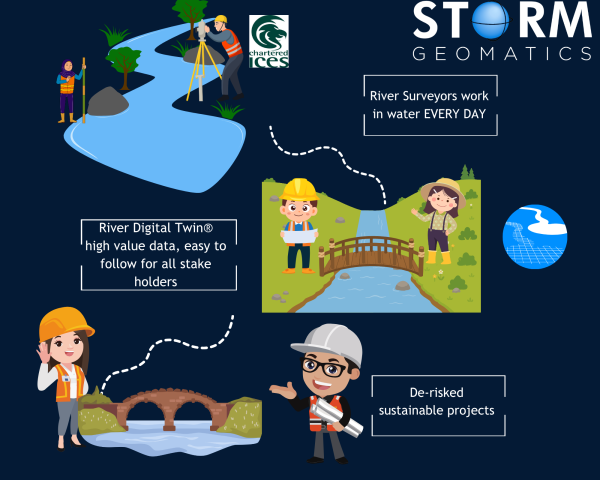
This creates a stronger connection between technical analysis and real‑world understanding, helping build trust and alignment across diverse groups.
From Insight to Stewardship
Stage 4 moves the River Digital Twin® beyond design and into long‑term river management and stewardship.
With the ability to:
- Monitor continuously
- Simulate system response
- Test future scenarios
The River Digital Twin® becomes an operational tool that supports ongoing decision‑making over the lifetime of a river system.
In a changing climate, where rivers are under increasing pressure, this ability to adapt and respond in near‑real‑time is critical.
Delivering the Full Potential of River Digital Twin®
Stage 4 represents the culmination of the River Digital Twin® journey.
What began as high‑resolution data capture has evolved into a living, operational system that:
- Combines observation and simulation
- Brings together data, modelling and physical processes
- Supports both immediate decisions and long‑term planning
It is here that River Digital Twin® delivers its full value enabling better outcomes for river restoration, flood management, and environmental resilience.
If you’re interested in how a Near‑Real‑Time Operational River Digital Twin® could support your project, feel free to get in touch with Mike Hopkins MCInstCES who is always happy to discuss how RDT® can bring clarity and confidence to complex river systems.