
Collaboration and determination on the River Irwell
The Background
- Date
- Late 2021
- Client
- Atkins Global
In late 2021 Storm Geomatics visited the site of Springwater Park, Bury, to assess a potential monitoring survey for a vegetated area of the park suffering bank slippage. The park is situated on the right bank of the River Irwell and during storm events such as Christoph 2021 and Ciara/Dennis in 2020 slippage and erosion had occurred.
Working in collaboration with colleagues of Atkins Global, Storm devised a plan to create a thorough & comprehensive baseline survey of the park, banks, and River Irwell itself.
The Challenge
Owing to the steep banks and loose shale which was covered in a variety of vegetation Storm decided that a mixture of high-definition LiDAR, multibeam echo sounding, and traditional topographic survey would provide the best results for analysis and ongoing monitoring.
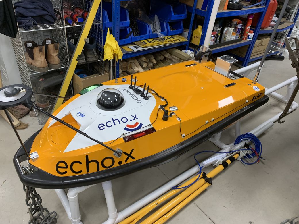
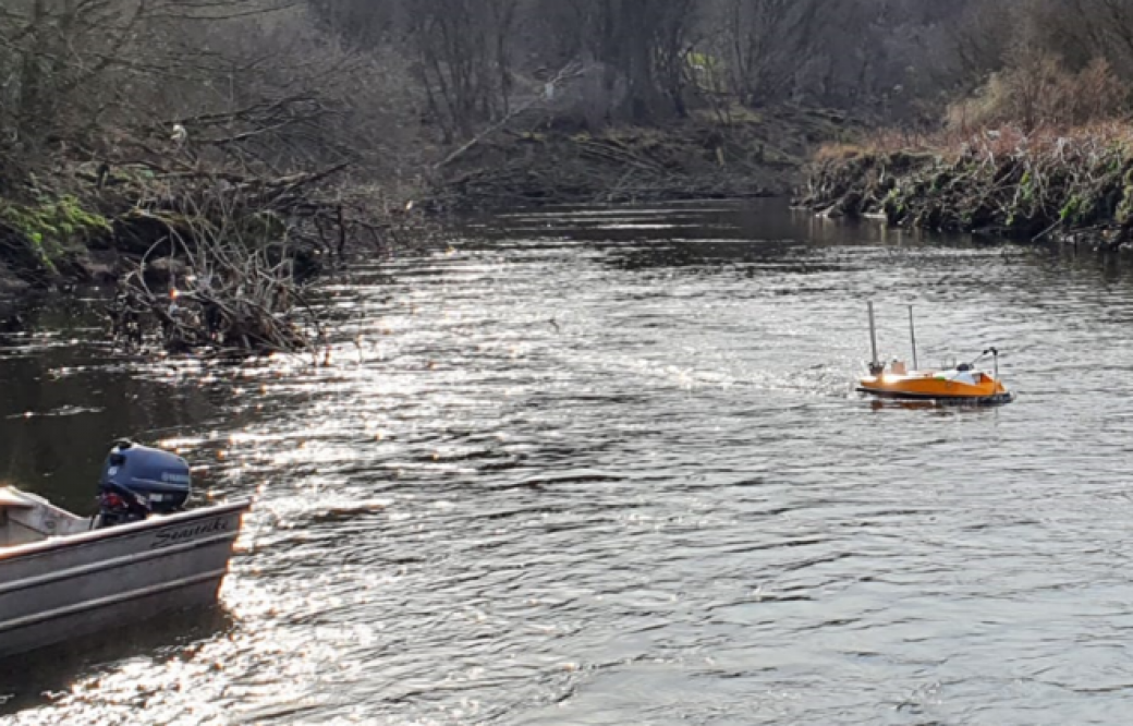
Fast forward to March 2022 and the survey was finally underway. Storm utilised their Unmanned SL40 survey vessel fitted with an SGB INS and Geoswath 4 Interferometric Multibeam system. The river was inaccessible for a manned multibeam vessel and shallow in areas so traditional topographic survey was used to fill in any gaps.
When that stage of the survey was complete a UAV Drone LiDAR survey was completed in collaboration with Mark Hudson of Geoterra. Mark utilised his DJI M300 UAV and Yellowscan LiDAR pod coupled with multiple ground control survey stations.
The penetration of the LiDAR was extremely impressive throughout the site with the comparisons between manually surveyed data and LiDAR data better than +/-20mm on hard surfaces.
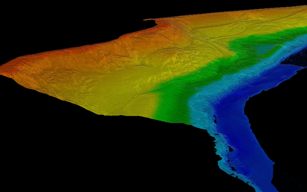
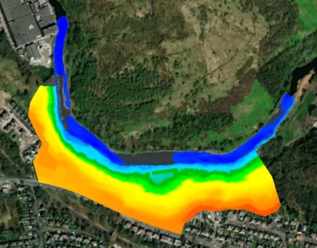
Storm combined the LiDAR, bathymetric, and manually surveyed data sets to create a single seamless digital elevation ground model.
The Results
This resulting model provides a great baseline for which to compare future surveys allowing comprehensive and intelligent monitoring of the park and especially the relationship between the low bank and River Irwell.
The data was delivered in the usual cad cross-section, location, and contoured plans but also within the GISGRO portal suit which allows the client to view, analyse, and interrogate the data in an intuitive manner without the need to download large data sets.
Images shown are from the GISGRO portal with cross-section below.

Recent News

Biodiversity Gains Delivered with Data

Geospatial Data Powers Asset Management
