
A River Digital Twin® for Halford Flood Meadow
The Background
- Date
- Winter 2025
- Client
- Storm Wildlife
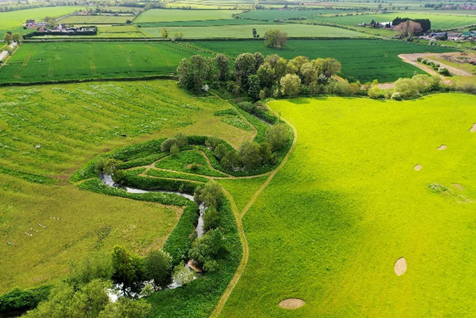
Halford Flood Meadow, a floodplain along the River Stour, was bought in 2020 as a grassland field with a history of seasonal flooding. Storm Geomatics undertook a pioneering project to create a River Digital Twin® for this site, combining traditional survey deliverables with advanced visualisation technology. The goal was to improve flood resilience planning, support habitat restoration, and provide stakeholders with an interactive view of future scenarios.
Objectives
Deliver accurate topographic and riverbed data for engineering and environmental planning.
Integrate real-time monitoring capabilities for water levels and weather.
Build a fully interactive River Digital Twin® to visualise habitat development and flood scenarios.
Methodology
- Detailed Topography
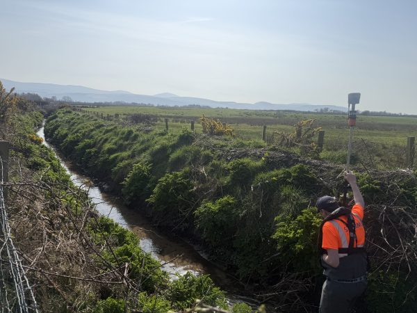
High-resolution point clouds were captured using UAV LiDAR and photogrammetry. This provided a precise digital representation of Halford Flood Meadow’s terrain and river corridor.
2. Layer Classification 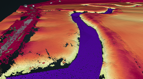
The point cloud was classified into distinct layers; ground, vegetation, and water surface, enabling more efficient modelling and analysis.
3. Riverbed Survey
Survey teams measured bed levels within the river channel and integrated this data into the point cloud, creating a seamless above-and-below-water model.
4. Sensor Planning 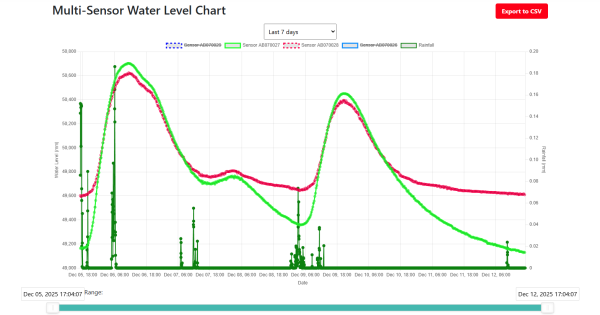
Using the integrated dataset, we identified optimal locations for sensors, including three water-level gauges and a weather station, to enable real-time monitoring and future predictive analytics.
5. Building the Digital Twin 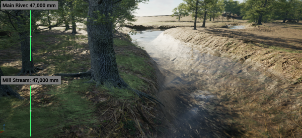
The combined datasets formed the foundation for a full River Digital Twin®, developed further using Unreal Engine assets. This interactive model simulates near-real conditions, allowing stakeholders and professionals to explore flow dynamics, flood scenarios, and ecological changes, using controls created by our River Digital Twin® team.
6. Habitat Planning & Visualisation
The digital twin was used to plan and position habitat types suitable for Halford Flood Meadow from georeferenced soil chemistry data, topographic data and flooding records. Simulations were then used to visualise long-term ecological outcomes, helping stakeholders and ecologist teams to see what restoration will look like over time.
The Concept
The River Digital Twin® concept transforms traditional survey deliverables into interactive components. Clients receive the standard outputs, topographic data, riverbed levels, model files and streaming sensor data, but also gain the option to go one step further, bringing their project to life through immersive visualisation.
Outcomes
Enhanced Flood Resilience: Improved accuracy in flood-risk modelling and scenario testing.
Ecological Insight: Informed habitat planning and biodiversity strategies.
Stakeholder Engagement: Interactive visualisation tools for engineers, ecologists, and local authorities.
Standard deliverables included: No risk of failing to reach objectives, only improving outcomes.
Allows stakeholders to understand river behaviour on their land so they can make more informed decisions on land management.
Future Applications
Integration with predictive analytics for real-time flood forecasting.
Expansion to catchment-scale digital twins for regional water and habitat management.
Monitoring apps that stream into the River Digital Twin® for easy updates.
River Digital Twins® for Flood Action Groups to coordinate maintenance tasks and plan emergency events and interventions.


- Mike Hopkins`
Managing DirectorRecent News

Helping Clients Reduce Risk with Better Geospatial Data
Why Early‑Stage River Survey Data Is Critical to Flood Risk Delivery
