Harbouring Data
The Background
- Date
- August 2025
- Client
- Arup
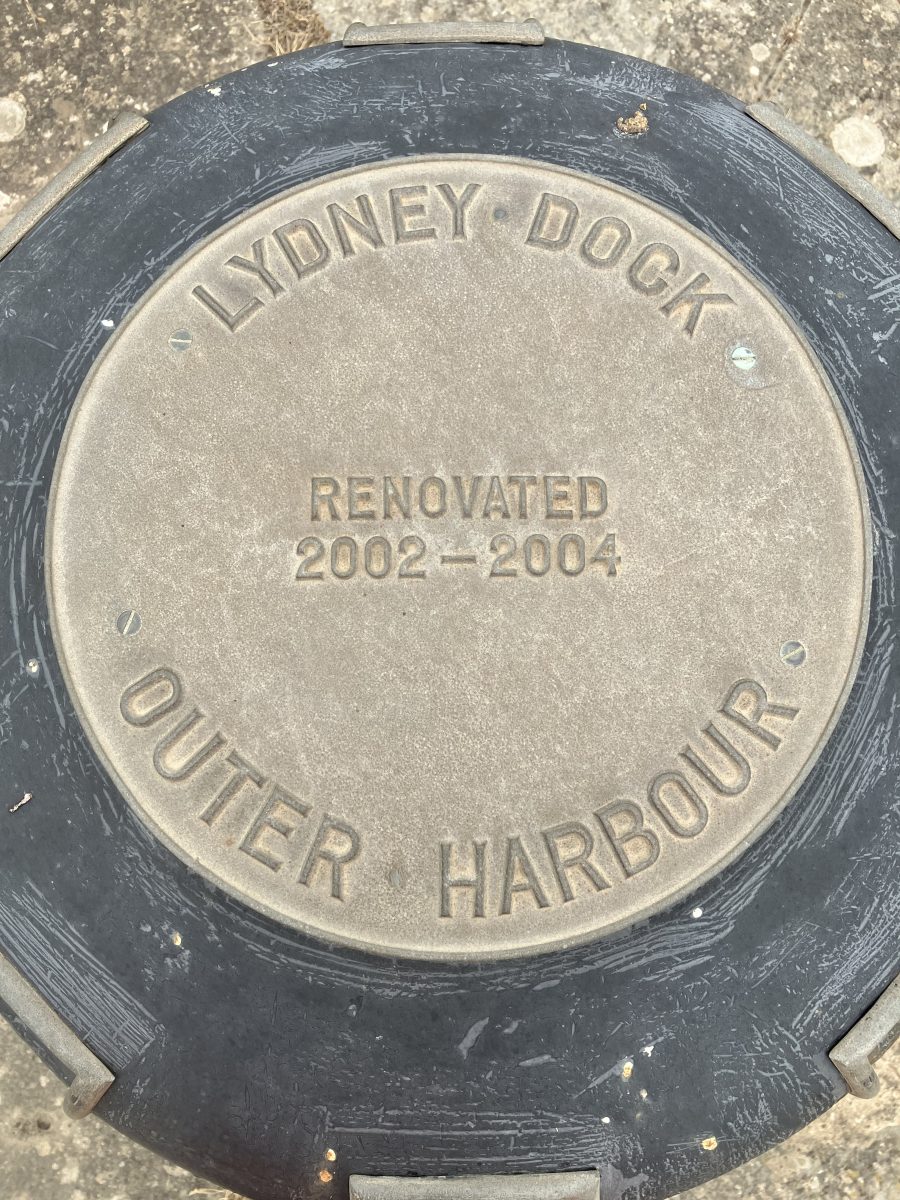
Storm Geomatics were approached by their client Arup to deliver a comprehensive suite of surveys of the inner and outer basin of Lydney Harbour for their stakeholder client. The project objective was to provide the client and designer with further information to support continued safe operation of the harbour, help ensure the River Lyd remains navigable and to conserve the historic structure.
This project therefore entailed gathering data for flood defence, maintenance of a scheduled monument and local utilities and services.
Storm Geomatics delivered a multi-discipline survey package:
Topographical Surveying
Photogrammetry via Remotely Piloted Aircraft (RPAS)
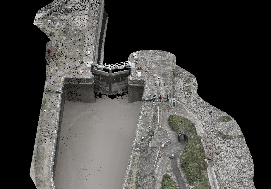
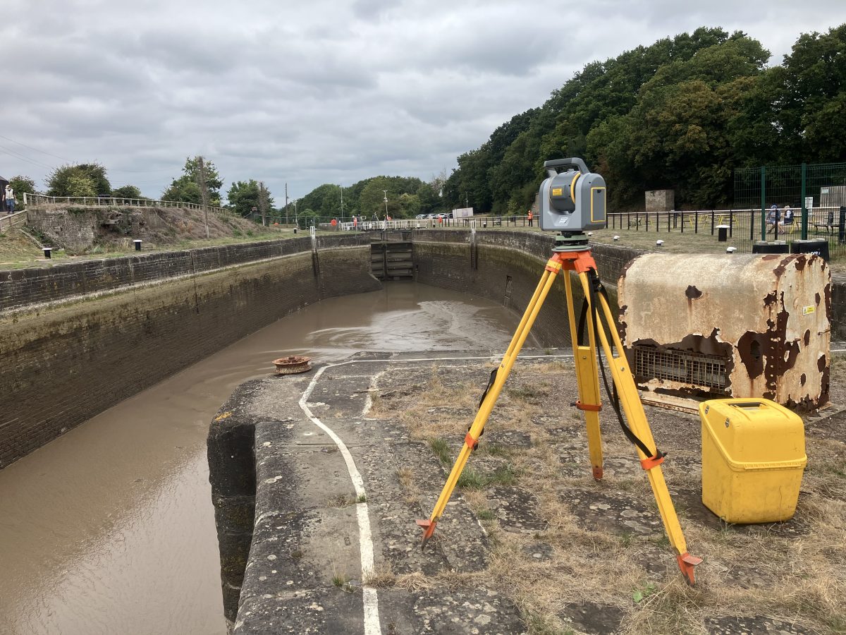
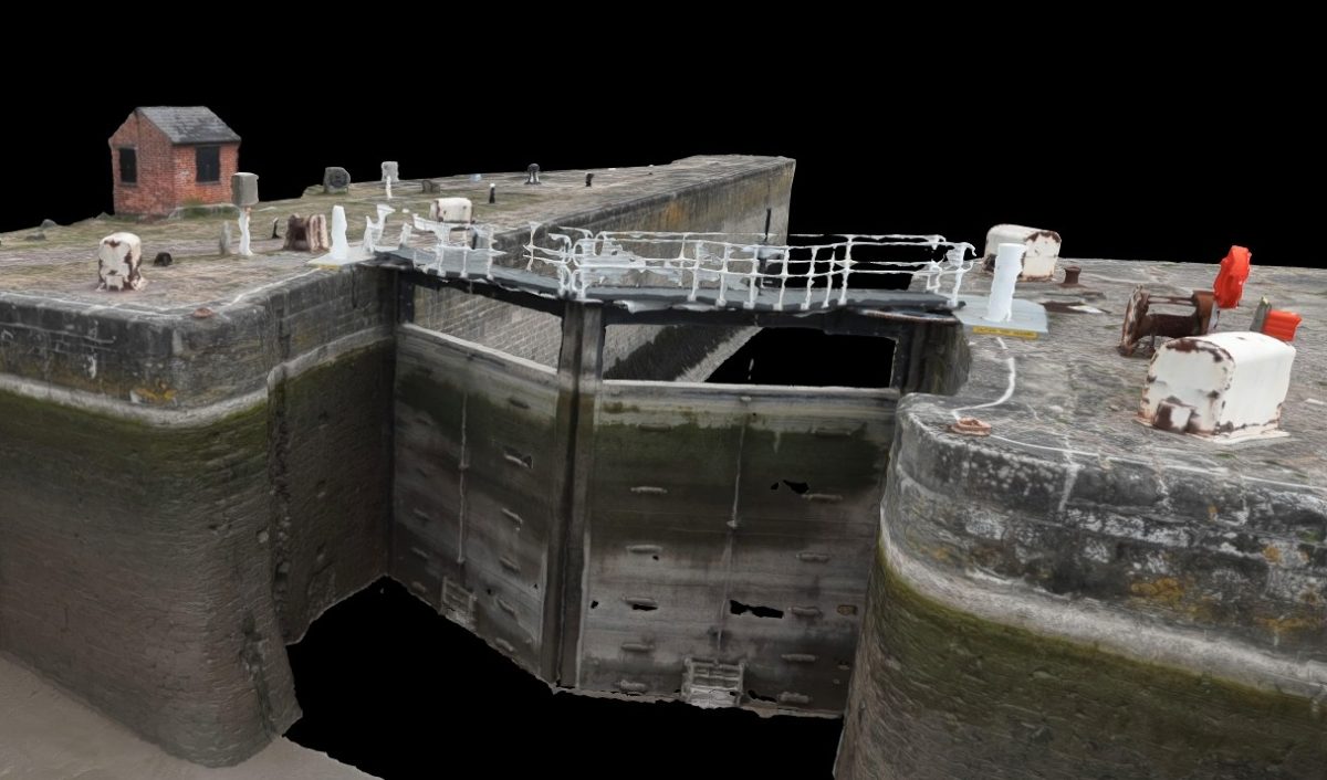
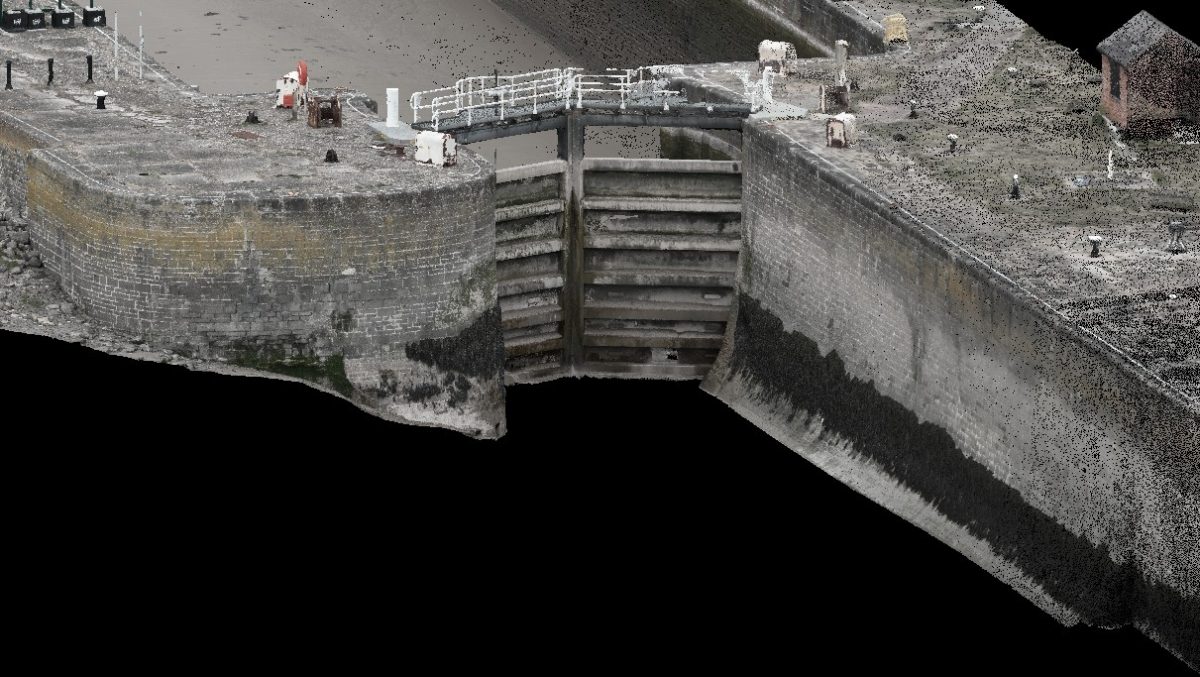
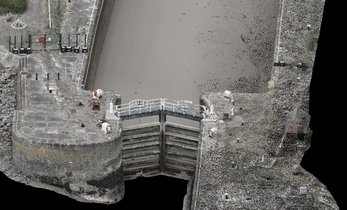
Point Cloud Survey
Utility Survey
The Challenge
Gathering various forms of data for the client: from locations of facilities and utilities, accurate readings of the harbour wall on a tidal river and photo/photogrammetry information of historical assets posed a challenge for the surveying team. Success depended on applying Storm’s Four Cornerstones
-
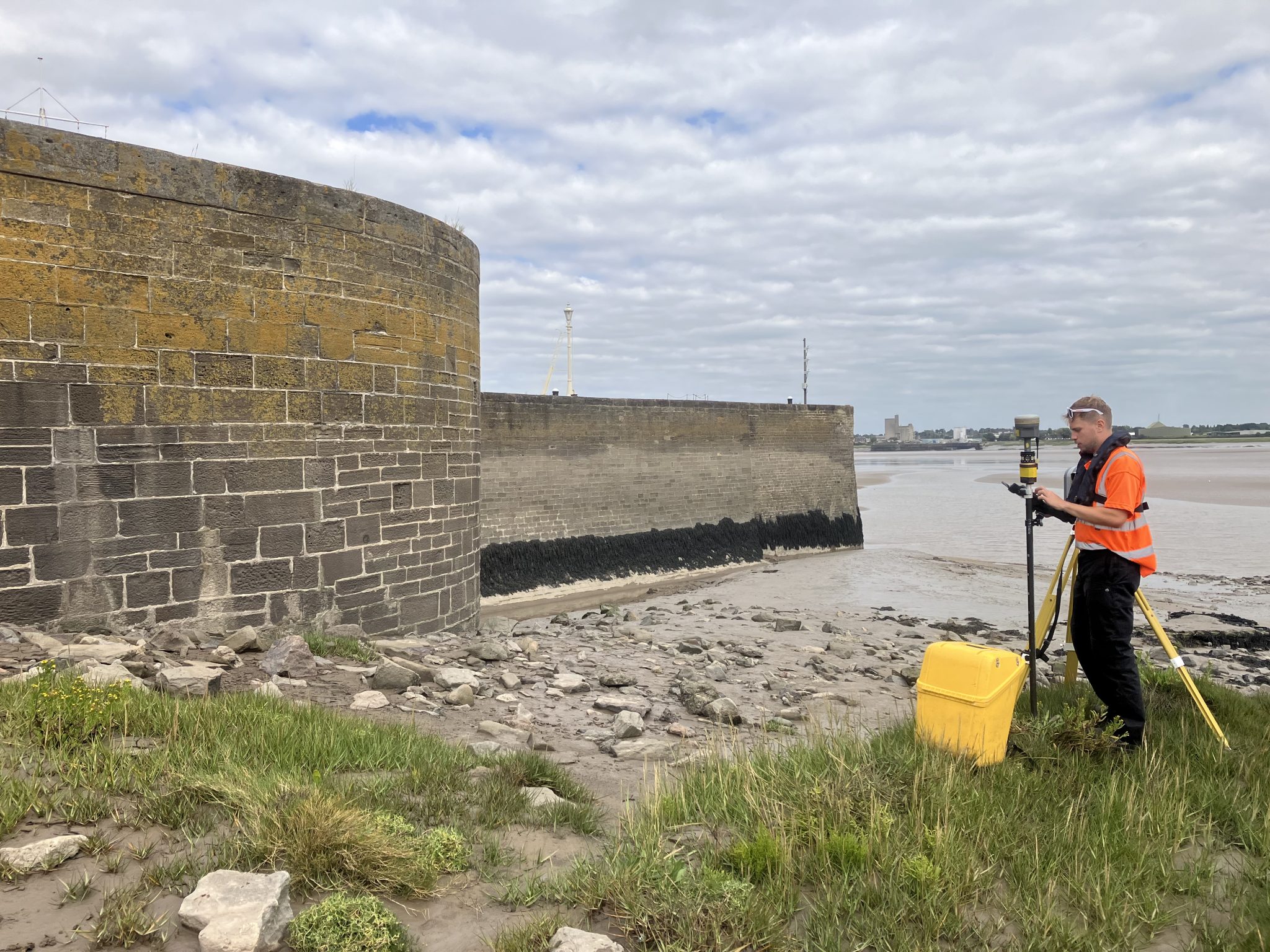
Reduce All Risks
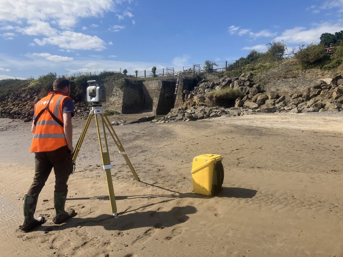
Tidal flows, historic structures, and live utilities posed significant hazards. Surveyor Tom coordinated access windows, safe working methods, and precise sequencing of tasks so all surveys could be completed without incident. -
Accurate Data Capture
From Point Cloud to RPAS photogrammetry, each technique was selected to ensure accuracy. The team collated topographic, point cloud, and utility datasets, giving the client confidence in every measurement. -
Deliver on Time
The scale of data collection and the tidal restrictions demanded tight scheduling. Storm’s teams worked in sync to gather all survey types within agreed windows, supported by weekly progress reports direct to their client’s project leaders. -
Superior Value
By combining traditional topo surveying with advanced scanning and photogrammetry, Storm delivered a digital record that not only meets immediate project needs but also provides long-term asset insight — protecting both heritage and functionality. -
A level of expertise from the project lead Surveyor Tom Issac to the topographical, scanning, RPAS and utilities teams was vital to ensure that all data was gathered in a safe, timely and presentable manner.
- Key Issues:
- Scale of site.
- Complexity of deliverables.
- Maintaining safe working practices.
- Collating multiple types of data.
The Results
Storm delivered:
-
A detailed Topographical Survey to client specification.
-
A Utilities Survey to PAS 128:2022 standard.
-
A comprehensive Point cloud and photogrammetry dataset showing current condition and extent.
-
Regular progress updates and final reporting to demonstrate clear, transparent delivery.
The outcome: a reliable, risk-managed, on-time, and high-value dataset enabling maintenance, preservation and planning for the future of Lydney Harbour.
Recent News

Do All Rivers Lead to Liverpool?

Geospatial Survey Delivery Across UK River Infrastructure
