From Reservoirs to Riverbeds: July Survey Stories

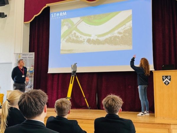
Storm Surveyors tackled July with a full order book, that consisted of an array of survey projects from River Thames in South East England to Dumfries in Scotland. This month we explore a snapshot of some of these projects.
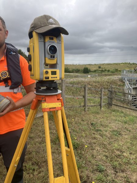
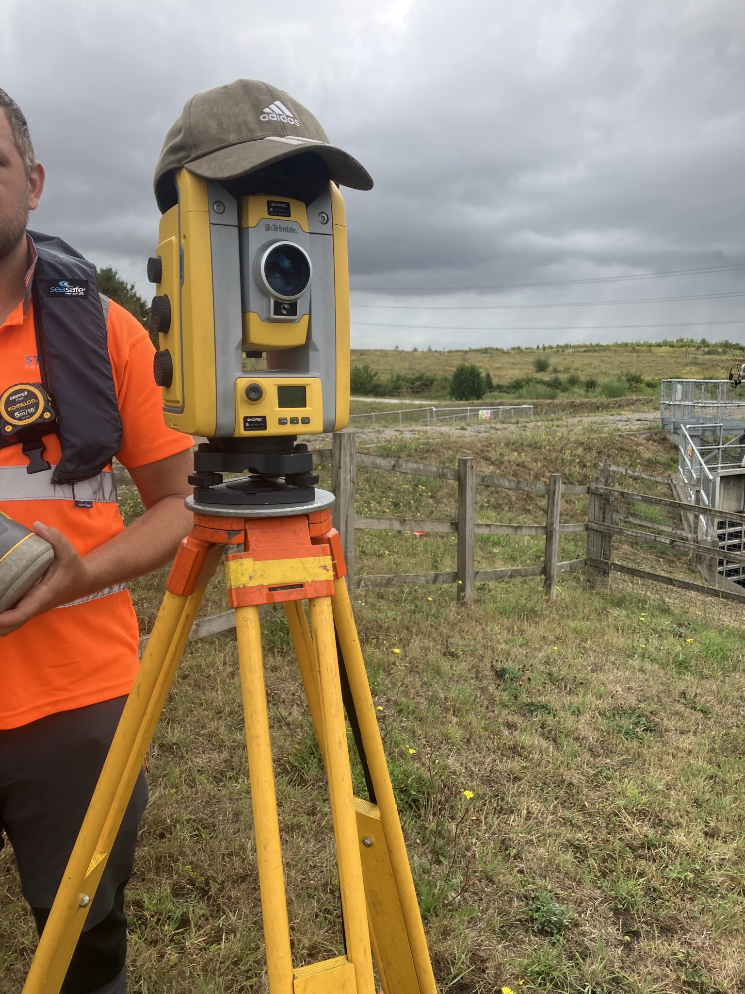
Each year Storm Geomatics is commissioned to undertake a detailed survey of a series of reservoirs and flood storage areas. One of the sites is Horsbere Flood Storage Area on the outskirts of Gloucester. The survey is aimed to assess asset condition and detect any deformation, providing critical data for future maintenance and risk mitigation. This survey included cross-section data, topographic surveying, and precise levelling using a Trimble DiNi digital level to ensure the highest levels of accuracy.
One of the key challenges is maintaining consistency across annual surveys. This survey data is referenced against datasets collected in previous years, which means that measurements must be taken in precisely the same locations each time. However, as the landscape naturally evolves, due to vegetation growth, erosion, or human activity. It can become increasingly difficult to place a cross-section exactly where it was previously recorded.
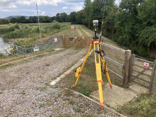
To overcome this, a Trimble R10 GNSS base setup was used, positioned over a known EABM (Environment Agency Benchmark) and measured against a fixed control point from previous years, Storm Surveyors can ensure high positional accuracy and repeatability. This allows surveyors to confidently compare current data with previous years and detect changes in elevation or deformation by overlaying each year’s data.
The survey provides Storm’s client with robust, high-accuracy data to support ongoing reservoir monitoring and asset management. By identifying subtle changes in elevation and structure, the project contributes to flood risk reduction around Gloucestershire. Find out what the data offers.
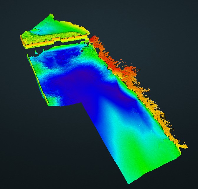
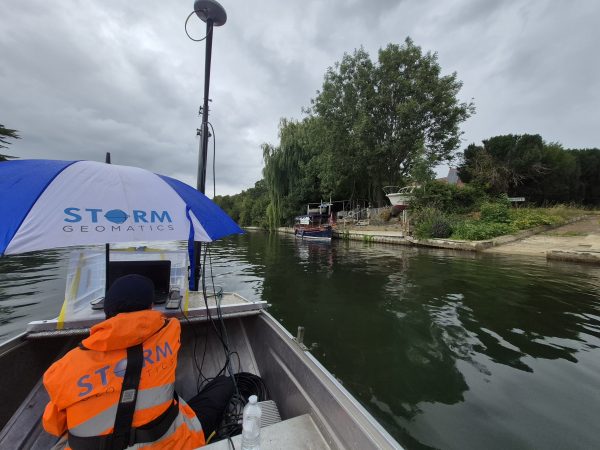
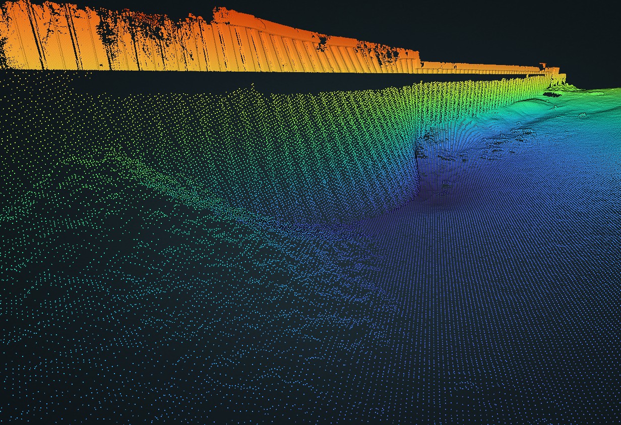
Another survey team lead by Senior Surveyor Alex Lyall conducted a high resolution bathymetric survey of Bell Weir on the River Thames for a long standing client. The purpose was to ascertain the extent of the damage and plan for the repair.
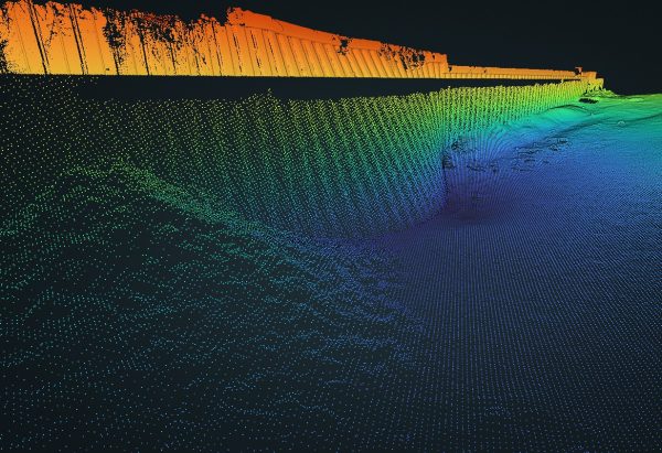
For the high resolution bathymetric survey, surveyors utilised the Norbit iWBMS multibeam sensor attached to the small seastrike vessel which allows easy launch without a slipway and to survey in smaller and shallower rivers when required.

Delivering a point cloud of the river bed and the sheet metal pilling, gave a clear representation of the river bed and walls. The scour of the bed, causing the sheet metal piling to slip out into the river, is easily visible with the high resolution data.
Downstream of the weir, the water was very aerated which has a negative impact on the number of returns from the sonar. To counter this, surveyors managed to liaise with the lock keeper and reduce the flow through the sluices. There was still aeration in the water immediately downstream which reduced the data captured, as expected, however the Norbit iWBMS worked well in this challenging location. The area of main interest was further downstream.
In conjunction the team surveyed the wall above the water with a terrestrial laser scan. Combining both the above and below water into a single point cloud model. The data was supplied as a .LAZ file and also hosted it on our Point Cloud portal allowing the client to easily open and interrogate the data by using the measuring a cross sectional view tools.
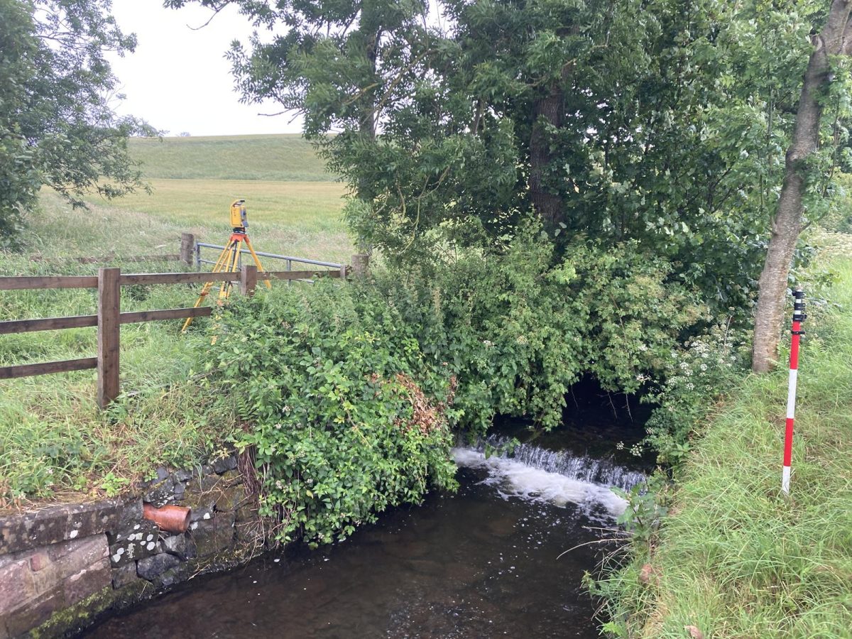
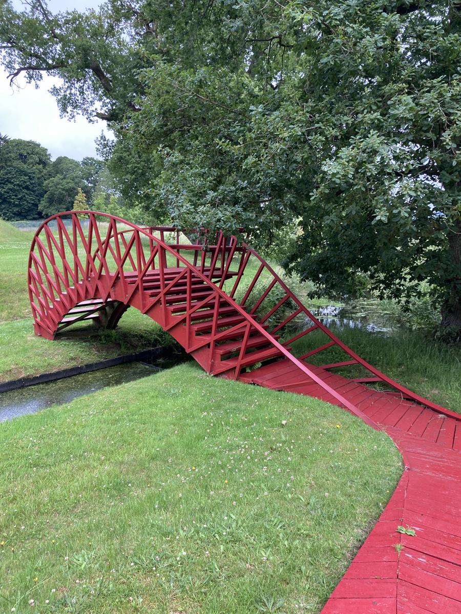
Surveyor Caitlin Tonge & Trainee Surveyor James Walker travelled to Scotland to complete a survey to assist with a River Restoration Project. This high-accuracy geospatial survey was requested by long standing client Royal Haskoning DHV Ltd. Discover Laggan Burn now.
As the hot, dry weather continues into late summer, the foliage is starting to die back, making life a little easier for our intrepid River Surveyors. Please check back in next month for more of our “wet n wild” survey adventures on the UK’s rivers.

Other News
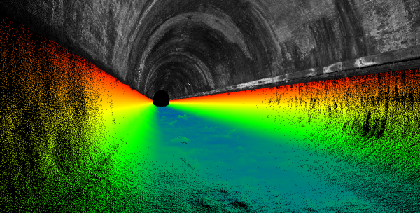
London’s Underground Tunnels bring out the Rockstar’s of Geospatial Survey

Biodiversity Gains Delivered with Data