GeoSwath surveying 40 miles on Great Ouse

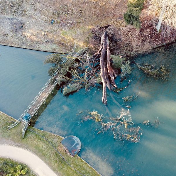
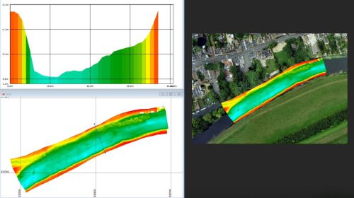
Storm GeoSwath is the latest survey vessel in the Storm Geomatics Fleet and it has been very busy for a lot of reasons. [nbsp]This month she surveyed 65km of the Great Ouse and 100ft Drain from Kings Lynn to Huntington. [nbsp]The purpose of the survey was to check bed levels along the navigable route to ensure clearances were sufficient for passing boats. [nbsp]The customer specified a single beam echo sounder for the project which we used on board Storm GeoSwath, but while the team were there they turned on the interferometric sonar which gives a full swath of information in one pass. [nbsp]The image here shows a sample of the data that was collected and how it overlays on the satellite imagery. [nbsp]There is also a cross section through the river which was post processed in the office using the Kongsberg GS4 Software. [nbsp]This technology is only normally available on bigger vessels, Storm GeoSwath is a small vessel which can be launched over vegetated banks by using Storms custom built ramp system and therefore opens up smaller bodies of water to this very powerful measuring sensor.
In order to pilot any of the boats at Storm Geomatics, you need to hold a Royal Yacht Association Powerboat Level II certificate. [nbsp]Three surveyors have recently attained this certificate at the RYA test centre at Draycote Water, which brings the company up to eight RYA Powerboat Level II qualified survey staff. [nbsp]If you think being a river surveyor is the job for you, then keep an eye out on Twitter @StormGeomatics and on Storm’s recruitment page for new opportunities, could you be the next team member to help reduce flooding across the globe?

Other News
From Dee to Data: Storm Delivers Dynamic River Data
Pioneering River Digital Twin® Innovation and Optimal Survey Season Insights