Full Survey for the Steeping River

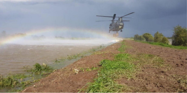
In June the man-made bank that holds back the Steeping River at Wainfleet in Lincolnshire collapsed flooding 70 properties and causing residents to evacuate the area. The news showed photographs of people’s homes submerged in up to a meter of flood water and fire crews rescuing people in inflatable boats. The RAF were called in to lift large bags of ballast into the remote location to “plug” the gap in the embankment.
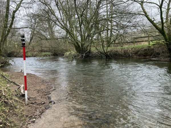
When the flood water had receded in August Storm Geomatics were called in to provide a survey of the river from Wainfleet Clough to Gibralter – sounds like a long way but it is only 2km! The survey will be used to create a detailed hydraulic model of this reach of the Steeping River to assess the impact the water flows have on the embankments. The model can be run at different rainfall return periods to assess the different impacts that are possible and therefore make sound decisions on how to mitigate this situation ever happening again.

Other News
Storm Geomatics: A New Chapter Unfolds
Storm brings in the Big Guns…