Topographic Data & Natural Flood Management – A Love Match
The Background
- Date
- April 2025
- Client
- Milestone Environmental / National Trust
The perfect was match made in the Upper Thames when Storm Geomatics were appointed by Milestone Environmental Ltd on behalf of the National Trust, to carry out a detailed topographic survey of agricultural land near Buscot in West Oxfordshire.
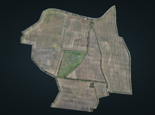
The survey supports a land management project led by the National Trust, to introduce natural flood management (NFM) features across 103 hectares of greenfield arable land. Proposed interventions include attenuation basins, ponds and baffled watercourses to reduce flood levels in Buscot village. Provision of improved habitat is a secondary benefit, but compliments the NFM features to restore catchment function and achieve significant biodiversity benefits.
The project follows repeated, high-impact flooding in Buscot village, which highlights the urgent need to manage runoff and flood flows from the impermeable, steep upstream catchment and reduce pressure on the downstream village drainage systems.
The Challenge

The survey area lies immediately south of Buscot village and spans a varied landscape that slopes northward towards the River Thames. The site is dominated by responsive surface-water overland flows, with runoff contributing to the flooding issues downstream. A number of existing culverts also required detailed inspection and survey.
Key challenges included:
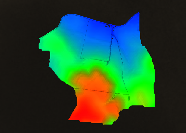
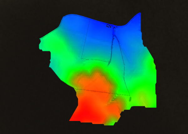
- Topographic Variation: Terrain drops from ~100m to 70m AOD, requiring high-density elevation data to model overland flow accurately.
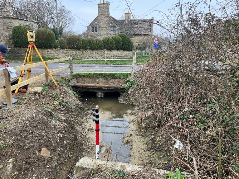
- Hydrological Complexity: Multiple watercourses and five culverts, including two under Lechlade Road, demanded precise survey control and modelling.
- Airspace Awareness: Situated near low-level military flight paths, the survey required advanced visual line-of-sight planning and risk mitigation.
The Process
Prior to deployment, a full walkover of the site was carried out. This allowed the team to identify the telecoms tower as the optimal RPAS launch point—providing full 360° visibility of the site and airspace. This location proved critical during operations: on one occasion, a low-flying military helicopter was seen approaching from a distance. The RPAS, already operating with altitude margins in place, was immediately brought to 20m AGL and held in a safe hover well before the aircraft passed overhead.
The survey combined RPAS LiDAR with traditional ground-based techniques. Aerial LiDAR was used to capture wide-area terrain data, while total station and GNSS methods were employed for structures and detail points.
The Results
Storm Geomatics delivered a complete, high-resolution topographic dataset tailored to support flood management design, including:
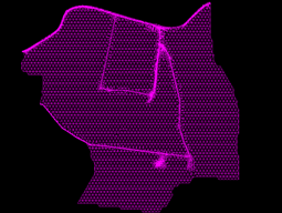
A fully classified point cloud from RPAS LiDAR
A digital elevation model (DEM) derived from the ground-classified data
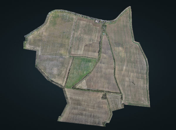
2D orthomosaic imagery with high ground sample resolution
Manual topographic detail, including above-ground features and linear infrastructure
Structure cross sections for all culverts and key hydraulic features
This integrated dataset gives Milestone Environmental and the National Trust the confidence to plan and deliver natural flood interventions, supported by accurate terrain and hydrological modelling.
Recent News

Biodiversity Gains Delivered with Data

Geospatial Data Powers Asset Management
