3D Survey Replaces Divers at Nafford Sluice & Weir
The Background
- Date
- Spring 2025
- Client
- Jackson's Civils
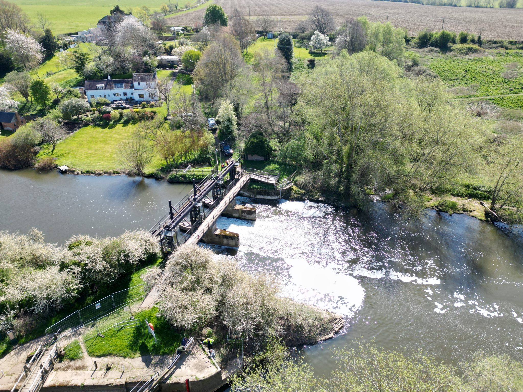
Nafford Sluice and Weir, situated on the River Avon in Worcestershire, are Environment Agency-owned structures approaching the end of their original design life. Ongoing assessment and maintenance are vital to ensure their continued safe and effective operation.
The River Avon, stretching from Stratford-upon-Avon to Tewkesbury, is a navigable waterway managed by the Avon Navigation Trust. Maintaining appropriate water levels is crucial for navigation, and these assets play a central role in that balance.
Jackson Civil Engineering, the Environment Agency’s framework contractor, was tasked with managing these ageing structures. Storm Geomatics was brought on board to deliver high-resolution surveys above and below the waterline—providing a data-rich alternative to traditional inspection methods.

Fig 1: Bathymetric Survey with Storm Geoswath
The Challenge
Historically, the Environment Agency has relied on divers for underwater inspections. While divers provide valuable insight, their effectiveness is often limited by poor visibility, resulting in sparse or imprecise geospatial information. This lack of positional accuracy makes it difficult to design and implement remedial works with confidence and there are also risks involved with deploying divers near flow control structures.
Fast-moving, aerated water—particularly downstream of weirs and sluices—poses hazards to both equipment and personnel and significantly reduces sonar effectiveness. Additional challenges include water level fluctuations, weed growth, vessel traffic, public access, and fishing activity.
Fortunately, the project’s proximity to our headquarters offered logistical advantages and a welcome contrast to jobs that typically take us far afield.
Our Approach
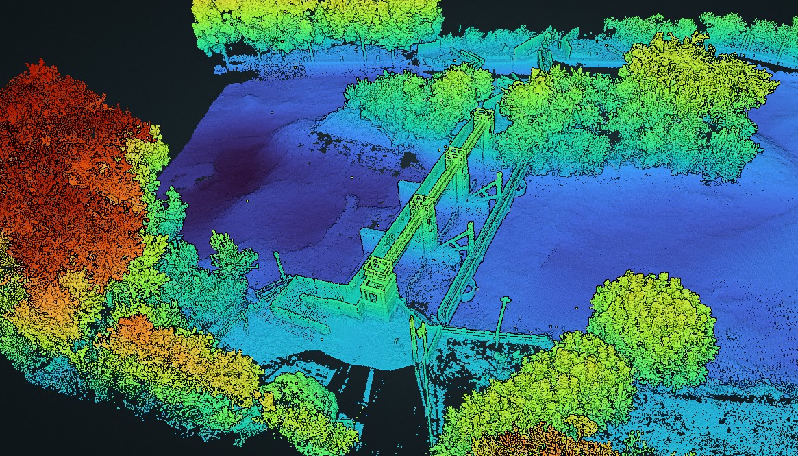
Storm Geomatics aim was to deliver a comprehensive 3D model of the site, encompassing both above and below water features. Ambitious? Certainly. Straightforward? Rarely.
Technical Director Anthony Pritchard led the initial site walk, equipped with our trusted PhotoMapp app. He captured a series of geolocated photographs complete with field notes, which were swiftly compiled and emailed back to the office as a PDF report. Upstream and downstream gauge readings were also taken to establish precise water levels for survey planning.
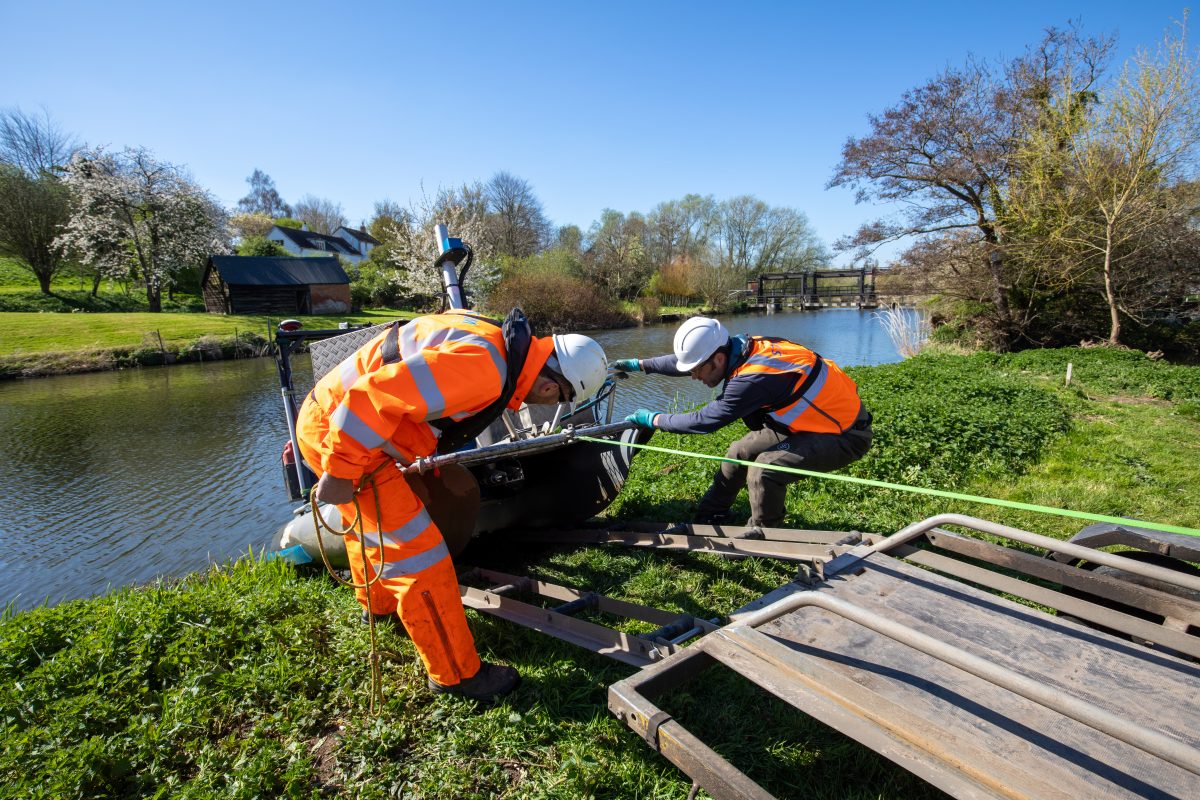
Survey operations were divided between two specialist teams: one focusing on bathymetric (underwater) data, the other on the structure above water. Each worked independently before comparing and validating their respective data sets. Where sonar struggled—particularly in turbulent, aerated zones—manual probing was used to confirm bed levels around the concrete apron.

Fig 2: Bathymetric Survey Team
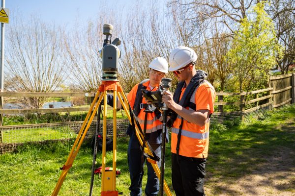
Fig 3: Topographic Survey Team
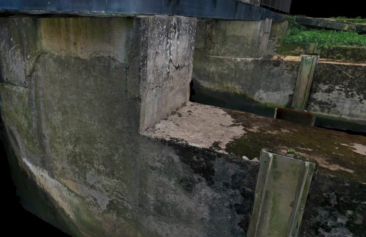
The above-water elements were captured via high-definition laser scanning and thousands of RPAS and static images for photogrammetry.
 Fig 4: Photogrammetry
The Results
All site work was completed on schedule and to a high standard. One challenge arose when debris prevented the complete closure of a sluice gate, introducing noise into the bathymetric data. This was addressed with targeted manual survey work, ensuring a complete and accurate model.
Undertaken in spring 2025, the survey benefitted from consistent sunshine—ideal for site work, though less so for photogrammetry. Harsh lighting conditions forced us to adapt, capturing images during early mornings and late evenings to take advantage of softer, more even light.
Integrating the various data streams into a single unified model went smoothly, until we hit an unexpected snag with the photogrammetry. Our go-to software, which had performed reliably in past projects, struggled to process the model accurately, likely due to lighting inconsistencies. After multiple attempts, including reshooting select areas, we ultimately switched to an alternative processing platform. A few adjustments later, the model was complete.

With focus and determination these problems are overcome and we can produce solutions for our clients.”

- Anthony Pritchard
Technical DirectorRecent News

Biodiversity Gains Delivered with Data

Geospatial Data Powers Asset Management
