River Ryburn
The Background
- Date
- August 2022
- Client
- Yorkshire Water
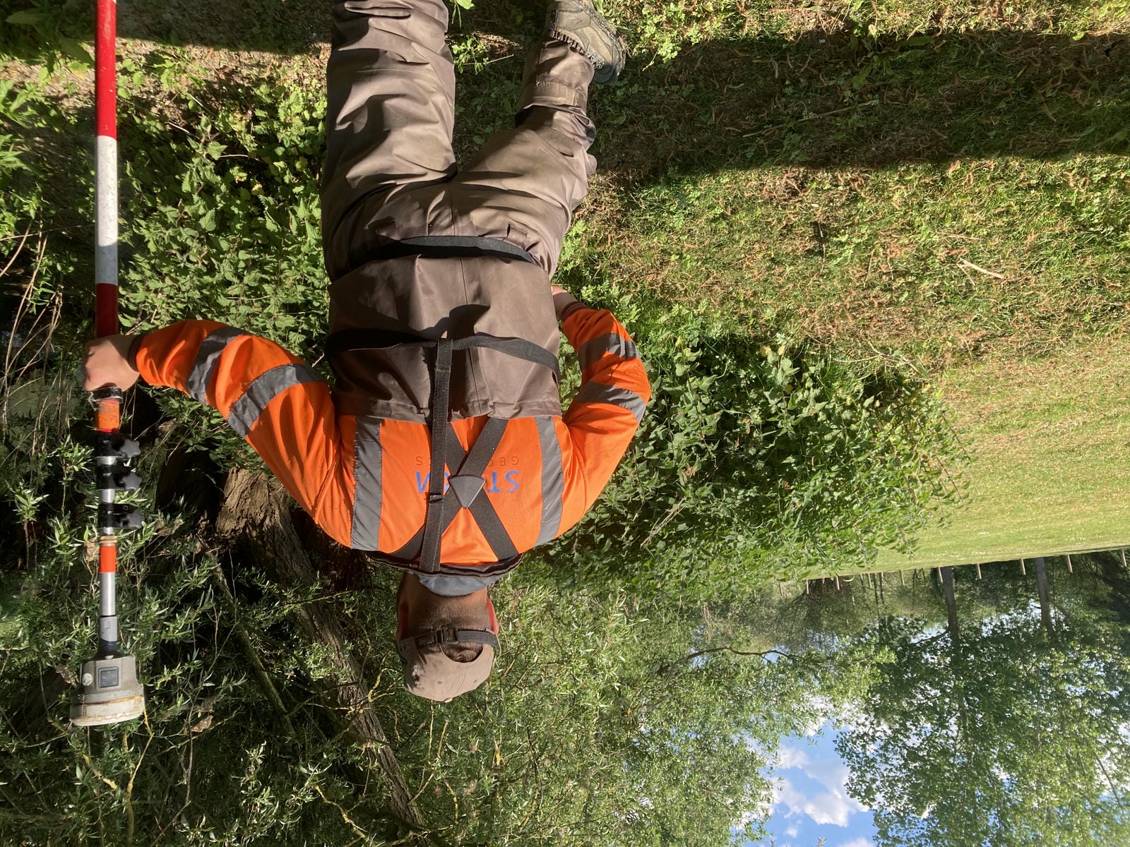
In August 2022, the survey was instructed by a consultancy working on behalf of Yorkshire Water. The data was collected to help inform a flood risk model that was to support a flood risk assessment study at Ripponden Sewage Treatment Works. A two-person team was deployed from the south-west office with a Trimble S5 total station, R12i receiver and TSC7 controller.
The Challenge
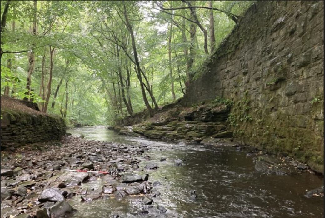
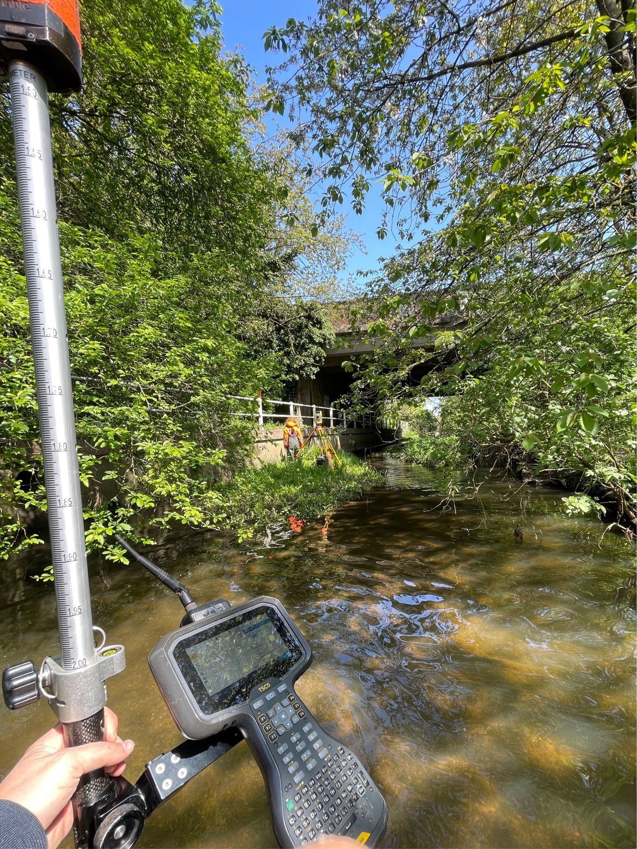
The downstream portion of the River Ryburn was heavily wooded making for challenging surveying due to a lack of sky visibility. About a third of the cross sections were surveyed from total station set-ups using wooden pegs which required plenty of forethinking and a fair bit of head-scratching from the surveyors!
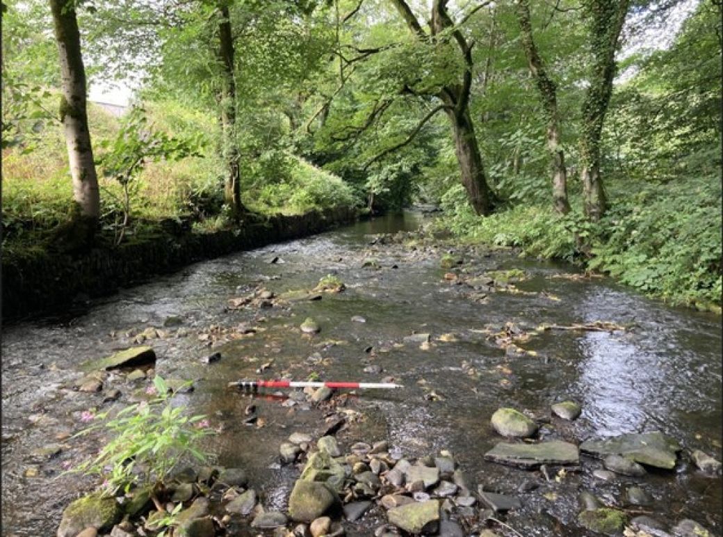
The recent dry weather meant the project was completed without the need for a float tube or boat. Judging by the height of the channel walls and steepness of the surrounding topography this may have been a very different story in the winter. Highlighting the importance pre project site walk to assess all hazards and current condition of the site.
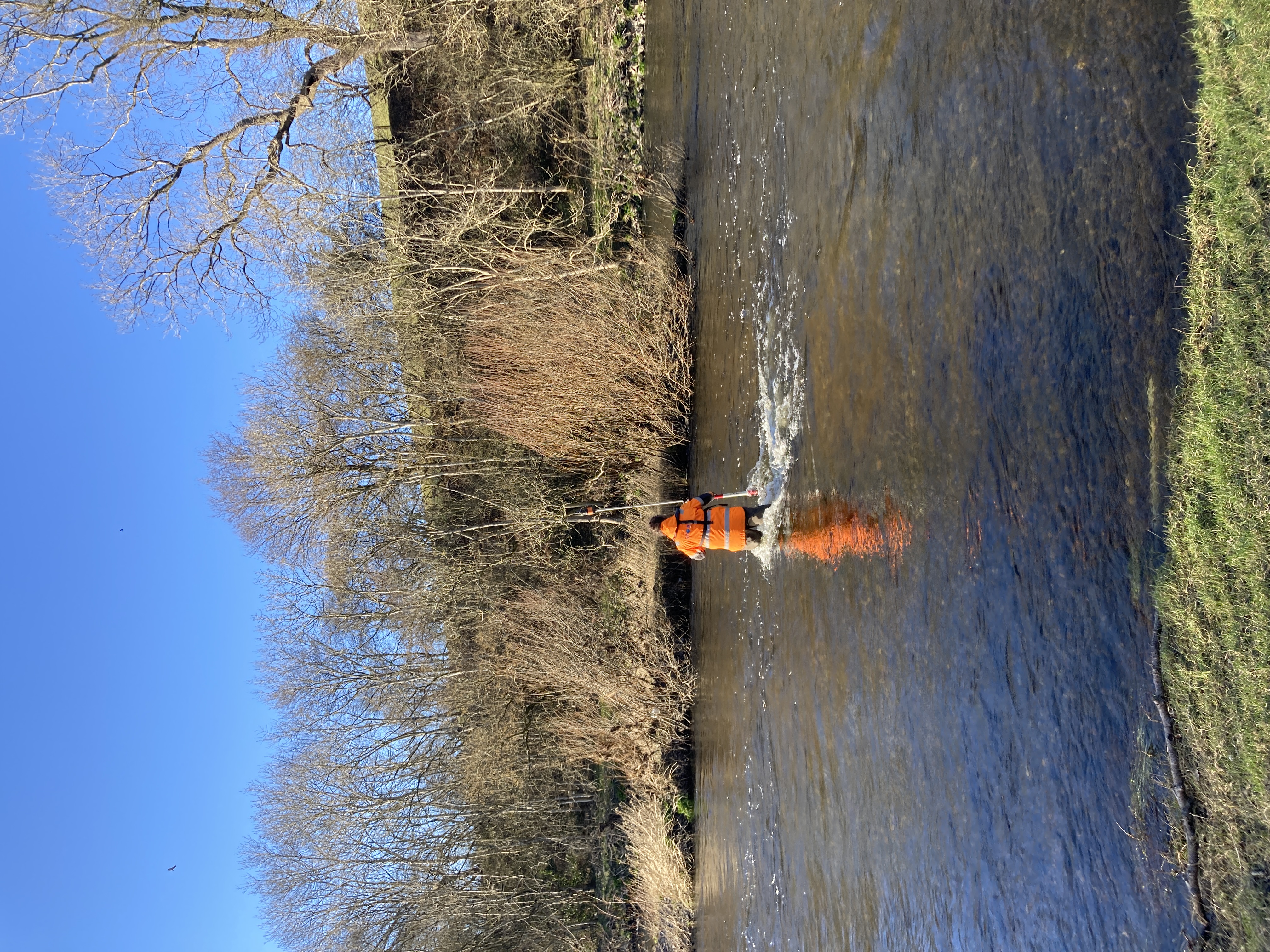
In places the right bank of River Ryburn was comprised of sheer rocks cliffs and/or high stone walls. Employing the principles of ‘Safety First – Data Later’ measurements were taken using the contactless measurement feature of the total station removing the need for surveyors to stand atop the steep and potential unstable and slippery banks but still collect the required data.
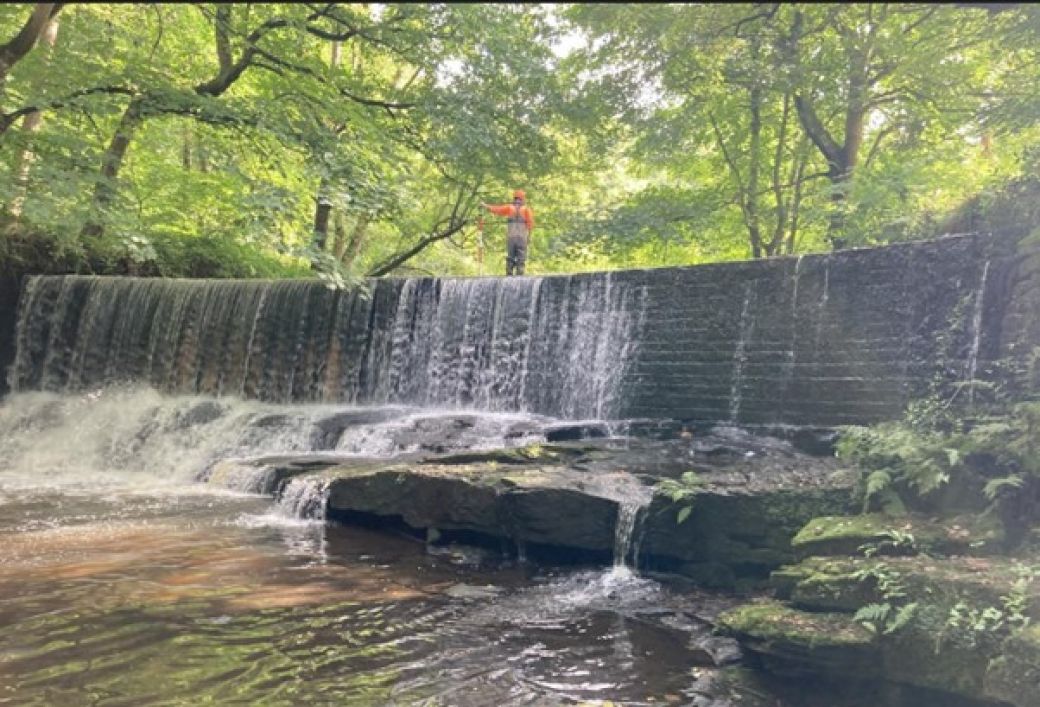
A large weir was also present within the survey extents. After heavy rainfall at the start of the site work the surveyors used their experience to assess the risks posed by higher water levels over the weir. Following a discussion and a review of the weather forecast on site it was deemed safer to leave the surveying of the weir to later on in the week. Fortunately, after a few days of dry weather the weir could be safely surveyed in full.
The Results
Despite the challenges presented by the project the site works were completed within the timeframe allocated and office processing could begin on schedule.
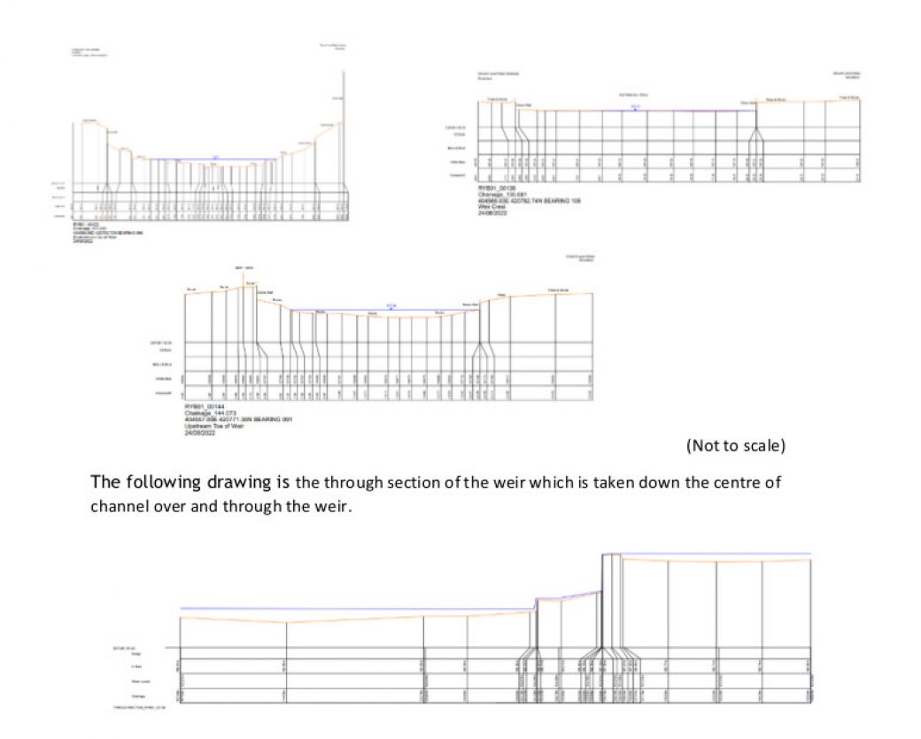
The following three drawings show a cross sections of the weir including the down stream toe, weir crest and up stream toe.
Recent News
Data to Decisions – Storm’s May Update
Dry Spring, Fresh Momentum – April Survey Highlights