Habitat Restoration given a Head Start with Geospatial Survey
The Background
- Date
- Winter 2025
- Client
- Oxygen Conservation
Oxygen Conservation ,a business founded with the mission to Scale Conservation, commissioned Storm Geomatics to conduct a geospatial survey to inform the design of a river restoration project on the River Thet in Norfolk. Features in and around the river that make up the river valley were surveyed in full to explore opportunities to enhance the biodiversity value of the site.
Recognising the critical role of accurate geospatial data in shaping effective interventions, Oxygen Conservation engaged Storm Geomatics early in the project life cycle.
Collecting geospatial data to the highest possible levels of accuracy is fundamental to designing transformational river restoration schemes. While it may be tempting to view our landscapes as beautiful and untouched, detailed spatial data helps to provide a precise understanding of their current condition, helping to assess physical and ecological parameters. This data is essential for identifying the factors influencing river health, enabling targeted interventions that enhance hydrology, habitat complexity, and biodiversity.
“This data-driven approach allows for the creation of connected, biodiverse habitat networks that catalyse natural processes and support flagship and priority species.” Dan Johnston, Head of Environment for Oxygen Conservation
The Challenge
Storm Geomatics deployed their most experienced senior surveyor to lead the project, with four different types of survey/deliverables required to meet the desired results.
- River cross section surveys
- Long sections along the two watercourses
- Topographic point survey
- Bathymetric surveys of ponds
The survey presented several significant challenges, requiring adaptability and technical expertise from the Storm Geomatics team:
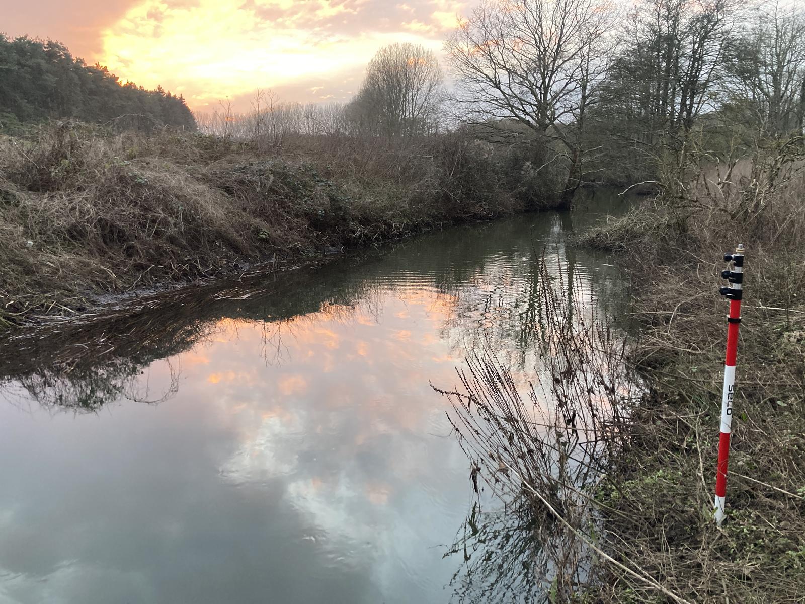
High Water Levels: Elevated river levels made much of the topographic survey area difficult to access, as the margins of the bathymetric survey were inundated. The survey team employed best survey practices to capture sufficient data despite these constraints.

Figure 1: High Water Levels
Difficult Terrain and Vegetation: Scrub encroachment in the river valley restricted access in certain places making traditional GNSS surveying challenging due to limited satellite visibility. As a solution, total station surveying methods were used. Although total station surveying is slower as it is a “static” survey method, with the technical experience of the surveyors and the understanding of the purpose of the survey, the correct amount of data was captured to inform the project.

Figure 2: Dense Scrub
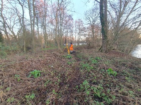
Figure 3: Total Station Method
Aquatic Vegetation Impact: Some areas of the lake were inaccessible due to dense aquatic plant growth. In response, the team employed pole probing techniques to measure silt depths and worked within available access points to capture ample data for the purpose of the survey.Natural features such as a large tree in the river were reported, offering potential restoration benefits by influencing flow patterns and habitat diversity. These insights were essential for integrating nature-based solutions into the restoration design in what appeared to be a canalised river.
The Results
By engaging Storm Geomatics early in the project’s critical path, Oxygen Conservation secured high-quality geospatial data that played a fundamental role in designing an effective and sustainable river restoration plan.
A robust baseline survey not only informs restoration strategies but also ensures that interventions support complex habitat and species interactions, strengthening ecological resilience in the process.
Key outcomes included:
Accurate Baseline Data: The survey provided a precise representation of the river’s current conditions—‘point zero’—which serves as a benchmark for assessing ecological and hydrological changes over time.
Enhanced Restoration Design: The data informed floodplain reconnection opportunities, supporting the creation of a valuable wetland ecosystem that fosters biodiversity and habitat complexity.
Robust and Versatile Data Delivery: Survey results were delivered in multiple formats, including Flood Modeller Pro-compatible data, DWG files, XYZ coordinates, and georeferenced PDFs. This ensured seamless integration with hydrological modelling and conservation planning.

Figure 4: Flood Modeller pro data for hydraulic modelling. (Note changes in Mannings “n” values in column three. This is automatically generated from the meta data in the survey).
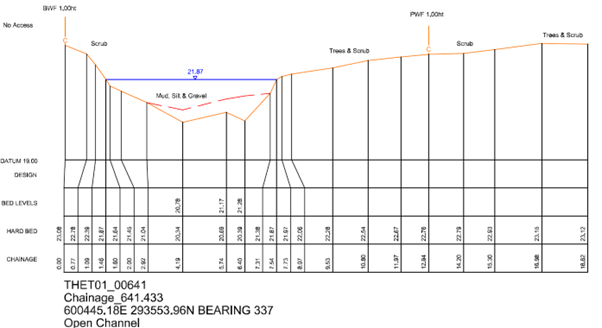
Figure 5 Corresponding cross section drawing to the Flood Modeller Pro file in figure 4.
This survey project forms part of a nature regeneration project on the Shropham Estate in south -west Norfolk. Oxygen Conservation are continuing the work of the previous custodians by not only protecting the existing farm’s organic certification but also significantly increasing ecology along the River Thet and its floodplain. Forming part of a project to redefine and strengthen the relationship between and working farm and nature conservation.

The ability to visualise and quantify changes over time strengthens our ability to refine restoration techniques, demonstrate impact, and secure funding. Ultimately, our goal is to set a best-practice partnership model for delivering conservation at scale, ensuring that restored rivers function as dynamic, self-sustaining ecosystems well into the future.
”
Recent News

Biodiversity Gains Delivered with Data

Geospatial Data Powers Asset Management
