Introducing “Storm GeoSwath”

Introducing Storm GeoSwath
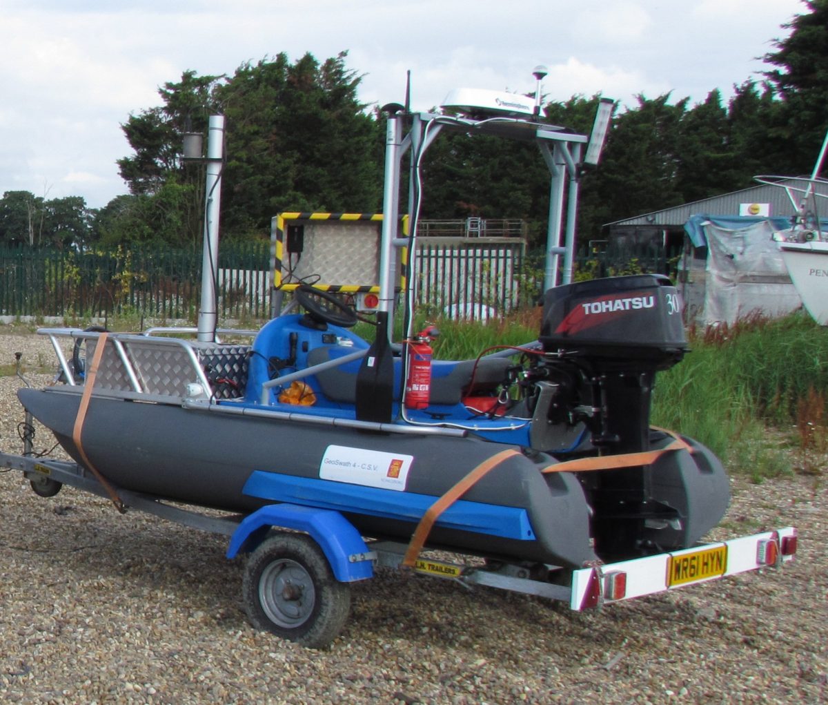
Storm GeoSwath is our latest addition to the Storm family.[nbsp] She is a Compact Survey Vessel designed to survey shallow coastal and inland waterways.[nbsp] The beauty of this powerful and manoeuvrable two person catamaran is the speed in which she works and the volume of data collected. The whole surface geometry of the river/lake bed can be captured in one pass making the value and use of data incomparable with single beam techniques.
Comprising an interferometric sonar in a waterproof housing with all connections to external sensors and transducers Storm GeoSwath is able to capture full 3D data of the river bed. The beam width extends 240 degrees and can therefore measure up to water level by capturing a corridor of data with a width up to twelve times the depth of water. Team Storm are all fully trained and we have a specialised “Swath” Team ready to go.[nbsp]
Other News
It Was a Hot One!
Traditionally August is a slower paced month for Storm's surveying teams as clients enjoy summer breaks. However, 2022 was...
Dry February Creates Perfect Surveying for Storm
Storm surveyors welcomed February’s unseasonal weather being the driest in England for 30 years.
A Grand Day Out
July became a month of completing large and complex survey projects for clients across the UK.